Ouachita County, Arkansas
| Ouachita County, Arkansas | |
|---|---|
|
Ouachita County Courthouse in Camden | |
 Location in the U.S. state of Arkansas | |
 Arkansas's location in the U.S. | |
| Founded | November 29, 1842 |
| Seat | Camden |
| Largest city | Camden |
| Area | |
| • Total | 740 sq mi (1,917 km2) |
| • Land | 733 sq mi (1,898 km2) |
| • Water | 7.0 sq mi (18 km2), 0.9% |
| Population (est.) | |
| • (2015) | 24,358 |
| • Density | 36/sq mi (13.77/km²) |
| Congressional district | 4th |
| Time zone | Central: UTC-6/-5 |

Ouachita County (/ˈwɑːʃᵻtɑː/ WAH-shi-tah) is a county located in the U.S. state of Arkansas. As of the 2010 census, the population was 26,120.[1] The county seat is Camden.[2] The county was formed on November 29, 1842, and named for the Ouachita River.
Ouachita County is part of the Camden, AR Micropolitan Statistical Area.
The county is a former Democratic Party stronghold and the home of the Pryor family, which includes two U.S. senators, David Pryor (1978–1997) and his son Mark Pryor (elected 2002). The elder Pryor is also a former Arkansas governor and congressman. In 1972, U.S. President Richard M. Nixon became the first Republican presidential nominee in the 20th Century to win a majority in Ouachita County. Much later, in the 2008 presidential election, U.S. Senator John S. McCain won the county by nearly ten percentage votes over Senator Barack Obama, following President George W. Bush's victory over Senator John F. Kerry in 2004.
The county is served by a daily newspaper, The Camden News.
Geography
According to the U.S. Census Bureau, the county has a total area of 740 square miles (1,900 km2), of which 733 square miles (1,900 km2) is land and 7.0 square miles (18 km2) (0.9%) is water.[3]
Major Highways
Adjacent counties
- Dallas County (north)
- Calhoun County (east)
- Union County (south)
- Columbia County (southwest)
- Nevada County (west)
- Clark County (northwest)
Demographics
| Historical population | |||
|---|---|---|---|
| Census | Pop. | %± | |
| 1850 | 9,591 | — | |
| 1860 | 12,936 | 34.9% | |
| 1870 | 12,975 | 0.3% | |
| 1880 | 11,758 | −9.4% | |
| 1890 | 17,033 | 44.9% | |
| 1900 | 20,892 | 22.7% | |
| 1910 | 21,774 | 4.2% | |
| 1920 | 20,636 | −5.2% | |
| 1930 | 29,890 | 44.8% | |
| 1940 | 31,151 | 4.2% | |
| 1950 | 33,051 | 6.1% | |
| 1960 | 31,641 | −4.3% | |
| 1970 | 30,896 | −2.4% | |
| 1980 | 30,541 | −1.1% | |
| 1990 | 30,574 | 0.1% | |
| 2000 | 28,790 | −5.8% | |
| 2010 | 26,120 | −9.3% | |
| Est. 2015 | 24,358 | [4] | −6.7% |
| U.S. Decennial Census[5] 1790–1960[6] 1900–1990[7] 1990–2000[8] 2010–2015[1] | |||

As of the 2000 United States Census,[10] there were 28,790 people, 11,613 households, and 8,071 families residing in the county. The population density was 39 people per square mile (15/km²). There were 13,450 housing units at an average density of 18 per square mile (7/km²). The racial makeup of the county was 59.74% White, 38.64% Black or African American, 0.25% Native American, 0.24% Asian, 0.03% Pacific Islander, 0.26% from other races, and 0.83% from two or more races. 0.73% of the population were Hispanic or Latino of any race.
There were 11,613 households out of which 30.80% had children under the age of 18 living with them, 50.00% were married couples living together, 15.60% had a female householder with no husband present, and 30.50% were non-families. 28.00% of all households were made up of individuals and 13.50% had someone living alone who was 65 years of age or older. The average household size was 2.45 and the average family size was 2.99.
In the county the population was spread out with 25.90% under the age of 18, 8.00% from 18 to 24, 25.60% from 25 to 44, 23.60% from 45 to 64, and 16.90% who were 65 years of age or older. The median age was 39 years. For every 100 females there were 89.80 males. For every 100 females age 18 and over, there were 85.00 males.
The median income for a household in the county was $29,341, and the median income for a family was $35,736. Males had a median income of $30,976 versus $18,800 for females. The per capita income for the county was $15,118. About 16.10% of families and 19.50% of the population were below the poverty line, including 26.20% of those under age 18 and 18.60% of those age 65 or over.
Communities
Cities
- Bearden
- Camden (county seat)
- Chidester
- East Camden
- Stephens
Town
Census designated place
Unincorporated community
Townships
Townships in Arkansas are the divisions of a county. Each township includes unincorporated areas; some may have incorporated cities or towns within part of their boundaries. Arkansas townships have limited purposes in modern times. However, the United States Census does list Arkansas population based on townships (sometimes referred to as "county subdivisions" or "minor civil divisions"). Townships are also of value for historical purposes in terms of genealogical research. Each town or city is within one or more townships in an Arkansas county based on census maps and publications. The townships of Ouachita County are listed below; listed in parentheses are the cities, towns, and/or census-designated places that are fully or partially inside the township. [11][12]
Gallery
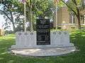 Ouachita County Veterans Memorial is located on the courthouse lawn in Camden.
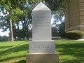 Vietnam Monument in Camden
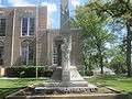 Confederate Women's Monument at Ouachita County Courthouse in Camden
See also
- National Register of Historic Places listings in Ouachita County, Arkansas
- USS Ouachita County (LST-1071)
References
- 1 2 "State & County QuickFacts". United States Census Bureau. Retrieved May 23, 2014.
- ↑ "Find a County". National Association of Counties. Retrieved 2011-06-07.
- ↑ "2010 Census Gazetteer Files". United States Census Bureau. August 22, 2012. Retrieved August 27, 2015.
- ↑ "County Totals Dataset: Population, Population Change and Estimated Components of Population Change: April 1, 2010 to July 1, 2015". Retrieved July 2, 2016.
- ↑ "U.S. Decennial Census". United States Census Bureau. Retrieved August 27, 2015.
- ↑ "Historical Census Browser". University of Virginia Library. Retrieved August 27, 2015.
- ↑ Forstall, Richard L., ed. (March 27, 1995). "Population of Counties by Decennial Census: 1900 to 1990". United States Census Bureau. Retrieved August 27, 2015.
- ↑ "Census 2000 PHC-T-4. Ranking Tables for Counties: 1990 and 2000" (PDF). United States Census Bureau. April 2, 2001. Retrieved August 27, 2015.
- ↑ Based on 2000 census data
- ↑ "American FactFinder". United States Census Bureau. Retrieved 2011-05-14.
- ↑ 2011 Boundary and Annexation Survey (BAS): Ouachita County, AR (PDF) (Map). U. S. Census Bureau. Retrieved 2011-08-24.
- ↑ "Arkansas: 2010 Census Block Maps - County Subdivision". United States Census Bureau. Retrieved May 29, 2014.
External links
 |
Clark County | Dallas County | | |
| Nevada County | |
Calhoun County | ||
| ||||
| | ||||
| Columbia County | Union County |
Municipalities and communities of Ouachita County, Arkansas, United States | ||
|---|---|---|
| Cities | | |
| Town | ||
| CDP | ||
| Unincorporated communities | ||

Coordinates: 33°36′N 92°55′W / 33.600°N 92.917°W