Stone County, Arkansas
| Stone County, Arkansas | |
|---|---|
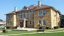 Stone County courthouse in Mountain View | |
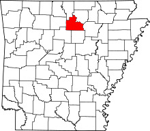 Location in the U.S. state of Arkansas | |
 Arkansas's location in the U.S. | |
| Founded | April 21, 1873 |
| Seat | Mountain View |
| Largest city | Mountain View |
| Area | |
| • Total | 609 sq mi (1,577 km2) |
| • Land | 606 sq mi (1,570 km2) |
| • Water | 3.0 sq mi (8 km2), 0.5% |
| Population (est.) | |
| • (2015) | 12,456 |
| • Density | 20/sq mi (8/km²) |
| Congressional district | 1st |
| Time zone | Central: UTC-6/-5 |
Stone County is a county located in the U.S. state of Arkansas. As of the 2010 census, the population was 12,394.[1] The county seat is Mountain View.[2] The county was formed on April 21, 1873, and named for the natural stone formations in the area. It is a dry county, meaning that the sale of alcoholic beverages in any form is prohibited. Though recently, Anglers located by the White River, was granted permission to sell alcoholic beverages in the restaurant.
Stone County is home to the famous Blanchard Springs Caverns, a three-level system of still-developing caves administered by the United States Forest Service. The area is also widely known — particularly in Mountain View — as a cultural center of music and crafts associated with the Ozark Mountains region. The Ozark Folk Center is a unique state park located in Mountain View that works to preserve the region's culture.
Geography
According to the U.S. Census Bureau, the county has a total area of 609 square miles (1,580 km2), of which 606 square miles (1,570 km2) is land and 3.0 square miles (7.8 km2) (0.5%) is water.[3]
Major highways
Adjacent counties
- Baxter County (northwest)
- Izard County (northeast)
- Independence County (east)
- Cleburne County (south)
- Van Buren County (southwest)
- Searcy County (west)
National protected area
- Ozark National Forest (part)
Demographics
| Historical population | |||
|---|---|---|---|
| Census | Pop. | %± | |
| 1880 | 5,089 | — | |
| 1890 | 7,043 | 38.4% | |
| 1900 | 8,100 | 15.0% | |
| 1910 | 8,946 | 10.4% | |
| 1920 | 8,779 | −1.9% | |
| 1930 | 7,993 | −9.0% | |
| 1940 | 8,603 | 7.6% | |
| 1950 | 7,662 | −10.9% | |
| 1960 | 6,294 | −17.9% | |
| 1970 | 6,838 | 8.6% | |
| 1980 | 9,022 | 31.9% | |
| 1990 | 9,775 | 8.3% | |
| 2000 | 11,499 | 17.6% | |
| 2010 | 12,394 | 7.8% | |
| Est. 2015 | 12,456 | [4] | 0.5% |
| U.S. Decennial Census[5] 1790–1960[6] 1900–1990[7] 1990–2000[8] 2010–2015[1] | |||
As of the 2000 United States Census,[10] there were 11,499 people, 4,768 households, and 3,461 families residing in the county. The population density was 19 people per square mile (7/km²). There were 5,715 housing units at an average density of 9 per square mile (4/km²). The racial makeup of the county was 97.27% White, 0.08% Black or African American, 0.77% Native American, 0.05% Asian, 0.03% Pacific Islander, 0.15% from other races, and 1.64% from two or more races. 1.08% of the population were Hispanic or Latino of any race.
There were 4,768 households out of which 26.90% had children under the age of 18 living with them, 62.30% were married couples living together, 7.10% had a female householder with no husband present, and 27.40% were non-families. 24.80% of all households were made up of individuals and 11.20% had someone living alone who was 65 years of age or older. The average household size was 2.38 and the average family size was 2.82.
In the county the population was spread out with 22.20% under the age of 18, 7.10% from 18 to 24, 23.60% from 25 to 44, 28.50% from 45 to 64, and 18.60% who were 65 years of age or older. The median age was 43 years. For every 100 females there were 96.90 males. For every 100 females age 18 and over, there were 95.30 males.
The median income for a household in the county was $22,209, and the median income for a family was $28,009. Males had a median income of $20,904 versus $16,118 for females. The per capita income for the county was $14,134. About 14.10% of families and 18.90% of the population were below the poverty line, including 26.20% of those under age 18 and 12.10% of those age 65 or over.
Communities
Cities
- Fifty-Six
- Mountain View (county seat)
Unincorporated communities
Townships
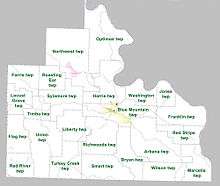
Townships in Arkansas are the divisions of a county. Each township includes unincorporated areas; some may have incorporated cities or towns within part of their boundaries. Arkansas townships have limited purposes in modern times. However, the United States Census does list Arkansas population based on townships (sometimes referred to as "county subdivisions" or "minor civil divisions"). Townships are also of value for historical purposes in terms of genealogical research. Each town or city is within one or more townships in an Arkansas county based on census maps and publications. The townships of Stone County are listed below; listed in parentheses are the cities, towns, and/or census-designated places that are fully or partially inside the township. [11][12]
- Arbana (small part of Mountain View)
- Blue Mountain (most of Mountain View)
- Bryan
- Farris
- Flag
- Franklin
- Harris (small part of Mountain View)
- Jones
- Liberty
- Locust Grove
- Marcella
- Northwest (Fifty-Six)
- Optimus
- Red River
- Red Stripe
- Richwoods
- Roasting Ear
- Smart
- Sylamore
- Timbo
- Turkey Creek
- Union
- Washington
- Wilson
See also
- National Register of Historic Places listings in Stone County, Arkansas
- Missy Irvin, state senator from Stone County
References
- 1 2 "State & County QuickFacts". United States Census Bureau. Retrieved May 19, 2014.
- ↑ "Find a County". National Association of Counties. Retrieved 2011-06-07.
- ↑ "2010 Census Gazetteer Files". United States Census Bureau. August 22, 2012. Retrieved August 27, 2015.
- ↑ "County Totals Dataset: Population, Population Change and Estimated Components of Population Change: April 1, 2010 to July 1, 2015". Retrieved July 2, 2016.
- ↑ "U.S. Decennial Census". United States Census Bureau. Retrieved August 27, 2015.
- ↑ "Historical Census Browser". University of Virginia Library. Retrieved August 27, 2015.
- ↑ Forstall, Richard L., ed. (March 27, 1995). "Population of Counties by Decennial Census: 1900 to 1990". United States Census Bureau. Retrieved August 27, 2015.
- ↑ "Census 2000 PHC-T-4. Ranking Tables for Counties: 1990 and 2000" (PDF). United States Census Bureau. April 2, 2001. Retrieved August 27, 2015.
- ↑ Based on 2000 census data
- ↑ "American FactFinder". United States Census Bureau. Retrieved 2011-05-14.
- ↑ 2011 Boundary and Annexation Survey (BAS): Stone County, AR (PDF) (Map). U. S. Census Bureau. Retrieved 2011-08-07.
- ↑ "Arkansas: 2010 Census Block Maps - County Subdivision". United States Census Bureau. Retrieved May 29, 2014.
External links
 |
Baxter County | Izard County | | |
| Searcy County | |
Independence County | ||
| ||||
| | ||||
| Van Buren County | Cleburne County |
Municipalities and communities of Stone County, Arkansas, United States | ||
|---|---|---|
| Cities | | |
| Unincorporated communities | ||

Coordinates: 35°52′46″N 92°08′50″W / 35.87944°N 92.14722°W