Calhoun County, Arkansas
| Calhoun County, Arkansas | |
|---|---|
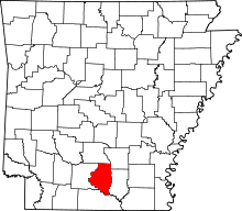 Location in the U.S. state of Arkansas | |
 Arkansas's location in the U.S. | |
| Founded | December 6, 1850 |
| Named for | John C. Calhoun |
| Seat | Hampton |
| Largest city | Hampton |
| Area | |
| • Total | 632 sq mi (1,637 km2) |
| • Land | 629 sq mi (1,629 km2) |
| • Water | 3.8 sq mi (10 km2), 0.6% |
| Population (est.) | |
| • (2015) | 5,229 |
| • Density | 8.5/sq mi (3/km²) |
| Congressional district | 4th |
| Time zone | Central: UTC-6/-5 |
Calhoun County is a county located in the U.S. state of Arkansas. As of the 2010 census, the population was 5,368,[1] making it the least populous county in Arkansas. The county seat is Hampton.[2] Calhoun County is Arkansas's 55th county, formed on December 6, 1850, and named for John C. Calhoun, a Vice President of the United States.
The county is part of the Camden, AR Micropolitan Statistical Area.
Geography
According to the U.S. Census Bureau, the county has a total area of 632 square miles (1,640 km2), of which 629 square miles (1,630 km2) is land and 3.8 square miles (9.8 km2) (0.6%) is water.[3]
Major highways
Adjacent counties
- Dallas County (north)
- Cleveland County (northeast)
- Bradley County (east)
- Union County (south)
- Ouachita County (west)
Demographics
| Historical population | |||
|---|---|---|---|
| Census | Pop. | %± | |
| 1860 | 4,103 | — | |
| 1870 | 3,853 | −6.1% | |
| 1880 | 5,671 | 47.2% | |
| 1890 | 7,267 | 28.1% | |
| 1900 | 8,539 | 17.5% | |
| 1910 | 9,894 | 15.9% | |
| 1920 | 11,807 | 19.3% | |
| 1930 | 9,752 | −17.4% | |
| 1940 | 9,636 | −1.2% | |
| 1950 | 7,132 | −26.0% | |
| 1960 | 5,991 | −16.0% | |
| 1970 | 5,573 | −7.0% | |
| 1980 | 6,079 | 9.1% | |
| 1990 | 5,826 | −4.2% | |
| 2000 | 5,744 | −1.4% | |
| 2010 | 5,368 | −6.5% | |
| Est. 2015 | 5,229 | [4] | −2.6% |
| U.S. Decennial Census[5] 1790–1960[6] 1900–1990[7] 1990–2000[8] 2010–2015[1] | |||

As of the 2000 United States Census,[10] there were 5,744 people, 2,317 households, and 1,628 families residing in the county. The population density was 9 people per square mile (4/km²). There were 3,012 housing units at an average density of 5 per square mile (2/km²). The racial makeup of the county was 74.51% White, 23.38% Black or African American, 0.21% Native American, 0.03% Asian, 0.92% from other races, and 0.94% from two or more races. 1.50% of the population were Hispanic or Latino of any race.
There were 2,317 households out of which 31.20% had children under the age of 18 living with them, 55.60% were married couples living together, 11.30% had a female householder with no husband present, and 29.70% were non-families. 27.30% of all households were made up of individuals and 12.60% had someone living alone who was 65 years of age or older. The average household size was 2.43 and the average family size was 2.94.
In the county the population was spread out with 24.60% under the age of 18, 7.00% from 18 to 24, 28.20% from 25 to 44, 24.30% from 45 to 64, and 16.00% who were 65 years of age or older. The median age was 39 years. For every 100 females there were 92.70 males. For every 100 females age 18 and over, there were 88.30 males.
The median income for a household in the county was $28,438, and the median income for a family was $34,647. Males had a median income of $30,353 versus $17,452 for females. The per capita income for the county was $15,555. About 13.20% of families and 16.50% of the population were below the poverty line, including 19.90% of those under age 18 and 18.20% of those age 65 or over.
Government
| Year | GOP | DNC | Others |
|---|---|---|---|
| 2016 | 68.6% 1,556 | 28.2% 639 | 3.2% 74 |
| 2012 | 67.0% 1,458 | 30.4% 660 | 2.6% 56 |
| 2008 | 65.9% 1,462 | 31.2% 691 | 2.9% 64 |
| 2004 | 58.3% 1,340 | 40.8% 939 | 0.9% 20 |
| 2000 | 51.6% 1,128 | 46.6% 1,017 | 1.8% 40 |
Education
Public education for elementary and secondary school students is primarily provided by the Hampton School District, which leads to graduation from Hampton High School.
Communities
Cities
Towns
Townships
Note: Unlike most counties, Calhoun County has numbered townships instead of named townships.
Townships in Arkansas are the divisions of a county. Each township includes unincorporated areas; some may have incorporated cities or towns within part of their boundaries. Arkansas townships have limited purposes in modern times. However, the United States Census does list Arkansas population based on townships (sometimes referred to as "county subdivisions" or "minor civil divisions"). Townships are also of value for historical purposes in terms of genealogical research. Each town or city is within one or more townships in an Arkansas county based on census maps and publications. The townships of Calhoun County are listed below; listed in parentheses are the cities, towns, and/or census-designated places that are fully or partially inside the township. [12][13]
- Township 1 (Thornton)
- Township 2
- Township 3 (Tinsman)
- Township 4 (Harrell)
- Township 5
- Township 6
- Township 7
- Township 8 (part of Hampton)
- Township 9 (most of Hampton)
See also
- List of lakes in Calhoun County, Arkansas
- National Register of Historic Places listings in Calhoun County, Arkansas
References
- 1 2 "State & County QuickFacts". United States Census Bureau. Retrieved May 20, 2014.
- ↑ "Find a County". National Association of Counties. Archived from the original on 2011-05-31. Retrieved 2011-06-07.
- ↑ "2010 Census Gazetteer Files". United States Census Bureau. August 22, 2012. Retrieved August 25, 2015.
- ↑ "County Totals Dataset: Population, Population Change and Estimated Components of Population Change: April 1, 2010 to July 1, 2015". Retrieved July 2, 2016.
- ↑ "U.S. Decennial Census". United States Census Bureau. Archived from the original on May 11, 2015. Retrieved August 25, 2015.
- ↑ "Historical Census Browser". University of Virginia Library. Retrieved August 25, 2015.
- ↑ Forstall, Richard L., ed. (March 27, 1995). "Population of Counties by Decennial Census: 1900 to 1990". United States Census Bureau. Retrieved August 25, 2015.
- ↑ "Census 2000 PHC-T-4. Ranking Tables for Counties: 1990 and 2000" (PDF). United States Census Bureau. April 2, 2001. Retrieved August 25, 2015.
- ↑ Based on 2000 census data
- ↑ "American FactFinder". United States Census Bureau. Archived from the original on 2013-09-11. Retrieved 2011-05-14.
- ↑ "Dave Leip's Atlas of U.S. Presidential Elections". Retrieved November 18, 2016.
- ↑ 2011 Boundary and Annexation Survey (BAS): Calhoun County, AR (PDF) (Map). U. S. Census Bureau. Retrieved 2011-08-24.
- ↑ "Arkansas: 2010 Census Block Maps - County Subdivision". United States Census Bureau. Retrieved May 27, 2014.
 |
Dallas County | Cleveland County | | |
| Ouachita County | |
Bradley County | ||
| ||||
| | ||||
| Union County |
Municipalities and communities of Calhoun County, Arkansas, United States | ||
|---|---|---|
| Cities | | |
| Towns | ||

Coordinates: 33°34′15″N 92°31′25″W / 33.57083°N 92.52361°W