Paungbyin, Shan State
For the village in Shan State, Burma, see Paungbyin, Shan State.
| Paungbyin ဖောင်းြင် | |
|---|---|
| Village | |
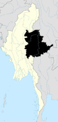
 Paungbyin Location in Burma | |
| Coordinates: 20°39′49″N 96°54′06″E / 20.66361°N 96.90167°ECoordinates: 20°39′49″N 96°54′06″E / 20.66361°N 96.90167°E | |
| Country | Burma |
| Region | Shan State |
| District | Taunggyi |
| Township | Kalaw Township |
| Elevation | 878 m (2,883 ft) |
| Time zone | MST (UTC+6.30) |
Paungbyin[1] is a village in Kalaw Township, Taunggyi District, Shan State, of Myanmar. It lies in the Inle Valley north of Inle Lake.
References
External links

This article is issued from Wikipedia - version of the 2/13/2016. The text is available under the Creative Commons Attribution/Share Alike but additional terms may apply for the media files.