Pine Island, Minnesota
| Pine Island, Minnesota | |
|---|---|
| City | |
|
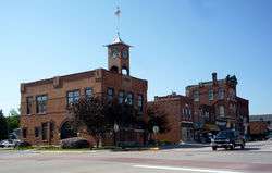
City Hall and downtown Pine Island | |
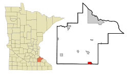 Location of Pine Island within Goodhue and Olmsted Counties in the state of Minnesota | |
| Coordinates: 44°12′10″N 92°38′38″W / 44.20278°N 92.64389°W | |
| Country | United States |
| State | Minnesota |
| Counties | Goodhue, Olmsted |
| Area[1] | |
| • Total | 5.61 sq mi (14.53 km2) |
| • Land | 5.59 sq mi (14.48 km2) |
| • Water | 0.02 sq mi (0.05 km2) |
| Elevation | 1,004 ft (306 m) |
| Population (2010)[2] | |
| • Total | 3,318 |
| • Estimate (2014[3]) | 3,398 |
| • Density | 583.7/sq mi (225.4/km2) |
| Time zone | Central (CST) (UTC-6) |
| • Summer (DST) | CDT (UTC-5) |
| ZIP code | 55963 |
| Area code(s) | 507 |
| FIPS code | 27-51136[4] |
| GNIS feature ID | 0649465[5] |
| Website | pineislandmn.com |
Pine Island is a city in Goodhue and Olmsted counties in the U.S. state of Minnesota. Most of Pine Island is located within Goodhue County, but a small part extends into Olmsted County, making that small portion part of the Rochester metropolitan area. The city's population was 3,263 at the 2010 census.[6]
The community has a strong agricultural base, but has been transitioning over time into a bedroom community for nearby Rochester which employs many local residents. Large development is planned for the Olmsted County side as it becomes a suburb of Rochester, including the Elk Run Bioscience Park, and the state's first diverging diamond interchange.[7]
History
Pine Island was platted in 1856.[8] A post office has been in operation at Pine Island since 1856.[9]
Geography
Pine Island lies along the Middle Fork of the Zumbro River. According to the United States Census Bureau, the city has a total area of 5.61 square miles (14.53 km2), of which 5.59 square miles (14.48 km2) is land and 0.02 square miles (0.05 km2) is water.[1]
U.S. Highway 52 serves as a main route in the community.
Climate
| Climate data for Pine Island, Minnesota | |||||||||||||
|---|---|---|---|---|---|---|---|---|---|---|---|---|---|
| Month | Jan | Feb | Mar | Apr | May | Jun | Jul | Aug | Sep | Oct | Nov | Dec | Year |
| Record high °F (°C) | 58 (14) |
64 (18) |
83 (28) |
93 (34) |
107 (42) |
106 (41) |
109 (43) |
101 (38) |
101 (38) |
94 (34) |
78 (26) |
79 (26) |
109 (43) |
| Average high °F (°C) | 24 (−4) |
29 (−2) |
43 (6) |
61 (16) |
69 (21) |
79 (26) |
85 (29) |
81 (27) |
73 (23) |
63 (17) |
42 (6) |
29 (−2) |
56.5 (13.6) |
| Average low °F (°C) | 3 (−16) |
7 (−14) |
20 (−7) |
45 (7) |
44 (7) |
55 (13) |
62 (17) |
56 (13) |
49 (9) |
35 (2) |
22 (−6) |
8 (−13) |
33.8 (1) |
| Record low °F (°C) | −43 (−42) |
−35 (−37) |
— | — | — | — | — | — | — | — | — | — | −43 (−42) |
| Average precipitation inches (mm) | 0.90 (22.9) |
0.88 (22.4) |
1.92 (48.8) |
3.35 (85.1) |
3.75 (95.3) |
4.67 (118.6) |
4.25 (108) |
4.88 (124) |
3.80 (96.5) |
2.46 (62.5) |
2.02 (51.3) |
1.13 (28.7) |
34.01 (864.1) |
| Source: The Weather Channel[10] | |||||||||||||
Demographics
| Historical population | |||
|---|---|---|---|
| Census | Pop. | %± | |
| 1880 | 656 | — | |
| 1890 | 548 | −16.5% | |
| 1900 | 832 | 51.8% | |
| 1910 | 834 | 0.2% | |
| 1920 | 934 | 12.0% | |
| 1930 | 961 | 2.9% | |
| 1940 | 1,040 | 8.2% | |
| 1950 | 1,298 | 24.8% | |
| 1960 | 1,308 | 0.8% | |
| 1970 | 1,640 | 25.4% | |
| 1980 | 1,977 | 20.5% | |
| 1990 | 2,125 | 7.5% | |
| 2000 | 2,337 | 10.0% | |
| 2010 | 3,263 | 39.6% | |
| Est. 2015 | 3,337 | [11] | 2.3% |
As of 2000 the median income for a household in the city was $47,500, and the median income for a family was $59,792. Males had a median income of $32,788 versus $25,031 for females. The per capita income for the city was $20,370. About 4.5% of families and 5.6% of the population were below the poverty line, including 6.2% of those under age 18 and 14.6% of those age 65 or over.
2010 census
As of the census[2] of 2010, there were 3,263 people, 1,292 households, and 873 families residing in the city. The population density was 583.7 inhabitants per square mile (225.4/km2). There were 1,399 housing units at an average density of 250.3 per square mile (96.6/km2). The racial makeup of the city was 96.6% White, 0.9% African American, 0.1% Native American, 0.8% Asian, 0.1% Pacific Islander, 0.1% from other races, and 1.3% from two or more races. Hispanic or Latino of any race were 1.7% of the population.
There were 1,292 households of which 36.1% had children under the age of 18 living with them, 53.3% were married couples living together, 10.5% had a female householder with no husband present, 3.8% had a male householder with no wife present, and 32.4% were non-families. 26.9% of all households were made up of individuals and 10.7% had someone living alone who was 65 years of age or older. The average household size was 2.47 and the average family size was 3.02.
The median age in the city was 35.2 years. 27.4% of residents were under the age of 18; 6.8% were between the ages of 18 and 24; 26.9% were from 25 to 44; 25.3% were from 45 to 64; and 13.5% were 65 years of age or older. The gender makeup of the city was 48.4% male and 51.6% female.
Notable people
Pine Island was temporarily thrown into the national spotlight in 2002 for having been the home town of the Midwest pipe bomber Luke Helder.
Ralph Wilford Samuelson (July 3, 1904 – August 28, 1977), the inventor of water skiing, moved here from Lake City, Minnesota to raise turkeys and remained here until his death in 1977.
References
- 1 2 "US Gazetteer files 2010". United States Census Bureau. Archived from the original on January 24, 2012. Retrieved 2012-11-13.
- 1 2 "American FactFinder". United States Census Bureau. Retrieved 2012-11-13.
- ↑ "Population Estimates". United States Census Bureau. Archived from the original on June 17, 2013. Retrieved 2013-05-28.
- ↑ "American FactFinder". United States Census Bureau. Retrieved 2008-01-31.
- ↑ "US Board on Geographic Names". United States Geological Survey. 2007-10-25. Retrieved 2008-01-31.
- ↑ "2010 Census Redistricting Data (Public Law 94-171) Summary File". American FactFinder. United States Census Bureau. Archived from the original on July 21, 2011. Retrieved 27 April 2011.
- ↑ http://www.elkrun.info/
- ↑ Upham, Warren (1920). Minnesota Geographic Names: Their Origin and Historic Significance. Minnesota Historical Society. p. 207.
- ↑ "Goodhue County". Jim Forte Postal History. Retrieved 14 June 2015.
- ↑ "The Weather Channel: Monthly Averages for Pine Island, Minnesota". The Weather Channel. 2011. Retrieved on October 5, 2014.
- ↑ "Annual Estimates of the Resident Population for Incorporated Places: April 1, 2010 to July 1, 2015". Retrieved July 2, 2016.
- ↑ "Census of Population and Housing". Census.gov. Archived from the original on May 11, 2015. Retrieved June 4, 2015.
External links
Municipalities and communities of Goodhue County, Minnesota, United States | ||
|---|---|---|
| Cities |  | |
| Townships | ||
| CDP | ||
| Unincorporated communities | ||
| Indian reservation | ||
| Footnotes | ‡This populated place also has portions in an adjacent county or counties | |
Municipalities and communities of Olmsted County, Minnesota, United States | ||
|---|---|---|
| Cities | 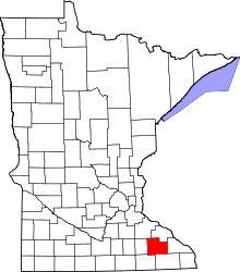 | |
| Townships | ||
| Unincorporated communities | ||
| Footnotes | ‡This populated place also has portions in an adjacent county or counties | |
| Core city | 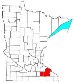 | |
|---|---|---|
| Incorporated Places | ||
| Counties | ||
‡ indicates that it is partially in the metropolitan area. † indicates a county seat. | ||
Coordinates: 44°12′05″N 92°38′47″W / 44.20139°N 92.64639°W