Plaisir, Yvelines
| Plaisir | ||
|---|---|---|
|
The church and shops in Plaisir | ||
| ||
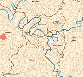 Location (in red) within Paris inner and outer suburbs | ||
| Coordinates: 48°49′06″N 1°56′50″E / 48.8183°N 1.9472°ECoordinates: 48°49′06″N 1°56′50″E / 48.8183°N 1.9472°E | ||
| Country | France | |
| Region | Île-de-France | |
| Department | Yvelines | |
| Arrondissement | Versailles | |
| Canton | Plaisir | |
| Government | ||
| • Mayor (2012–) | Joséphine Kollmannsberger | |
| Area1 | 18.68 km2 (7.21 sq mi) | |
| Population (2006)2 | 31,952 | |
| • Density | 1,700/km2 (4,400/sq mi) | |
| Time zone | CET (UTC+1) | |
| • Summer (DST) | CEST (UTC+2) | |
| INSEE/Postal code | 78490 / 78370 | |
| Elevation |
92–173 m (302–568 ft) (avg. 111 m or 364 ft) | |
|
1 French Land Register data, which excludes lakes, ponds, glaciers > 1 km² (0.386 sq mi or 247 acres) and river estuaries. 2 Population without double counting: residents of multiple communes (e.g., students and military personnel) only counted once. | ||
.jpg)

Plaisir is a commune in the Yvelines department in the Île-de-France in north-central France. It is located in the western suburbs of Paris, 29.5 km (18.3 mi) from the center of Paris.
It borders among others on Élancourt (south), Trappes (southeast) and Les-Clayes-sous-Bois (east).
Inhabitants are called Plaisirois.
It has a major shopping mall.
Twin towns
It is twinned with Lowestoft, England and Bad Aussee, Austria.
Transport
Plaisir is served by two stations on the Transilien Paris – Montparnasse suburban rail line: Plaisir – Les Clayes and Plaisir – Grignon
Education
The commune has 17 preschools with 1,560 students and 13 elementary schools with 2,273 students, with a total of 3,843 students.[1]
Secondary schools in Plaisir:[1]
- Collège Guillaume-Apollinaire
- Collège Blaise-Pascal et SEGPA
- Lycée Jean Vilar
Secondary schools in nearby municipalities:[1]
- Collège La-Fosse-aux-Dames (Les Clayes-sous-Bois)
- Collège La-Clef-de-Saint-Pierre (Elancourt)
See also
References
- 1 2 3 "Etablissements." Plaisir. Retrieved on September 2, 2016.
External links
| Wikimedia Commons has media related to Plaisir (Yvelines). |