Presidency division
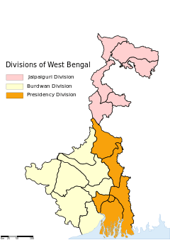
Divisions of West Bengal
Presidency Division (Bengali: প্রেসিডেন্সি বিভাগ, Presidency Bibhāg) is an administrative division within the Indian state of Paschimbanga (West Bengal). The headquarters and the largest city of the Presidency division is Kolkata, the state capital.
It consists of 6 districts:[1]
| Code[2] | District | Headquarters[3] | Established[4] | Subdivisions[1] | Area[3] | Population As of 2001[3] | Population Density | Map |
|---|---|---|---|---|---|---|---|---|
| HR | Howrah | Howrah | 1947 | 1,467 km2 (566 sq mi) | 4,273,099 | 2,913/km2 (7,540/sq mi) | 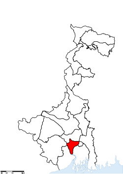 | |
| KO | Kolkata | Kolkata | 1947 | — | 185 km2 (71 sq mi) | 4,572,876 | 24,718/km2 (64,020/sq mi) | 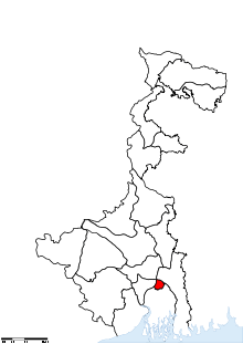 |
| MU | Murshidabad | Baharampur | 1947 | 5,324 km2 (2,056 sq mi) | 5,866,569 | 1,102/km2 (2,850/sq mi) | 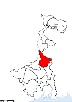 | |
| NA | Nadia | Krishnanagar | 1947 | 3,927 km2 (1,516 sq mi) | 4,604,827 | 1,173/km2 (3,040/sq mi) | 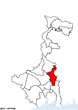 | |
| PN | North 24 Parganas | Barasat | 1986[5] | 4,094 km2 (1,581 sq mi) | 8,934,286 | 2,182/km2 (5,650/sq mi) | 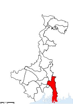 | |
| PS | South 24 Parganas | Alipore | 1986[5] | 9,960 km2 (3,850 sq mi) | 6,906,689 | 693/km2 (1,790/sq mi) | 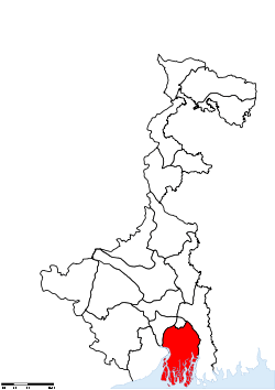 | |
| Total | — | — | — | 21 | 24,957 km2 (9,636 sq mi) | 35,158,346 | - | 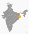 |
References
- 1 2 "Directory of District, Sub division, Panchayat Samiti/ Block and Gram Panchayats in West Bengal, March 2008". West Bengal. National Informatics Centre, India. 2008-03-19. p. 1. Retrieved 2009-02-28.
- ↑ "NIC Policy on format of e-mail Address: Appendix (2): Districts Abbreviations as per ISO 3166–2" (PDF). Ministry Of Communications and Information Technology, Government of India. 2004-08-18. pp. 5–10. Retrieved 2008-11-24.
- 1 2 3 "Districts : West Bengal". Government of India portal. Retrieved 2008-11-24.
- ↑ Here 'Established' means year of establishment as a district of West Bengal. The state of West Bengal was established in 1947 with 14 districts of erstwhile Bengal province of British India.
- 1 2 Mandal, Asim Kumar (2003). The Sundarbans of India: A Development Analysis. Indus Publishing. pp. 168–169. ISBN 81-7387-143-4. Retrieved 2008-09-04.
Coordinates: 22°34′00″N 88°22′00″E / 22.5667°N 88.3667°E
This article is issued from Wikipedia - version of the 10/31/2016. The text is available under the Creative Commons Attribution/Share Alike but additional terms may apply for the media files.