Buchy, Seine-Maritime
| Buchy | ||
|---|---|---|
| ||
 Buchy | ||
|
Location within Normandy region  Buchy | ||
| Coordinates: 49°35′10″N 1°21′37″E / 49.5861°N 1.3603°ECoordinates: 49°35′10″N 1°21′37″E / 49.5861°N 1.3603°E | ||
| Country | France | |
| Region | Normandy | |
| Department | Seine-Maritime | |
| Arrondissement | Rouen | |
| Canton | Buchy | |
| Intercommunality | Moulin d'Ecalles | |
| Government | ||
| • Mayor (2001–2008) | Patrick Chauvet | |
| Area1 | 3.67 km2 (1.42 sq mi) | |
| Population (2006)2 | 1,407 | |
| • Density | 380/km2 (990/sq mi) | |
| Time zone | CET (UTC+1) | |
| • Summer (DST) | CEST (UTC+2) | |
| INSEE/Postal code | 76146 / 76750 | |
| Elevation |
169–211 m (554–692 ft) (avg. 192 m or 630 ft) | |
|
1 French Land Register data, which excludes lakes, ponds, glaciers > 1 km² (0.386 sq mi or 247 acres) and river estuaries. 2 Population without double counting: residents of multiple communes (e.g., students and military personnel) only counted once. | ||
Buchy is a commune in the Seine-Maritime department in the Haute-Normandie region in northern France.
The inhabitants of the town of Buchy are "Buchois, Buchoises."[1]
Geography
A small farming town situated in the Pays de Bray some 16 miles (26 km) northeast of Rouen, at the junction of the D7, D41 and the D919 roads.
Heraldry
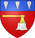 |
The arms of Buchy are blazoned : Azure, an ax argent, handled Or, planted in a stump proper, on a chief gules, 3 logger's wedges argent. |
Population
| Year | 1962 | 1968 | 1975 | 1982 | 1990 | 1999 | 2006 |
|---|---|---|---|---|---|---|---|
| Population | 891 | 1001 | 1024 | 1057 | 1109 | 1150 | 1407 |
| From the year 1962 on: No double counting—residents of multiple communes (e.g. students and military personnel) are counted only once. | |||||||
Places of interest
- The church of Sts. Peter & Paul, dating from the sixteenth century.
- An eleventh-century feudal motte.
- The seventeenth-century market hall.
See also
References
External links
| Wikimedia Commons has media related to Buchy (Seine-Maritime). |
- Buchy on the Quid website (French)
This article is issued from Wikipedia - version of the 11/10/2016. The text is available under the Creative Commons Attribution/Share Alike but additional terms may apply for the media files.