Josephine County, Oregon
| Josephine County, Oregon | |
|---|---|
 Josephine County Courthouse in Grants Pass | |
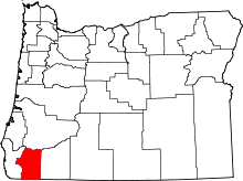 Location in the U.S. state of Oregon | |
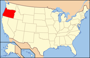 Oregon's location in the U.S. | |
| Founded | January 22, 1856 |
| Seat | Grants Pass |
| Largest city | Grants Pass |
| Area | |
| • Total | 1,642 sq mi (4,253 km2) |
| • Land | 1,640 sq mi (4,248 km2) |
| • Water | 2.2 sq mi (6 km2), 0.1% |
| Population (est.) | |
| • (2015) | 84,745 |
| • Density | 50/sq mi (19/km²) |
| Congressional districts | 2nd, 4th |
| Time zone | Pacific: UTC-8/-7 |
| Website |
www |
Josephine County is a county located in the U.S. state of Oregon. As of the 2010 census, the population was 82,713.[1] The county seat is Grants Pass.[2] The county is probably named after a stream in the area called Josephine Creek, which in turn is probably named after Virginia Josephine Rollins Ort. Josephine County comprises the Grants Pass, OR Metropolitan Statistical Area, which is included in the Medford-Grants Pass, OR Combined Statistical Area.
History
The discovery of rich placers at Sailor Diggings (later known as Waldo) in 1852 and the resulting gold rush brought the first settlers to this region. Several U.S. Army forts were maintained in the county and many engagements during the Rogue River Indian War (1855–1858) took place within its boundaries. In 1851, a group of prospectors moved to the Illinois Valley and made the first discovery of gold in Southern Oregon. In this group was Floyd Rollins and his daughter, Josephine Rollins Ort, after whom the county is named.[3] On January 22, 1856, a bill was passed by the territorial legislature separating what is now Josephine County from Jackson County. The bill made Sailor Diggings (later known as Waldo) the county seat.[4] It was the nineteenth, and last, county created before statehood.
In 1885, the county seat was relocated to Kerby, where the county's first jail was built[5] In 1885, the Oregon Legislature adjusted the boundary between Jackson and Josephine County, making Grants Pass a part of Josephine County. This was done primarily to have a railroad head within the new county.[6] In June 1886 the voters of Josephine County considered three towns for the new county seat. These were: Kerby, Wilderville and Grants Pass. Grants Pass won with 116 votes out of the 716 ballots cast.[6][7]
In the 1920s, the county improved its tourist facilities.[8] In 1922, the Grants Pass Cavemen booster club was created, where members dressed in furs and wielded clubs at events. Events organized by the club ranged from simply blocking traffic, to bidding on the construction of the San Francisco–Oakland Bay Bridge (at a cost of 23,756,000 deer hides), to initiating politicians into their club including Mark Hatfield and Thomas E. Dewey during his 1948 presidential campaign. Russian newspapers used images of the Grants Pass Cavemen to show 'how the rich "cavort" in America.'[9] Although bridges had been built across the Rogue River by the 1920s, ferries were still used to convey people and cars across. The first Grants Pass bridge was destroyed by a flood in 1890.[10] The first newspaper in Josephine County was the Argus, which began publication on March 13, 1885. It lasted only a few months, but the Grants Pass Courier began three weeks later.[11] In 1897, the first legal hanging took place in Josephine County. L. W. Nelson confessed to the murder of Charles Perry while the noose was around his neck.[12]
Ethnic history
Although several tribes of Native Americans lived in the area from which Josephine County was created, most of their members had been moved to the reservation at Grand Ronde by the end of the Rogue River Indian War. Soon afterwards all Indians in southwest Oregon, with the exception of a few small bands, were moved to the Coast reservation (later known as the Siletz Reservation).[7] Josephine County was also the home to a large Chinese population. Most had come to the area to work gold claims purchased from whites no longer interested in working them. Even though they could not own land, they had to pay a tax to mine gold, and were usually relegated to inferior claims.
Geography
According to the U.S. Census Bureau, the county has a total area of 1,642 square miles (4,250 km2), of which 1,640 square miles (4,200 km2) is land and 2.2 square miles (5.7 km2) (0.1%) is water.[13]
Adjacent counties
- Curry County (west)
- Jackson County (east)
- Douglas County (north)
- Del Norte County, California (southwest)
- Siskiyou County, California (south)
National protected areas
Demographics
| Historical population | |||
|---|---|---|---|
| Census | Pop. | %± | |
| 1860 | 1,623 | — | |
| 1870 | 1,204 | −25.8% | |
| 1880 | 2,485 | 106.4% | |
| 1890 | 4,878 | 96.3% | |
| 1900 | 7,517 | 54.1% | |
| 1910 | 9,567 | 27.3% | |
| 1920 | 7,655 | −20.0% | |
| 1930 | 11,498 | 50.2% | |
| 1940 | 16,301 | 41.8% | |
| 1950 | 26,542 | 62.8% | |
| 1960 | 29,917 | 12.7% | |
| 1970 | 35,746 | 19.5% | |
| 1980 | 58,855 | 64.6% | |
| 1990 | 62,649 | 6.4% | |
| 2000 | 75,726 | 20.9% | |
| 2010 | 82,713 | 9.2% | |
| Est. 2015 | 84,745 | [14] | 2.5% |
| U.S. Decennial Census[15] 1790-1960[16] 1900-1990[17] 1990-2000[18] 2010-2015[1] | |||
2000 census
As of the census[19] of 2000, there were 75,726 people, 31,000 households, and 21,359 families residing in the county. The population density was 46 people per square mile (18/km²). There were 33,239 housing units at an average density of 20 per square mile (8/km²). The racial makeup of the county was 93.90% White, 0.27% Black or African American, 1.25% Native American, 0.63% Asian, 0.11% Pacific Islander, 1.17% from other races, and 2.68% from two or more races. 4.26% of the population were Hispanic or Latino of any race. 18.5% were of German, 14.3% English, 10.4% Irish and 9.3% American ancestry according to Census 2000. 95.6% spoke English and 2.8% Spanish as their first language.
There were 31,000 households, out of which 26.90% had children under the age of 18 living with them, 54.40% were married couples living together, 10.40% had a female householder with no husband present, and 31.10% were non-families. 25.40% of all households were made up of individuals and 12.10% had someone living alone who was 65 years of age or older. The average household size was 2.41 and the average family size was 2.85.
In the county, the population was spread out, with 23.10% under the age of 18, 6.50% from 18 to 24, 23.20% from 25 to 44, 27.20% from 45 to 64, and 20.10% who were 65 years of age or older. The median age was 43 years. For every 100 females there were 94.60 males. For every 100 females age 18 and over, there were 91.10 males.
The median income for a household in the county was $31,229, and the median income for a family was $36,894. Males had a median income of $30,798 versus $22,734 for females. The per capita income for the county was $17,234. About 11.30% of families and 15.00% of the population were below the poverty line, including 21.10% of those under age 18 and 6.80% of those age 65 or over.
2010 census
As of the 2010 United States Census, there were 82,713 people, 34,646 households, and 22,498 families residing in the county.[20] The population density was 50.4 inhabitants per square mile (19.5/km2). There were 38,001 housing units at an average density of 23.2 per square mile (9.0/km2).[21] The racial makeup of the county was 92.4% white, 1.4% American Indian, 0.8% Asian, 0.4% black or African American, 0.2% Pacific islander, 1.5% from other races, and 3.2% from two or more races. Those of Hispanic or Latino origin made up 6.3% of the population.[20] In terms of ancestry, 26.3% were German, 15.6% were Irish, 15.5% were English, 5.5% were Italian, and 5.5% were American.[22]
Of the 34,646 households, 25.5% had children under the age of 18 living with them, 49.2% were married couples living together, 11.0% had a female householder with no husband present, 35.1% were non-families, and 28.3% of all households were made up of individuals. The average household size was 2.34 and the average family size was 2.82. The median age was 47.3 years.[20]
The median income for a household in the county was $38,035 and the median income for a family was $48,180. Males had a median income of $38,675 versus $27,926 for females. The per capita income for the county was $21,539. About 13.5% of families and 17.8% of the population were below the poverty line, including 27.3% of those under age 18 and 9.1% of those age 65 or over.[23]
Economy
Most of the commercial activity during the territorial period centered on gold mining and the supply of provisions to miners. Miners had been active in the Rogue and Illinois valleys since 1851. By the late 1850s, however, gold mining was beginning to decline and population dwindled as well. In 1859, gold was discovered along the Fraser River in British Columbia and numerous people left Josephine County to search for valuable claims there.
Josephine County shares the Rogue Valley and Applegate Valley wine appellations with Jackson County. The U.S. government owns the majority of the land within the county boundaries, with the Bureau of Land Management owning 28% of the lands within the county boundaries, most of which are Oregon and California Railroad lands, and the Forest Service owning 39%.
Grants Pass is now the departure point for most Rogue River scenic waterway guided fishing and boat trips, one of the destinations being Hellgate canyon. The Illinois River, one of the Rogue's tributaries, has also been designated a scenic waterway.
Transportation
Initially, freight was brought into Josephine County by pack train. As the trails improved, freight wagons were used. Stage coaches were the primary mode of transportation until 1914, when auto stages took over, halving the time from Crescent City to Grants Pass from 24 to 12 hours.[24]
In 1883, the Oregon and California Railroad reached Grants Pass, in Jackson County at the time.[25] The first through train from Portland, Oregon arrived in Grants Pass on Christmas Eve of 1883. Due to delays in completing a railroad through the Siskiyou Mountains, the first train from California didn't arrive until 1887. Josephine County was served by the Oregon and California Railroad.[26] In 1923, commercial flight in Josephine County began when airplanes began taking off from the American Legion Air Field. The airfield has since been replaced by an industrial park.[27]
Libraries
In May 2007, all libraries in Josephine County were closed due to lack of county government funding. In September 2007, committed community members formed Josephine Community Libraries, Inc., a nonprofit, nongovernmental organization. On December 20, 2008, the Grants Pass library opened again. On September 5, 2009, the Illinois Valley library was reopened. On November 7, 2009, the Williams library was reopened. With the reopening of the Wolf Creek branch on December 19, 2009, all four library branches in Josephine County were restored. Josephine Community Libraries, Inc. (JCLI) is a nonprofit, nongovernmental library system serving the 82,000 residents of Josephine County. It is a privately run, public library that relies on membership contributions for funding and a large and varied volunteer force to staff operations and support functions.[28]
Politics
Josephine County has been among the most consistently Republican counties in Oregon with regard to Presidential elections. In 1964, it was one of two Oregon counties to give a majority to Barry Goldwater.[29] The last Democratic candidate to win the county was Franklin D. Roosevelt in 1936.[30] Although shifting Democratic in the last 12 years John McCain received 55.2% of the county's vote in the 2008 U.S. presidential election.[31] In 2004 Democrat Dennis Kucinich spoke publicly while campaigning in Josephine County, making appearances in both Grants Pass and Cave Junction. Robert Kennedy made a campaign stop in Grants Pass in late May 1968 at the conclusion of a whistle stop campaign tour by train originating in Portland. Kennedy spoke to a crowd of several hundred in a supermarket parking lot on the site of the former Southern Pacific passenger station which had been demolished some years previously just a week before his assassination in California June 5, 1968.[32]
Communities
Cities
- Cave Junction
- Grants Pass (county seat)
Census-designated places
Unincorporated communities
- Dryden
- Galice
- Golden
- Greenback
- Harbeck-Fruitdale (former)
- Holland
- Hugo
- Leland
- Murphy
- Placer
- Pleasant Valley
- Sunny Valley
- Waldo
- Wilderville
- Wolf Creek
- Wonder
See also
References
- 1 2 "State & County QuickFacts". United States Census Bureau. Retrieved November 15, 2013.
- ↑ "Find a County". National Association of Counties. Retrieved 2011-06-07.
- ↑ Sutton, p. 6.
- ↑ Sutton, p. 10.
- ↑ Sutton, pp. 15–17.
- 1 2 Sutton, p. 18.
- 1 2 Edna May Hill (1976). "Josephine County Historical Highlights". Josephine County Library System & Josephine County Historical Society. pp. 73, 74
- ↑ Sutton, p. 65.
- ↑ Sutton, pp. 59–61.
- ↑ Sutton, pp. 59–74.
- ↑ Sutton, pp. 59–76–78.
- ↑ Sutton, pp. 59–79.
- ↑ "2010 Census Gazetteer Files". United States Census Bureau. August 22, 2012. Retrieved February 26, 2015.
- ↑ "County Totals Dataset: Population, Population Change and Estimated Components of Population Change: April 1, 2010 to July 1, 2015". Retrieved July 2, 2016.
- ↑ "U.S. Decennial Census". United States Census Bureau. Retrieved February 26, 2015.
- ↑ "Historical Census Browser". University of Virginia Library. Retrieved February 26, 2015.
- ↑ Forstall, Richard L., ed. (March 27, 1995). "Population of Counties by Decennial Census: 1900 to 1990". United States Census Bureau. Retrieved February 26, 2015.
- ↑ "Census 2000 PHC-T-4. Ranking Tables for Counties: 1990 and 2000" (PDF). United States Census Bureau. April 2, 2001. Retrieved February 26, 2015.
- ↑ "American FactFinder". United States Census Bureau. Retrieved 2008-01-31.
- 1 2 3 "DP-1 Profile of General Population and Housing Characteristics: 2010 Demographic Profile Data". United States Census Bureau. Retrieved 2016-02-23.
- ↑ "Population, Housing Units, Area, and Density: 2010 - County". United States Census Bureau. Retrieved 2016-02-23.
- ↑ "DP02 SELECTED SOCIAL CHARACTERISTICS IN THE UNITED STATES – 2006-2010 American Community Survey 5-Year Estimates". United States Census Bureau. Retrieved 2016-02-23.
- ↑ "DP03 SELECTED ECONOMIC CHARACTERISTICS – 2006-2010 American Community Survey 5-Year Estimates". United States Census Bureau. Retrieved 2016-02-23.
- ↑ Sutton, pp. 86.
- ↑ Sutton, p. 201.
- ↑ Sutton, pp. 92–94.
- ↑ Sutton, pp. 99.
- ↑ "Josephine Community Libraries". Retrieved 2010-06-07.
- ↑ David Leip Presidential Election Atlas
- ↑ Geographie Electorale
- ↑ The New York Times electoral map
- ↑ Oregon Collegiate Broadcast System. "Oregon 1968 - RFK Campaign Train". Youtube. R.W. Rynerson. Retrieved June 5, 2016.
- General
- Jack Sutton (1966). "110 Years with Josephine: The History of Josephine County, Oregon". The Josephine County Historical Society
External links
- Josephine County (official website)
Coordinates: 42°22′N 123°34′W / 42.36°N 123.56°W
 |
Douglas County | | ||
| Curry County | |
Jackson County | ||
| ||||
| | ||||
| Del Norte County | Siskiyou County |
Municipalities and communities of Josephine County, Oregon, United States | ||
|---|---|---|
| Cities | | |
| CDPs | ||
| Other unincorporated communities | ||
| Ghost towns | ||