Greensville County, Virginia
| Greensville County, Virginia | ||
|---|---|---|
|
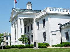
Greensville County Courthouse, also serving the City of Emporia | ||
| ||
 Location in the U.S. state of Virginia | ||
 Virginia's location in the U.S. | ||
| Founded | 1780 | |
| Seat | Emporia | |
| Largest town | Jarratt | |
| Area | ||
| • Total | 297 sq mi (769 km2) | |
| • Land | 295 sq mi (764 km2) | |
| • Water | 2 sq mi (5 km2), 0.5% | |
| Population (est.) | ||
| • (2015) | 11,885 | |
| • Density | 40/sq mi (15/km²) | |
| Congressional district | 4th | |
| Time zone | Eastern: UTC-5/-4 | |
| Website |
www | |

Greensville County is a county located in the Commonwealth of Virginia. As of the 2010 census, the population was 12,243.[1] Its county seat is Emporia.[2]
History
Greensville County was established in 1781 from Brunswick County. The county is probably named for Sir Richard Grenville, leader of the settlement on Roanoke Island, 1585. There is also belief that it may be named after Nathanael Greene, a major general of the Continental Army and one of George Washington's brightest officers.
An early chapter of the National Association for the Advancement of Colored People was formed in Greensville County and Emporia (the county seat) in May 1940, under the leadership of dentist Dr. F. A. Sealy, of Boydton, Virginia and president of the Mecklenburg County, Virginia branch. However he died in 1943, as efforts to desegregate the county's schools began with the assistance of attorneys Oliver W. Hill.[3] After service in World War II, Hill's colleague Samuel W. Tucker moved to Emporia, married a schoolteacher and became the county's only African American attorney, as well as a leader in desegregating schools across Virginia.[4]
Geography
According to the U.S. Census Bureau, the county has a total area of 297 square miles (770 km2), of which 295 square miles (760 km2) is land and 1.6 square miles (4.1 km2) (0.5%) is water.[5]
The Meherrin River forms the boundary between Greensville County and Southampton County.
Adjacent counties / independent city
- Brunswick County, Virginia – west
- Dinwiddie County, Virginia – north
- Sussex County, Virginia – northeast
- Southampton County, Virginia – east
- Northampton County, North Carolina – south
- Emporia, Virginia – surrounded by Greensville County
Major highways
Demographics
| Historical population | |||
|---|---|---|---|
| Census | Pop. | %± | |
| 1790 | 6,362 | — | |
| 1800 | 6,727 | 5.7% | |
| 1810 | 6,853 | 1.9% | |
| 1820 | 6,858 | 0.1% | |
| 1830 | 7,117 | 3.8% | |
| 1840 | 6,366 | −10.6% | |
| 1850 | 5,639 | −11.4% | |
| 1860 | 6,374 | 13.0% | |
| 1870 | 6,362 | −0.2% | |
| 1880 | 8,407 | 32.1% | |
| 1890 | 8,230 | −2.1% | |
| 1900 | 9,758 | 18.6% | |
| 1910 | 11,890 | 21.8% | |
| 1920 | 11,606 | −2.4% | |
| 1930 | 13,388 | 15.4% | |
| 1940 | 14,866 | 11.0% | |
| 1950 | 16,319 | 9.8% | |
| 1960 | 16,155 | −1.0% | |
| 1970 | 9,604 | −40.6% | |
| 1980 | 10,903 | 13.5% | |
| 1990 | 8,853 | −18.8% | |
| 2000 | 11,560 | 30.6% | |
| 2010 | 12,243 | 5.9% | |
| Est. 2015 | 11,885 | [6] | −2.9% |
| U.S. Decennial Census[7] 1790–1960[8] 1900–1990[9] 1990–2000[10] 2010–2012[1] | |||
As of the 2010 United States Census, there were 12,243 people residing in the county. 59.8% were Black or African American, 38.5% White, 0.3% Asian, 0.2% Native American, 0.3% of some other race and 0.8% of two or more races. 1.4% were Hispanic or Latino (of any race).
As of the census[11] of 2000, there were 11,560 people, 3,375 households, and 2,396 families residing in the county. The population density was 39 people per square mile (15/km²). There were 3,765 housing units at an average density of 13 per square mile (5/km²). The racial makeup of the county was 38.94% White, 59.75% Black or African American, 0.10% Native American, 0.40% Asian, 0.02% Pacific Islander, 0.47% from other races, and 0.32% from two or more races. 0.93% of the population were Hispanic or Latino of any race.
There were 3,375 households out of which 29.30% had children under the age of 18 living with them, 49.80% were married couples living together, 16.00% had a female householder with no husband present, and 29.00% were non-families. 25.40% of all households were made up of individuals and 11.30% had someone living alone who was 65 years of age or older. The average household size was 2.51 and the average family size was 2.99.
In the county, the population was spread out with 18.20% under the age of 18, 7.40% from 18 to 24, 38.70% from 25 to 44, 24.20% from 45 to 64, and 11.40% who were 65 years of age or older. The median age was 38 years. For every 100 females there were 160.90 males. For every 100 females age 18 and over, there were 177.80 males.
The median income for a household in the county was $32,002, and the median income for a family was $38,810. Males had a median income of $24,919 versus $19,849 for females. The per capita income for the county was $14,632. 14.70% of the population and 12.40% of families were below the poverty line. Out of the total people living in poverty, 17.00% are under the age of 18 and 18.60% are 65 or older.
Government and infrastructure
Virginia Department of Corrections operates the Greensville Correctional Center in unincorporated Greensville County, near Jarratt.[12] Greensville houses the State of Virginia execution chamber.[13]
Board of Supervisors
District 1: James C. Vaughan (I)
District 2: Michael W. Ferguson (I)
District 3: Margaret T. Lee (I)
District 4: Peggy R. Wiley (I)
Constitutional officers
*Clerk of the Circuit Court: Robert C. Wrenn (I)
Commissioner of the Revenue: Martha S. Swenson (I)
*Commonwealth's Attorney: Patricia Taylor Watson (I)
*Sheriff: Timothy Jarratt (I)
Treasurer: Pamela Allen Lifsey (I)
*Positions shared with Emporia City.
Greensville is represented by Democrat L. Louise Lucas in the Virginia Senate, Democrat Roslyn C. Tyler in the Virginia House of Delegates, and Republican J. Randy Forbes in the U.S. House of Representatives.
Communities
Although Emporia lies within the boundaries of Greensville County and serves as the county seat, it is an independent city and thus not part of the county.
Town
Unincorporated communities
See also
References
- 1 2 "State & County QuickFacts". United States Census Bureau. Retrieved January 2, 2014.
- ↑ "Find a County". National Association of Counties. Retrieved 2011-06-07.
- ↑ First Annual Founders' Day program at Greensville County High School June 23, 2007 pp. 15-27
- ↑ Nancy Noyes Silcox, Samuel Wlbert Tucker: The Story of a Civil Rights Trailblazer (Fairfax, Virginia: History4All, 2014) pp. 61-62
- ↑ "US Gazetteer files: 2010, 2000, and 1990". United States Census Bureau. 2011-02-12. Retrieved 2011-04-23.
- ↑ "County Totals Dataset: Population, Population Change and Estimated Components of Population Change: April 1, 2010 to July 1, 2015". Retrieved July 2, 2016.
- ↑ "U.S. Decennial Census". United States Census Bureau. Retrieved January 2, 2014.
- ↑ "Historical Census Browser". University of Virginia Library. Retrieved January 2, 2014.
- ↑ "Population of Counties by Decennial Census: 1900 to 1990". United States Census Bureau. Retrieved January 2, 2014.
- ↑ "Census 2000 PHC-T-4. Ranking Tables for Counties: 1990 and 2000" (PDF). United States Census Bureau. Retrieved January 2, 2014.
- ↑ "American FactFinder". United States Census Bureau. Retrieved 2011-05-14.
- ↑ "Greensville Correctional Center/Greensville Work Center (major male institution)." Virginia Department of Corrections. Retrieved on August 22, 2010.
- ↑ "Virginia Death Row/Execution Facts." My FOX DC. Tuesday November 10, 2009. Retrieved on August 22, 2010.
External links
 |
Dinwiddie County | Sussex County | | |
| Brunswick County | |
Southampton County | ||
| ||||
| | ||||
| Northampton County, North Carolina |
Municipalities and communities of Greensville County, Virginia, United States | ||
|---|---|---|
| Town | | |
| Unincorporated community | ||
| Footnotes | ‡This populated place also has portions in an adjacent county or counties | |
Coordinates: 36°43′17″N 77°31′56″W / 36.72139°N 77.53222°W