Prince George County, Virginia
| Prince George County, Virginia | ||
|---|---|---|
|
Prince George County Courthouse | ||
| ||
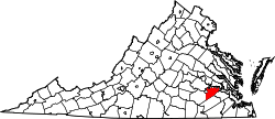 Location in the U.S. state of Virginia | ||
 Virginia's location in the U.S. | ||
| Founded | 1703 | |
| Named for | Prince George of Denmark | |
| Seat | Prince George | |
| Largest community | Fort Lee | |
| Area | ||
| • Total | 282 sq mi (730 km2) | |
| • Land | 265 sq mi (686 km2) | |
| • Water | 17 sq mi (44 km2), 5.9% | |
| Population (est.) | ||
| • (2015) | 37,862 | |
| • Density | 124/sq mi (48/km²) | |
| Congressional districts | 3rd, 4th | |
| Time zone | Eastern: UTC-5/-4 | |
| Website |
www | |


Prince George County is a county located in the Commonwealth of Virginia. As of the 2010 census, the population was 35,725.[1] Its county seat is Prince George.[2]
Prince George County is in Tri-Cities area of the Greater Richmond Region.
History
Prince George County was formed in 1703 in the Virginia Colony from a portion of Charles City County. It was named in honor of Prince George of Denmark, husband of Anne, Queen of Great Britain.
In 1619, "Charles Cittie" [sic] was one of four "boroughs" or "incorporations" created by the Virginia Company. The first Charles City County courthouses were located along the James River at Westover and City Point. The Virginia Company lost its charter in 1624, and Virginia became a royal colony.
Charles City Shire was formed in 1634 in the Virginia Colony by order of Charles I, King of England. It became Charles City County in 1643, and is considered one of the five shires in Virginia still extant in essentially the same political entity (county) as they were originally formed in 1634.
Charles Cittie, Charles City Shire, and Charles City County all extended to both sides of the James River, which was the major transportation thoroughfare of the Virginia Colony throughout the 17th century. The original central city of Charles City County was Charles City Point, which was in an area south of the James River at the confluence of the Appomattox River. The name was later shortened to City Point.
In 1703, all of the original area of Charles City County south of the James River was severed to form Prince George County and eventually, several other counties. City Point later became an incorporated town in Prince George County. Annexed by the independent city of Hopewell in 1923, it is no longer in the county.
Nearby the current bridges, this water-only section of the county at the Appomattox River was the site of a fatal bus accident at an open drawbridge on December 22, 1935 which killed 13 persons.
Geography

According to the U.S. Census Bureau, the county has a total area of 282 square miles (730 km2), of which 265 square miles (690 km2) is land and 17 square miles (44 km2) (5.9%) is water.[3] The northwestern corner of the county near the cities of Hopewell and Petersburg, and the location of Fort Lee is exurban, but the rest of the county is rural with most land devoted to agriculture and timber production.
Adjacent counties / independent cities
- Petersburg, Virginia - northwest
- Chesterfield County, Virginia - northwest
- Hopewell, Virginia - northwest
- Charles City County, Virginia - north
- Surry County, Virginia - east
- Sussex County, Virginia - south
- Dinwiddie County, Virginia - west
- Colonial Heights, Virginia - east
National protected areas
Economy
Top employers
According to the County's 2009 Comprehensive Annual Financial Report,[4] the top employers in the county are:
| # | Employer | # of Employees |
|---|---|---|
| 1 | United States Department of Defense | 1,000+ |
| 2 | County of Prince George | 1,000+ |
| 3 | Food Lion | 500-999 |
| 4 | United States Department of Justice | 500-999 |
| 5 | Standard Motor Products | 250-499 |
| 6 | United States Army | 250-499 |
| 7 | Riverside Regional Jail | 250-499 |
| 8 | Perdue Farms | 250-499 |
| 9 | United States Departments of the Army & Air Force | 250-499 |
| 10 | Ace Hardware | 100-249 |
Goya Foods has its Virginia offices south of the Prince George CDP.[5][6]
Government
In modern times, there are no centralized cities or towns in the county. Prince George Court House, which uses the postal address Prince George, Virginia, is the focal point of government. The County Administrator answers to the elected Board of Supervisors.
Law enforcement
Prince George County is served primarily by the Prince George County Police Department and the Prince George County Sheriff's Office. The police department's responsibility is the enforcement of the laws of the Commonwealth and local ordinances. The primary responsibility of the Sheriff's Office is the security of the courts and service of court (criminal and civil) papers. The Sheriff's Office also assists the police department in the enforcement of the laws of the Commonwealth as a secondary responsibility.[7]
Towns, communities, region
There are currently no incorporated towns within Prince George County. Unincorporated towns or communities in the county include:
- Burrowsville
- Carson
- Disputanta
- Fort Lee (a military base)
- Garysville
- Jordan Point
- New Bohemia
- Newville
- Prince George
The independent city of Hopewell lies within Prince George County, and the county adjoins the independent cities of Petersburg and Colonial Heights and is considered part of the Tri-Cities area of the Richmond-Petersburg (or Greater Richmond) region. It also borders 5 other counties: Charles City (County), Chesterfield, Dinwiddie, Sussex, and Surry.
Transportation
Interstate Highways 95 and 295 pass through the county, as does north-south U.S. Route 301 and east-west U.S. Route 460. State Route 10 runs along the northern shore of the James River near several of the James River plantations located in the county. State Route 106 runs through Prince George, the county seat.
Freight railroad service for the county is provided by CSX Transportation, which interchanges with Norfolk Southern at Petersburg. The famous 52-mile long tangent rail line between Petersburg and Suffolk of the former Norfolk and Petersburg Railroad was built by William Mahone in the 1850s, and now forms a vital link of the Norfolk Southern system. A Norfolk Southern Railway automobile transloading facility is located nearby. There are future plans underway for a large Intermodal freight transport railroad-trucking transfer facility in Prince George County as well.
Major highways
Demographics
| Historical population | |||
|---|---|---|---|
| Census | Pop. | %± | |
| 1790 | 8,173 | — | |
| 1800 | 7,425 | −9.2% | |
| 1810 | 8,050 | 8.4% | |
| 1820 | 8,030 | −0.2% | |
| 1830 | 8,367 | 4.2% | |
| 1840 | 7,175 | −14.2% | |
| 1850 | 7,596 | 5.9% | |
| 1860 | 8,411 | 10.7% | |
| 1870 | 7,820 | −7.0% | |
| 1880 | 10,054 | 28.6% | |
| 1890 | 7,872 | −21.7% | |
| 1900 | 7,752 | −1.5% | |
| 1910 | 7,848 | 1.2% | |
| 1920 | 12,915 | 64.6% | |
| 1930 | 10,311 | −20.2% | |
| 1940 | 12,226 | 18.6% | |
| 1950 | 19,679 | 61.0% | |
| 1960 | 20,270 | 3.0% | |
| 1970 | 29,092 | 43.5% | |
| 1980 | 25,733 | −11.5% | |
| 1990 | 27,394 | 6.5% | |
| 2000 | 33,047 | 20.6% | |
| 2010 | 35,725 | 8.1% | |
| Est. 2015 | 37,862 | [8] | 6.0% |
| U.S. Decennial Census[9] 1790-1960[10] 1900-1990[11] 1990-2000[12] 2010-2013[1] | |||
As of the census[13] of 2000, there were 33,047 people, 10,159 households, and 8,096 families residing in the county. The population density was 124 people per square mile (48/km²). There were 10,726 housing units at an average density of 40 per square mile (16/km²). The racial makeup of the county was 60.93% White, 32.54% Black or African American, 0.42% Native American, 1.73% Asian, 0.15% Pacific Islander, 2.19% from other races, and 2.03% from two or more races. 4.92% of the population were Hispanic or Latino of any race.
There were 10,159 households out of which 41.90% had children under the age of 18 living with them, 63.50% were married couples living together, 12.20% had a female householder with no husband present, and 20.30% were non-families. 17.20% of all households were made up of individuals and 5.80% had someone living alone who was 65 years of age or older. The average household size was 2.76 and the average family size was 3.11.
In the county, the population was spread out with 25.10% under the age of 18, 13.60% from 18 to 24, 33.30% from 25 to 44, 20.80% from 45 to 64, and 7.30% who were 65 years of age or older. The median age was 32 years. For every 100 females there were 117.00 males. For every 100 females age 18 and over, there were 120.90 males.
The median income for a household in the county was $49,877, and the median income for a family was $53,750. Males had a median income of $37,363 versus $26,347 for females. The per capita income for the county was $20,196. About 6.50% of families and 8.00% of the population were below the poverty line, including 11.40% of those under age 18 and 8.30% of those age 65 or over.
Education
Prince George County Public Schools operates public schools in the county.
High school
Jr. high school
- N.B Clements Jr. High 8-9
Middle school
Elementary schools
- Harrison Elementary School
- North Elementary School
- South Elementary School
- L.L. Beazley Elementary School
- W.A. Walton Elementary School
Notable residents
- Richard Bland- Early American, planter, and statesman, member of the Virginia House of Burgesses.
- Richard Bland II- Planter and statesman, member of the Virginia House of Burgesses, and delegate to the Continental Congress.
- Theodorick Bland of Cawsons- Planter and statesman, member of the Virginia House of Burgesses.
- Theodorick Bland- Physician, revolutionary soldier, and statesman who became a major figure in the formation of the new United States Government, representing Virginia in both the Continental Congress and the United States House of Representatives.
- Colonel Robert Bolling - Early American planter and merchant resided at Kippax Plantation.
- Jane Rolfe Bolling - Wife of Colonel Robert Bolling, granddaughter of Pocahontas and English colonist John Rolfe
- Jackie Bradley, Jr.- Major League Baseball player, attended Prince George High School.
- Larry Brooks- National Football League player, graduated from Prince George High School
- Robert Williams Daniel- Banker who survived the sinking of the RMS Titanic and later served in the Virginia Senate resided at Brandon Plantation.
- Margery Durant Daniel- Wife of Robert Williams Daniel, daughter of businessman and General Motors founder, Billy Durant.
- Robert Williams Daniel, Jr.- Member of the US House of Representatives who served five terms representing Virginia's 4th congressional district.
- Richard Eppes- Planter and surgeon in the Confederate States Army during the American Civil War resided at Appomattox Manor.
- Elmon T. Gray- Waverly businessman and son of Garland Gray, served in the Virginia Senate from 1971 to 1992.
- Samuel Jordan - Jamestown colonist and one of the first colonial legislators, established Jordan's Point Plantation
- John Martin - Jamestown colonist who established Martin's Brandon Plantation
- John M. McBroom- Major General US Air Force, retired, commanded the 1st Tactical Fighter Wing, during Operations Desert Shield and Desert Storm where he flew 15 combat missions, graduated from Prince George High School
- Jeff Oakley- Businessman and NASCAR driver, lives in Prince George.
- Johnny Oates- Major League Baseball player, coach, and manager, graduated from Prince George High School.
- Edmund Ruffin- Planter and agronomist, was born at Evergreen Plantation.
- Reggie Williams- NBA player, graduated from Prince George High School.
- George Yeardley - Jamestown colonist who established Flowerdew Hundred Plantation
See also
- National Register of Historic Places listings in Prince George County, Virginia
- Prince George County Sheriff's Office
- Prince George County Police Department
References
- 1 2 "State & County QuickFacts". United States Census Bureau. Retrieved January 4, 2014.
- ↑ "Find a County". National Association of Counties. Retrieved 2011-06-07.
- ↑ "US Gazetteer files: 2010, 2000, and 1990". United States Census Bureau. 2011-02-12. Retrieved 2011-04-23.
- ↑ County of Prince George CAFR
- ↑ "Contact Us." Goya Foods. Retrieved on March 26, 2016. "Goya Foods of Virginia 6040 Quality Way Prince George, VA 23875"
- ↑ "2010 CENSUS - CENSUS BLOCK MAP: Prince George CDP, VA" (Archive). U.S. Census Bureau. Retrieved on April 19, 2016. - Interstate 295 is in the left side of the map
- ↑ Prince George County : Sheriff's Office
- ↑ "County Totals Dataset: Population, Population Change and Estimated Components of Population Change: April 1, 2010 to July 1, 2015". Retrieved July 2, 2016.
- ↑ "U.S. Decennial Census". United States Census Bureau. Retrieved January 4, 2014.
- ↑ "Historical Census Browser". University of Virginia Library. Retrieved January 4, 2014.
- ↑ "Population of Counties by Decennial Census: 1900 to 1990". United States Census Bureau. Retrieved January 4, 2014.
- ↑ "Census 2000 PHC-T-4. Ranking Tables for Counties: 1990 and 2000" (PDF). United States Census Bureau. Retrieved January 4, 2014.
- ↑ "American FactFinder". United States Census Bureau. Retrieved 2011-05-14.
External links
 |
City of Petersburg; Chesterfield County; and City of Hopewell | Charles City County | | |
| Dinwiddie County | |
Surry County | ||
| ||||
| | ||||
| Sussex County |
Municipalities and communities of Prince George County, Virginia, United States | ||
|---|---|---|
| CDPs | | |
| Unincorporated communities | ||
Coordinates: 37°11′N 77°13′W / 37.19°N 77.22°W