Inland port
An inland port is a port on an inland waterway, such as a river, lake, or canal, which may or may not be connected to the ocean. The term "inland port" is also used to refer to a dry port, which is an inland extension of a seaport, usually connected by rail to the docks. This article only covers ports under the first definition.
Examples
The United States Army Corps of Engineers publishes a list of such locations and for this purpose states that "inland ports" are ports that are located on rivers and do not handle deep draft ship traffic. The list includes familiar ports such as St. Louis, Cincinnati, Pittsburgh, Kansas City, and Memphis. A dense network of inland waterways including ports exists also in Europe (France, Germany, Poland, Russia, the United Kingdom and the Benelux countries), as well as in China and Brazil.
List of inland waterway ports
Africa
-
 - Inland port of Ismaïlia on the Suez Canal in Egypt
 -
 - Port of Boma - Boma, Democratic Republic of the Congo - Congo River
 - - Port of Ilebo - Ilebo, Democratic Republic of the Congo - Kasai River
- - Port of Matadi - Matadi, Democratic Republic of the Congo - Congo River
- - Port of Kinshasa - Kinshasa, Democratic Republic of the Congo - Congo River
- - Port of Kisangani - Kisangani, Democratic Republic of the Congo - Congo River
-
 - Kisumu Inland Port - Kisumu, Kenya - Lake Victoria - See Transport in Kenya
 -
 - Port of Brazzaville - Brazzaville, Republic of the Congo - Congo River
 -
 - Kenitra, Morocco - Sebou River
 -
 - Juba, South Sudan - White Nile River
 -
 - Mwanza, Tanzania - Lake Victoria
 - - Kigoma, Tanzania - Lake Tanganyika
-
 - Port Bell Inland Port, Uganda - Lake Victoria
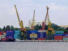
Asia
-
 - Port of Suzhou - Suzhou, China - Yangtze River
 -
 - Magampura Mahinda Rajapaksa Port - Hambantota, Sri Lanka
Europe
-
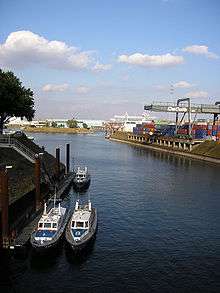
 - Duisburg Inland Port - Duisburg, Germany - Rhine River
 -
 - Autonomous Port of Paris - Paris, France - Waterways in Paris
 -
.svg.png) - Port of Liège - Liège, Belgium - Meuse River and canals
- Port of Liège - Liège, Belgium - Meuse River and canals -
 - Port of Bratislava - Bratislava, Slovakia - Danube river
 -
 - Port of Waterford - Waterford, Ireland - Suir river
 -
 - Port of Seville - Seville, Spain - Guadalquivir river
 -
 - Port of Moscow, North River Terminal, South River Terminal - Moscow, Russia - Moskva River, Moscow Canal
 -
 - Port of Manchester (including Manchester Docks), England, United Kingdom - Manchester Ship Canal provides Manchester direct access to the Irish Sea - closed in 1982; being renovated as the Atlantic Gateway
 - - Gloucester Docks, England, United Kingdom - Gloucester and Sharpness Canal
- - Birmingham, England, United Kingdom - Various canals
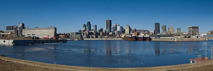
North America
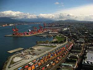
Great Lakes
Rivers and inland
South America
-
 - San Lorenzo-Puerto General San Martín Port Complex - San Lorenzo and Puerto General San Martín, Santa Fe, Argentina - Paraná River
 - - Port of Rosario - Rosario, Santa Fe, Argentina - Paraná River
- - Port of San Nicolás de los Arroyos - San Nicolás de los Arroyos, Buenos Aires (province), Argentina - Paraná River
-
 - Puerto Aguirre - Puerto Quijarro, Bolivia - Tamengo Canal
 - - Puerto Busch - Bolivia - Paraguay River - under construction
- - Port of Guayaramerín - Guayaramerín, Bolivia - Mamoré River
- - Port of Riberalta - Riberalta, Bolivia - Madre de Dios River and Beni River
-
 - Port of Porto Alegre - Porto Alegre, Rio Grande do Sul, Brazil - Guaíba Lake
 - - Port of Porto Velho - Porto Velho, Rondônia, Brazil - Madeira River
- - Port of Manaus - Manaus, Amazonas, Brazil - Rio Negro
- - Port of Santarém - Santarém, Pará, Brazil - Tapajós and Amazon Rivers
-
 - Port of Asunción - Asunción, Paraguay - Paraguay River
 - - Port of Encarnación - Encarnación, Itapúa Department, Paraguay - Paraná River
- - Port of San Antonio - San Antonio, Central Department, Paraguay - Paraguay River
- - Port of Villeta - Villeta, Central Department, Paraguay - Paraguay River
Proposed
See also
Notes
- Canada ranking from Transport Canada.[1]
- Saint Lawrence Seaway distances from Seaway Handbook.[2]
- United States ranking from American Association of Port Authorities.[3]
- Upper Mississippi River distances from U.S. Army Corps of Engineers.[4]
- Lower Mississippi River distances from U.S. Army Corps of Engineers.[7]
- Ohio River distances from U.S. Army Corps of Engineers.[8]
- Missouri River distances from U.S. Army Corps of Engineers.[6]
- Mississippi Basin ports marked.[10]
- Some ports were part of the Dubai Ports World controversy.[9]
References
- 1 2 3 Marine Transportation, Table 8-17," Canada's Marine Domestic &International Traffic Handled for CPA's and Other Ports, 2003–2004" Transportation in Canada 2005, Transport Canada; domestic and foreign in megatonnes.
- 1 2 3 4 Distance from the Montreal start of the Saint Lawrence Seaway in nautical miles; for river sides facing down stream L=left, R=right. Seaway Handbook - Complete 2006 Edition. Also Trade Mission Brochure, Great Lakes/St. Lawrence Seaway System.
- 1 2 3 Port rankings by tonnage from [AAPA website], accessed 2 Oct 2012
- 1 2 3 4 5 6 Distance up the Mississippi River from Cairo, Illinois; side of the river as one faces down river, L=left, R=right. St. Paul and Rock Island Districts, U.S. Army Corps of Engineers.
- ↑ "Minneapolis moves to close Upper Harbor Terminal". 2012-04-16. Retrieved 2016-08-04.
- 1 2 3 4 Distance up the Missouri River from St. Louis, Missouri; side of the river as one faces down river, L=left, R=right. Kansas City District, U.S. Army Corps of Engineers.
- 1 2 3 4 5 6 7 8 9 Distance up the Mississippi River from Head of Passes, Louisiana; side of the river as one faces down river, L=left, R=right. 1998 Mississippi River Navigation Charts, Upper Mississippi River Mile 300 to Gulf of Mexico, Mississippi Valley Division, U.S. Army Corps of Engineers. Also Index of maps by river mile 1998 Mississippi River Navigation Charts.
- 1 2 3 4 5 6 7 Distance down the Ohio River from Pittsburgh, Pennsylvania; side of the river as one faces down river, L=left, R=right. Louisville and Huntington Districts, U.S. Army Corps of Engineers.
- 1 2 Dubai Ports World controversy
- 1 2 3 4 5 6 7 8 9 10 11 12 13 14 Mississippi watershed
- ↑ "Port of Richmond".
- ↑ http://www.mondaytimes.co.ug/details.php?option=acat&a=1485#.VyRQvyb6xQI
| Types |
|
|---|---|
| Individual sites |
|
| Rankings | |
| Port management |
|
| Conventions | |
| Organizations |
|
| |