Maryville, Missouri
| Maryville, Missouri | |
|---|---|
| City | |
|
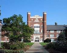
Nodaway County Courthouse, 2006 | |
 Location within Nodaway County and Missouri | |
 U.S. Census Map of Maryville | |
| Coordinates: 40°20′43″N 94°52′16″W / 40.34528°N 94.87111°WCoordinates: 40°20′43″N 94°52′16″W / 40.34528°N 94.87111°W[1] | |
| Country | United States |
| State | Missouri |
| County | Nodaway |
| Platted | 1845 |
| Government | |
| • Type | Mayor–Council |
| • Mayor | Renee Riedel [2] |
| • City Manager | Greg McDanel [3] |
| • City Clerk | Sheila Smail [3] |
| Area[4] | |
| • Total | 5.80 sq mi (15.02 km2) |
| • Land | 5.77 sq mi (14.94 km2) |
| • Water | 0.03 sq mi (0.08 km2) |
| Elevation[1] | 1,152 ft (351 m) |
| Population (2010)[5][6] | |
| • Total | 11,972 |
| • Estimate (2012) | 12,015 |
| • Density | 2,100/sq mi (800/km2) |
| Time zone | CST (UTC-6) |
| • Summer (DST) | CDT (UTC-5) |
| ZIP code | 64468 [7] |
| Area code | 660 |
| FIPS code | 29-46640 [1] |
| GNIS feature ID | 0721948 [1] |
| Website | maryvillemo.org |

Maryville is a city and county seat of Nodaway County, Missouri, United States.[1] As of the 2010 census, the city population was 11,972.[8][9] Maryville is home to Northwest Missouri State University, Northwest Technical School, and the Missouri Academy of Science, Mathematics and Computing.
Maryville is the second largest city (first is St. Joseph, Missouri) wholly within the boundaries of the 1836 Platte Purchase which expanded Missouri's borders into former Indian Territory in northwest Missouri.
History
Maryville was platted on September 1, 1845.[10]
The first post master in Maryville was Amos Graham. Graham was one of the first settlers in what became downtown Maryville. The city is named for his wife Mary.[11] Graham was one of the original Nodaway County Commissioners and its first county clerk when the county was organized in 1845. Maryville, which is near the geographic center of Nodaway County, was also named the county seat in 1845.[12][13]
The first courthouse was built in 1846 (county government was earlier held in the home of early settler I.N. Prather's home south of Maryville which had the post office name of Reindeer). A new courthouse was built in 1853. The existing courthouse was built in 1881 with a design by Edmond Jacques Eckel and George R. Mann (who designed the Arkansas State Capitol).[14] The current courthouse is on the National Register of Historic Places.[15] The original court complex included one of the country's only rotary jails. The jail was torn down in 1984 and replaced with a new structure on the same site.[16] A sculpture of a pineapple, the sign of welcome, is atop the courthouse.
The city was incorporated in 1856, annulled in 1857, reincorporated in 1859, annulled during the Civil War, reincorporated in 1869, disincoporated again in 1869 and finally formally incorporated on July 19, 1869.[17] when the Kansas City, St. Joseph, and Council Bluffs Railroad (later acquired by the Chicago, Burlington and Quincy Railroad) arrived. The Wabash Railroad arrived in 1879.[12] Both railroads no longer operate in the city and no railroads are operate anywhere in Nodaway County.
Missouri governors
In 1872 Albert P. Morehouse started the Nodaway Democrat, which became the Maryville Daily Forum. Morehouse would become governor. He lived in a house on Vine Street. Coincidentally, the house would later be occupied by Forrest C. Donnell before Donnell became a governor and U.S. Senator. The Forum was a chain-owned newspaper for nearly 100 years and in 2013 it reverted to local ownership by the Cobb Group.
In 1889 the Maryville Methodist Seminary opened.
In 1891 Elizabeth Howell (who operated Howell Millinery in Maryville) contributed to the development of the Lazy Susan when she received an American patent for "certain new and useful Improvements in Self-Waiting Tables". Howell's device ran more smoothly and did not permit crumbs to fall into the space between the Lazy Susan and the table.[18]
In 1894 Mary Augustine Giesen moved to Maryville and opened St. Francis Hospital.
Kentucky Derby Connections
In 1901 the horse Elwood was foaled at Faustiana Farms, owned by Mrs. J.B. Prather, on the west side of Maryville. It won the Kentucky Derby in 1904 and was the first Derby winner to be bred by a woman. Faustiana was located where the Maryville Country Club is today. Mrs. Prather also has connections with the second horse to be owned and bred by a woman to win the Derby -- Black Gold in 1924 which was the great grand child of Faustus the namesake of the Faustiana farm.[19] Elwood and Black Gold are two of 10 Kentucky Derby winners with Nodaway County connections. Trainer Ben A. Jones won the Derby in 1938, 1941, 1944, 1948 1949 and 1952. His son Jimmy Jones won in 1957 and 1958. They operated a horse farm at Parnell, Missouri until their deaths (although their racing fame is tied to Calumet Farm in Kentucky). Jimmy died in Maryville in 2001. Memorabilia from their horse racing days are St. Francis Hospital and at the Nodaway County Historical Society Museum.
Northwest Missouri State University founding
In 1905 Maryville won a contest to get the Fifth District Normal School which would become Northwest Missouri State University. It offered $58,672 and 86 acres (35 ha) including the Methodist Seminary to the state. The college was on the northeast corner of the city near adjoining the Wabash train station. The most significant structure on the land transferred to the state was the Thomas Gaunt mansion which is also on the National Register and is the college President's residence.[20] Gaunt owned an extensive nursery on his property which was on a birch lined street and it is now the Missouri Arboretum. The most recognizable building on the campus today is the Administration Building[21] designed by John H. Felt. It is on the National Register and resembles Brookings Hall at Washington University which was the Administration Building of the 1904 World's Fair in St. Louis, Missouri.
Herbert Hoover connections
In 1928 there was speculation that Maryville would become the "Western White House" for Herbert Hoover when it was discovered that he owned a farm 15 miles south of town. The farm was actually only 80 acres and he had acquired it after holding the mortgage for his Stanford University Class of 1895 roommate Samuel Wilson Collins. It was Iowa-native Hoover's only farm and Hoover visited it in 1933 after leaving office. He was accompanied by his former Secretary of Agriculture Arthur M. Hyde.[22] Hoover's vice president Charles Curtis visited Maryville on October 4, 1932 where spoke at the Administration Building after being rained out of a planned appearance at the Courthouse.[23]
Harry Truman connections
Harry S. Truman (along with Bess Truman and Margaret Truman) made the last of several visits to Maryville on August 3, 1962 when he dedicated the current post office.[24] Truman had extensive ties to Maryville. During World War I Truman was a member of the 129th Field Artillery Regiment in the Missouri National Guard which is headquartered in Maryville. Truman commanded Battery D in the war of the 129th. The 129th official motto is "Truman's Own" because of the affiliation. During the Meuse-Argonne Offensive during World War I in 1918 Truman prophetically told his troops, ""Right now, I'm where I want to be -- in command of this battery. I'd rather be here than president of the United States."[25] Among the original 129th soldiers was Edward V. Condon (1893-1974) who later operated the Condon Corner Drug Store across the street on the Square after the war.[26] Truman dedicated the 129th's armory on the northwest side of Bearcat Stadium on the college campus on February 20, 1955.[27][28] The 1955 armory was repurposed as the Jon T. Rickman Electronic Campus Support Center in 2003 when a new armory was built further west of the campus near the Maryville Country Club which is site the original Faustiana Farm complex.[29] Many of Maryville's most active citizens have ties to the 129th including Leigh Wilson (1881-1978) who rose to rank of Brigadier General. Wilson who operated the Wilson Motel in Maryville as well as Hitching Post restaurant was one of the biggest proponents for broadening Maryville's economic base away from just the college.[30]
Truman's sister Mary Jane Truman, who was active in the Order of Eastern Star, visited Maryville and Nodaway County several times for Eastern Star events before, during and after the Truman presidency.[31]
In 1969 Maryville received an All-America City Award.
In 1987 the Palms Bar in town began sponsoring the "World's Shortest Saint Patrick's Day Parade." The parades which are less than a block long have been getting shorter each year as other towns compete for the title. One of the mainstays of events has been a garbage truck driving down the street at the beginning pouring out buckets of green water as a Maryville homage to the dying of the Chicago River green.[32] In 2015 the parade moved from being a block off the square to actually being on the square after it became sponsored by Burny's Sports Bar.[33]
In 1994 Mozingo Lake opened east of Maryville. Its Mozingo Lake Golf Course has courses designed by Donald Sechrest and Tom Watson (which opened in 2016).[34]
In 1996 the Maryville Treatment Center, a minimum security prison, opened in a renovated Franciscan Sisters of Mary Motherhouse which had been built in 1947 and has a landmark yellow steeple on the bluffs above the One Hundred and Two River on the east side of Maryville.
Football Title Town
Maryville became a football powerhouse in 1994 when Mel Tjeerdsma became coach of Northwest Missouri State Bearcats football. The Bearcats played in 1998, 1999, 2005, 2006, 2007, 2008, 2009, 2013 and 2015 NCAA Division II Football Championship games winning in 1998, 1999, 2009, 2013 and 2015. In addition the Maryville High School (Missouri) football team appeared in 1996, 2008, 2009, 2012, 2013, 2016 (winning in 2009, 2012 and 2013 in addition to an earlier championship in 1982) state championship games. The dual championships have earned the town nickname of "Title Town." The high school has the unique mascot of "Spoofhounds." Both schools have green and white for the school colors.[35] Adam Dorrel, a Maryville High graduate, succeeded his former boss Tjeerdsma when he retired as coach in 2010 and kept up the tradition winning the national titles in 2013 and 2015.
In 2002 the principal highway through Maryville US Route 71 was converted to a 4-lane from Savannah, Missouri and a bypass was built along the east side of Maryville. 71 is at least a 4-lane and some cases an interstate highway for the entire length of Missouri from the Arkansas border and there had been considerable delays in converting the last remaining 2 lane section from Savannah to Maryville. US 71 north of Maryville to the Iowa border is the only remaining 2 lane portion of 71 in Missouri,
Crime
1931 lynching incident
In 1931, a notorious lynching occurred in Maryville when a mob burned alive African American Raymond Gunn, who had confessed to killing and attempting to rape a 20-year-old white school teacher. The lynching attracted national attention and was frequently invoked in the unsuccessful campaign to pass the Costigan-Wagner Bill, which would have made it a federal crime for law enforcement officials to refuse to try to prevent a lynching.[36][37][38][39]
2012 sexual assault incident
A controversial case arose in 2012 when Matthew Barnett, 17 at the time, was arrested for the sexual assault of a 14-year-old girl named Daisy Coleman. Another Maryville High senior, Jordan Zech, 17, was also charged with felony sexual exploitation of a minor because he videotaped Barnett and the girl on an iPhone. A significant controversy arose in 2013 when the prosecution dropped felony charges against Barnett, grandson of the former state representative Rex Barnett.[40][41]
Outrage in online communities soon followed when the story surrounding this case was revisited in October 2013.[42] Michael Schaffer, reporting on the incident for The New Republic, described Maryville as a "lawless hellhole".[43] In 2014, a special prosecutor was put in charge to reinvestigate the case. Barnett pleaded guilty to misdemeanor second-degree endangerment of the welfare of a child for leaving her outside of her house.[44][45] Barnett was sentenced in juvenile court for the assault.[46] The incident is featured in the 2016 Netflix documentary Audrie & Daisy.
Geography
Maryville is located at 40°20′43″N 94°52′16″W / 40.34528°N 94.87111°W (40.345353, -94.871199),[1] which is about 100 miles (160 km) north of the Kansas City metropolitan area. According to the United States Census Bureau, the city has a total area of 5.80 square miles (15.02 km2), of which, 5.77 square miles (14.94 km2) is land and 0.03 square miles (0.08 km2) is water.[4]
The One Hundred and Two River, located on the eastern side of the city, is the primary source of power and water for the city.
Climate
Situated in a transitional climate area, Maryville has a humid continental climate (Köppen climate classification Dfa[47]) with hot, humid summers combined with unusually cold winters by Missouri standards. Although prone to hard freezes, Maryville's coldest month of January still retains average highs above the freezing point. The large diurnal temperature variations plunge average lows into the mid-10's, with around 141 air frosts per year on average.[48]
| Climate data for Maryville, Missouri | |||||||||||||
|---|---|---|---|---|---|---|---|---|---|---|---|---|---|
| Month | Jan | Feb | Mar | Apr | May | Jun | Jul | Aug | Sep | Oct | Nov | Dec | Year |
| Record high °F (°C) | 75 (24) |
80 (27) |
92 (33) |
96 (36) |
110 (43) |
105 (41) |
112 (44) |
113 (45) |
107 (42) |
99 (37) |
82 (28) |
71 (22) |
113 (45) |
| Average high °F (°C) | 34 (1) |
38 (3) |
50 (10) |
63 (17) |
74 (23) |
83 (28) |
89 (32) |
87 (31) |
79 (26) |
67 (19) |
51 (11) |
37 (3) |
63 (17) |
| Daily mean °F (°C) | 24 (−4) |
27 (−3) |
38 (3) |
51 (11) |
62 (17) |
71 (22) |
77 (25) |
75 (24) |
67 (19) |
55 (13) |
40 (4) |
28 (−2) |
51 (11) |
| Average low °F (°C) | 14 (−10) |
17 (−8) |
27 (−3) |
40 (4) |
51 (11) |
60 (16) |
65 (18) |
63 (17) |
55 (13) |
43 (6) |
29 (−2) |
19 (−7) |
40 (4) |
| Record low °F (°C) | −28 (−33) |
−28 (−33) |
−26 (−32) |
6 (−14) |
25 (−4) |
38 (3) |
47 (8) |
39 (4) |
28 (−2) |
2 (−17) |
−5 (−21) |
−21 (−29) |
−28 (−33) |
| Average precipitation inches (mm) | 1.1 (28) |
1.3 (33) |
2 (50) |
3.2 (81) |
5 (130) |
5.5 (140) |
4.2 (107) |
4.3 (109) |
4.1 (104) |
2.6 (66) |
1.8 (46) |
1.1 (28) |
36 (910) |
| Average snowfall inches (cm) | 6.5 (16.5) |
6 (15) |
5.2 (13.2) |
1.1 (2.8) |
0.1 (0.3) |
0 (0) |
0 (0) |
0 (0) |
0 (0) |
0.5 (1.3) |
1.7 (4.3) |
4.9 (12.4) |
26 (66) |
| Source: [49] | |||||||||||||
Demographics
| Historical population | |||
|---|---|---|---|
| Census | Pop. | %± | |
| 1860 | 427 | — | |
| 1870 | 1,682 | 293.9% | |
| 1880 | 3,485 | 107.2% | |
| 1890 | 4,037 | 15.8% | |
| 1900 | 4,577 | 13.4% | |
| 1910 | 4,762 | 4.0% | |
| 1920 | 4,711 | −1.1% | |
| 1930 | 5,217 | 10.7% | |
| 1940 | 5,700 | 9.3% | |
| 1950 | 6,834 | 19.9% | |
| 1960 | 7,807 | 14.2% | |
| 1970 | 9,970 | 27.7% | |
| 1980 | 9,558 | −4.1% | |
| 1990 | 10,663 | 11.6% | |
| 2000 | 10,581 | −0.8% | |
| 2010 | 11,972 | 13.1% | |
| Est. 2015 | 11,879 | [50] | −0.8% |
| U.S. Decennial Census | |||
2010 census
As of the census[5] of 2010, there were 11,972 people, 4,217 households, and 1,865 families residing in the city. The population density was 2,074.9 inhabitants per square mile (801.1/km2). There were 4,543 housing units at an average density of 787.3 per square mile (304.0/km2). The racial makeup of the city was 92.3% White, 3.1% African American, 0.2% Native American, 2.7% Asian, 0.4% from other races, and 1.2% from two or more races. Hispanic or Latino of any race were 1.6% of the population.
There were 4,217 households of which 20.4% had children under the age of 18 living with them, 33.7% were married couples living together, 7.6% had a female householder with no husband present, 2.9% had a male householder with no wife present, and 55.8% were non-families. 35.5% of all households were made up of individuals and 11.8% had someone living alone who was 65 years of age or older. The average household size was 2.16 and the average family size was 2.82.
The median age in the city was 22.7 years. 13.8% of residents were under the age of 18; 43.6% were between the ages of 18 and 24; 16.3% were from 25 to 44; 14.8% were from 45 to 64; and 11.4% were 65 years of age or older. The gender makeup of the city was 47.9% male and 52.1% female.
2000 census
As of the census[51] of 2000, there were 10,581 people, 3,913 households, and 1,835 families residing in the city. The population density was 2,102.8 people per square mile (812.2/km²). There were 4,227 housing units at an average density of 840.0 per square mile (324.5/km²). The racial makeup of the city was 95.78% White, 1.48% African American, 0.18% Native American, 1.46% Asian, 0.02% Pacific Islander, 0.31% from other races, and 0.77% from two or more races. Hispanic or Latino of any race were 0.98% of the population.
There were 3,913 households out of which 20.8% had children under the age of 18 living with them, 37.4% were married couples living together, 7.2% had a female householder with no husband present, and 53.1% were non-families. 35.3% of all households were made up of individuals and 11.2% had someone living alone who was 65 years of age or older. The average household size was 2.16 and the average family size was 2.83.
In the city the population was spread out with 14.0% under the age of 18, 41.4% from 18 to 24, 17.3% from 25 to 44, 14.8% from 45 to 64, and 12.5% who were 65 years of age or older. The mean age was 23 years. For every 100 females there were 87.1 males. For every 100 females age 18 and over, there were 83.6 males.
The mean income for a household in the city was $29,043, and the mean income for a family was $43,906. Males had a mean income of $30,444 versus $22,444 for females. The per capita income for the city was $15,483. About 10.3% of families and 23.6% of the population were below the poverty line, including 12.3% of those under age 18 and 14.2% of those age 65 or over.
Points of interest


- Missouri Academy of Science, Mathematics and Computing
- Missouri State Arboretum
- Mozingo Lake Park and Golf Course
- Nodaway County Historical Society Museum
- Northwest Missouri State University
- Maryville Treatment Center
Recreation
Maryville has ten city parks, which includes six baseball fields, several soccer and American football fields, a skate park, a nature park, and the Maryville Aquatic Center. The city also maintains the Mozingo Lake Park and Golf Course. The golf course consists of 18 holes and is situated about the lake.
Government
The city of Maryville is governed by a city council consisting of five members who are elected at-large and serve terms of three years. There is no limit to the number of terms that one can serve on the council. Each year, one of the council members is selected to serve as the mayor of the city and another as the mayor pro tem.[2]
Education
Primary and secondary education
The Maryville R-II School District contains 3 separate buildings:
- Maryville High School (Grades 9-12)
- Maryville Middle School (Grades 5-8)
- Eugene Field Elementary School (Grades Pre-K-4)
Maryville is also served by
- St. Gregory's Barbarigo School (Grades K-8)
- Horace Mann Laboratory School (Grades Pre-K-6)
- The Missouri Academy of Science, Mathematics and Computing (Grades 11-12)
Colleges
Maryville is also home to Northwest Missouri State University.
Media
Radio
Four licensed broadcast stations in the town are:
- KNIM - 1580 AM - Oldies and Regional News
- KZLX-LP - 106.7 FM - NWMSU Student Radio Station
- KVVL - 97.1 FM - Oldies, Classic rock, and Regional Sports
- KNIM 95.9 Pickup Country
- KXCV - 90.5 FM - NWMSU University Radio Station: Classical/Jazz, National Public Radio, and Bearcat Radio Network (NWMSU Sports) Flagship Station
Infrastructure
Transportation
There are two U.S. Highways in Maryville. U.S. Route 71 and U.S. Route 136 intersect on the eastern side of the city. A branch of US 71, U.S. Route 71 Business, serves as the main street for the city. Route 46, Route 148, and Route V also provide access outside of the city.
Maryville is served by the Northwest Missouri Regional Airport, which is a general aviation airport with no commercial service.
Health care
Maryville is home of St. Francis Hospital and Health Services.[52]
Notable people
- Sarah Caldwell - Boston opera diva
- Dale Carnegie - author of How to Win Friends and Influence People
- Craig Cobb - white supremacist activist
- Homer Croy - author and screenwriter who wrote about life in Maryville
- Albert David - Medal of Honor recipient for capture of U-505 during World War II
- Forrest C. Donnell - Missouri Governor
- Elwood - Kentucky Derby winner born at Faustiana Farms
- Raymond Gunn - a black man burned to death by a mob of townsfolk in 1931
- Horace A. "Jimmy" Jones - horse trainer
- Darius Kinsey - photographer of logging industry
- Truman H. Landon - Air Force General
- Edward H. Moore - U.S. Senator in Oklahoma
- Albert P. Morehouse - Missouri Governor
- Lynne Overman - actor sidekick from the 1930s and 1940s
- Jim Spainhower - State Treasurer
- George S.E. Vaughn - accused Confederate spy who claimed to have been pardoned by Abraham Lincoln an hour before the President's assassination
See also
Further reading
- A Biographical History of Nodaway and Atchison Counties, Missouri; Lewis Publishing Company; 630 pages; 1901.
- The History of Nodaway County, Missouri; St. Joseph Steam Printing Company; 1034 pages; 1882.
References
- 1 2 3 4 5 6 "GNIS Detail - Maryville". Geonamesusgs.gov. Retrieved 5 July 2016.
- 1 2 "Mayor and Council - Maryville, MO". Maryville.org. Retrieved 5 July 2016.
- 1 2 "Maryville, Missouri - Official Website". Maryville.org. Retrieved 5 July 2016.
- 1 2 "US Gazetteer files 2010". United States Census Bureau. Archived from the original on 2012-01-24. Retrieved 2012-07-08.
- 1 2 "American FactFinder". United States Census Bureau. Retrieved 2012-07-08.
- ↑ "Population Estimates". United States Census Bureau. Archived from the original on 2013-06-17. Retrieved 2013-05-30.
- ↑ United States Postal Service (2012). "USPS - Look Up a ZIP Code". Retrieved 2012-02-15.
- ↑ "2010 City Population and Housing Occupancy Status". U.S. Census Bureau. Archived from the original on July 21, 2011. Retrieved July 9, 2012.
- ↑ "American FactFinder". United States Census Bureau. Archived from the original on 2013-09-11. Retrieved 2011-05-14.
- ↑ Eaton, David Wolfe (1917). How Missouri Counties, Towns and Streams Were Named. The State Historical Society of Missouri. p. 336.
- ↑ A Biographical History of Nodaway and Atchison Counties Missouri, Compendium on National Biography, The Lewis Publishing Company, 1901. Retrieved 2009-09-06.
- 1 2 "Community History - Maryville, MO". Maryville.org. Retrieved 5 July 2016.
- ↑ "The history of Nodaway county, Missouri, containing a history of the county, its cities, towns, etc., biographical sketches of its citizens". Archive.org. Retrieved 5 July 2016.
- ↑ "UED6073 Nodaway County Courthouse - University of Missouri Extension". Extension.missouri.edu. Retrieved 5 July 2016.
- ↑ "Archived copy" (PDF). Archived from the original (PDF) on March 6, 2016. Retrieved March 20, 2016.
- ↑ "Susan Cronk: Nodaway County's Human Squirrel Cage Jail". Susancronk.com. Retrieved 5 July 2016.
- ↑ "The history of Nodaway county, Missouri, containing a history of the county, its cities, towns, etc., biographical sketches of its citizens". Archive.org. Retrieved 5 July 2016.
- ↑ Howell, Elizabeth (1891). Patent No. 464,073. Maryville, Missouri: United States Patent Office.
- ↑ "Black Gold Horse Pedigree". Pedigreequery.com. Retrieved 5 July 2016.
- ↑ "Archived copy" (PDF). Archived from the original (PDF) on May 23, 2011. Retrieved March 20, 2016.
- ↑ "Archived copy" (PDF). Archived from the original (PDF) on September 12, 2015. Retrieved March 20, 2016.
- ↑ "Clipping from Shamokin News-Dispatch on Newspapers.com". Newspapers.com. Retrieved 5 July 2016.
- ↑ "VP Charles Curtis Speaks in Maryville October 4, 1932 - on Newspapers.com". Newspapers.com. Retrieved 5 July 2016.
- ↑ roger (4 January 2012). "Harry Truman Dedicates Maryville Post Office August 3, 1962". Maryvillemo.wordpress.com. Retrieved 5 July 2016.
- ↑ Kelly, Bethanne. "Content". Military.com. Retrieved 2016-07-07.
- ↑ "Truman Library - Edward V. Condon Papers". Trumanlibrary.org. Retrieved 5 July 2016.
- ↑ "The Maryville Daily Forum from Maryville, Missouri · Page 1". Newspapers.com. Retrieved 5 July 2016.
- ↑ "Maryville MO's Radio Station That ROCKS :: 97.1 The 'Vill KVVL". Nodawaybroadcasting.com. 2011-06-10. Retrieved 2016-07-07.
- ↑ "Northwest Missouri State University - Facilities". Nwmissouri.smartcatalogiq.com. Retrieved 5 July 2016.
- ↑ "The Maryville Daily Forum from Maryville, Missouri · Page 20". Newspapers.com. Retrieved 5 July 2016.
- ↑ "Mary Jane Truman Maryville Masonic Lodge May 28, 1948 - on Newspapers.com". Newspapers.com. Retrieved 5 July 2016.
- ↑ "CNN - EVENTS: World's Shortest St. Patrick's Day Parade - March 17, 1997". Cnn.com. Retrieved 5 July 2016.
- ↑ writer, TONY BROWN Staff. "New location, sponsor proposed for St. Pat's parade". Maryvilledailyforum.com. Retrieved 5 July 2016.
- ↑ TONY BROWN. "Tom Watson to attend youth course opening". Maryvilledailyforum.com. Retrieved 5 July 2016.
- ↑
- ↑ Lawrence O. Christensen, ed. (1999). Dictionary of Missouri Biography. University of Missouri Press. pp. 359–361. ISBN 978-0826212221.
- ↑ "RACES: Lynching No. 1". Time. January 19, 1931. Retrieved October 15, 2013.
- ↑ "Colter-Gunn Incident Bibliography". B. D. Owens Library, Northwest Missouri State University. Retrieved October 15, 2013.
- ↑ Raper, Arthur F. (2003). The Tragedy of Lynching (African American). Dover Publications. ISBN 978-0486430980.
- ↑ Arnett, Dugan (12 October 2013). Nightmare in Maryville: Teens’ sexual encounter ignites a firestorm against family, The Kansas City Star
- ↑ "Why Was The Maryville Rape Case Dropped?". KCUR.org. 2013-07-11. Retrieved 2016-07-07.
- ↑ David Von Drehle. Hackers Target Town After Dropped Sexual-Assault Case, Time, October 14, 2013
- ↑ Michael Schaffer (October 23, 2013). "Maryville, Missouri Is a Lawless Hellhole". The New Republic. Retrieved July 20, 2014.
- ↑ Times, Los Angeles. "'The case is closed': No rape charges in Maryville, Mo., case". Latimes.com. Retrieved 5 July 2016.
- ↑ "Maryville, Mo., Sexual Assault Case Comes to an End". ABC News. 2014-01-10.
- ↑ Green, Treye (2013-10-19). "Who Is Matthew Barnett? 7 Facts To Know About The Accused Maryville Rapist". International Business Times.
- ↑ "Maryville, Missouri Climate Summary". Weatherbase. Retrieved 25 November 2016.
- ↑ "Maryville climate normals""Maryville, Missouri Climate Normals". Weatherbase. Retrieved 25 November 2016.
- ↑
- ↑ "Annual Estimates of the Resident Population for Incorporated Places: April 1, 2010 to July 1, 2015". Retrieved July 2, 2016.
- ↑ "American FactFinder". United States Census Bureau. Archived from the original on 2013-09-11. Retrieved 2008-01-31.
- ↑ "Archived copy". Archived from the original on January 19, 2011. Retrieved December 30, 2010.
External links
| Wikimedia Commons has media related to Maryville, Missouri. |
- City of Maryville
- Maryville Modern Matrix (article in April-May 2000 issue of Missouri Life)
- "Nodaway County Historical Society Museum"
- "Northwest Missouri State University"
- "Ancestorology"
- Historic maps of Maryville in the Sanborn Maps of Missouri Collection at the University of Missouri
Municipalities and communities of Nodaway County, Missouri, United States | ||
|---|---|---|
| Cities | 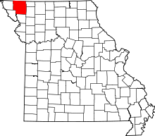 | |
| Villages | ||
| Townships | ||
| CDPs | ||
| Unincorporated communities | ||
| Ghost town | ||