U.S. Route 52
| |
|---|---|
 | |
| Route information | |
| Length: | 2,072 mi[1] (3,335 km) |
| Existed: | 1926[1] – present |
| Major junctions | |
| West end: |
|
| |
| South end: | Broad Street in Charleston, SC |
| Location | |
| States: | North Dakota, Minnesota, Iowa, Illinois, Indiana, Ohio, West Virginia, Kentucky, Virginia, North Carolina, South Carolina |
| Highway system | |

U.S. Route 52 (US 52) is a United States highway that runs across the northern, eastern and southeastern regions of the United States. Contrary to most other even-numbered U.S. Highways, US 52 primarily follows a northwest–southeast route, and is signed north–south or east–west depending on the local orientation of the route.
The highway's northwestern terminus is at Portal, North Dakota, on the Canadian border, where it continues as Saskatchewan Highway 39. The southeastern terminus of US 52 is in Charleston, South Carolina, at Number 2 Meeting Street and White Point Gardens along the Charleston Harbor.
Route description
| mi | km | |
|---|---|---|
| SC | 161 | 259 |
| NC | 150 | 240 |
| VA | 85 | 137 |
| WV | 186 | 299 |
| OH | 190 | 310 |
| IN | 198 | 319 |
| IL | 216 | 348 |
| IA | 164 | 264 |
| MN | 377 | 607 |
| ND | 361 | 581 |
| Total | 2,072 | 3,335 |
North Dakota
In North Dakota, US 52 continues from Highway 39 from the Canada–United States border at North Portal, Saskatchewan and Portal, North Dakota to the Red River in Fargo, a distance of 361 miles (581 km). US 52 passes through Burke, Ward, McHenry, Pierce, Sheridan, Wells, Foster, Stutsman, Barnes, and Cass counties.
US 52 is a two-lane highway in most areas, except for four lane segments between Burlington and Minot, Jamestown and Buchanan, and Jamestown and Fargo. Some segments in Fargo are six lanes.
US 52 is co-signed with US 2 near Minot, where it also intersects with US 83. US 52 is also co-signed with US 281 for 44 miles (71 km) between Jamestown and Carrington. US 52/US 281 in Jamestown is on sign different streets. Include 5th Street NW to 1st Ave, and to west bus loop. The former US 52 route was assigned to 10th street SE, 12th Ave SE, and 14th Street SE cosigned with Business Loop 94. The 93.5 miles (150 km) between Jamestown and Fargo are co-signed with Interstate 94. However, all of the interchanges for the Fargo/West Fargo portion of the route currently do not mention the concurrency with Interstate 94.
Minnesota

In the state of Minnesota, US 52 enters the state with Interstate 94 at Moorhead and follows Interstate 94 southeast all the way to the Twin Cities. The portion of the highway which overlaps Interstate 94 is unsigned. From downtown St. Paul, US 52 continues on its own southeast to Rochester and the Iowa border. South of the Twin Cities and through Rochester to Interstate 90, the road is being gradually improved to a freeway. It is currently a freeway from I-90, through Rochester, to Pine Island. It is also a freeway from Interstate 94 in St. Paul to just south of Concord Blvd in Inver Grove Heights. The rest of the highway between Pine Island and Inver Grove Heights is built to expressway standards. MnDOT has a long-term goal of making US 52 a freeway of controlled-access interchanges from Rochester to the Twin Cities.
Iowa
US 52 enters Iowa north of the unincorporated community of Burr Oak. It passes by Luther College on the west side of Decorah. At Calmar the road turns to a southwest-northeast orientation. It joins with U.S. Route 18 just to the west of Postville. The two highways overlap until a point east of the unincorporated community of Froelich. US 52 roughly parallels the Mississippi River for the rest of its path through Iowa. At Luxemburg it joins with Iowa Highway 3 and turns east. The two highways run together to downtown Dubuque, where it intersects U.S. Highway 61 and U.S. Highway 151.
South of Dubuque, US 52, US 61, and US 151 share a freeway routing until 52 departs in Key West to remain close to the Mississippi River. Just west of Sabula the highway turns to an east–west orientation at the junction of Iowa Highway 64 and the northern terminus of U.S. Route 67. In Sabula, the highway becomes a 'wrong way' road. Northbound traffic travels south, and vice versa, from Sabula to the Savanna–Sabula Bridge, where US 52 crosses into Illinois.
North of Dubuque, Iowa, US 52 is routed on to a narrow and often winding road. While scenic, the road has been the scene of numerous accidents over the years owing to this nature. Between 1964 and 1967, this segment of the route was called Alternate US 52 and US 52 was rerouted south from Luxemburg, Iowa to Dyersville, Iowa along Iowa Highway 136, and east from Dyersville to Dubuque along U.S. Route 20.[2]
The entire length of US 52 in Iowa is located within the unglaciated Driftless Area.
Illinois

In Illinois, US 52 runs southeast from the Savanna–Sabula Bridge at the terminus of Iowa Highway 64 and Illinois Route 64 in Savanna, passing through the cities of Dixon, Amboy and Mendota. US 52 then turns due south and then east, crossing Interstate 39 near Troy Grove. It continues east, passing through Shorewood and then through the southern portion of Joliet, where it is a major thoroughfare in the city of Joliet (Jefferson Street), avoiding the city of Chicago proper. It joins with U.S. Route 45 through Kankakee, and then runs concurrently with U.S. Route 24, east of Watseka to the Indiana state line.
Indiana
In Indiana, US 52 runs in a northwest-southeast direction. It passes through Lafayette and Indianapolis. Northwest of Indianapolis, US 52 runs along the same general area as, and is considered an alternative route to, Interstate 65. In the Indianapolis area, it is overlapped with Interstate 865 and Interstate 465. East of Indianapolis, it is considered an alternative to Interstate 74 before joining it before entering Ohio.
When U.S. 52 went through Downtown Indianapolis, it went onto Brookville Road, then turned right onto English Avenue. It then joined U.S. 421 when it turns right onto Southeastern Avenue. US 52/421 joined U.S. 40 when it turned left onto Washington Street. It then splits into Washington Street (westbound) and Maryland Street (eastbound). US 52 then turned right onto West Street (from West Street, it turned left onto Maryland Street). U.S. 52 turned left on either Indiana Avenue or 16th Street (US 136). Eventually, U.S. 52 would overlap U.S. 136 on 16th Street. It then turned right onto Lafayette Road, which became Indianapolis Road when reaching Zionsville. When I-65 was completed through Downtown Indianapolis, U.S. 52 got on I-65 from the Lafayette Road interchange, and traveled on I-65 the rest of the way. In 1970, the route was re-routed onto the south belt of I-465 from Brookville Road to I-65. It was re-routed again on its current route around Indianapolis in either 2000 or 2001.
Ohio
US 52 enters Ohio concurrently with Interstate 74 in northwestern Hamilton County. US 52 then parallels Interstate 75 from Interstate 74's terminus into and through downtown Cincinnati. It skirts the Cincinnati riverfront along Pete Rose Way in the vicinity of Paul Brown Stadium and Great American Ball Park. From this point eastward, US 52 generally follows the Ohio River. There is a brief concurrency with Interstate 275 near California, a neighborhood on the far eastern edge of the city of Cincinnati. Towns along its path include New Richmond, Aberdeen, Ripley and Manchester. The section between Interstate 275 and New Richmond was modernized in the 1960s. Parts of the old route run parallel to the newer highway. Around Portsmouth and Ironton US 52 has several freeway or expressway sections. In Portsmouth, US 52 intersects with US 23. At Chesapeake, US 52 crosses the Ohio River into Huntington, West Virginia.
The sections of US 52 that follow the Ohio River are known as the Ohio River Scenic Byway, which is part of the National Scenic Byway Project. The section between SR 125 and SR 73 (near Portsmouth) is also designated as Scenic Scioto Heritage Trail. This portion of US 52, along the Ohio between Cincinnati and Huntington, is the only part where it falls in geographical sequence, south of US 50 and north of US 60.
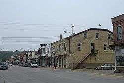
US 52 passes by the birthplace of U.S. President Ulysses S. Grant in Point Pleasant, Ohio.
West Virginia
US 52 serves western and southern portions of West Virginia, running from Huntington to Bluefield. The highway is undergoing a major expansion project which began in 2007 and at current funding levels is likely to take many years to finish.
During its run in West Virginia, US 52 enters Kentucky briefly, as described in the next paragraph. (Eventually, however, US 52 leaves West Virginia and enters Virginia.)
Kentucky
US 52 briefly enters Kentucky twice along the Williamson, West Virginia bypass, in order to prevent the blasting of several hillsides in West Virginia. These stretches were completed in 1996 as part of the Corridor G (U.S. Route 119) project. The speed limit in West Virginia is 65 mph (105 km/h), but drops to 55 mph (89 km/h) along the Kentucky portions, as Kentucky law states that any non-freeway (as is US 52) must not have a speed limit higher than 55 mph (89 km/h).
Virginia
US 52 enters Virginia from West Virginia, and in Virginia closely follows Interstate 77. It enters southwestern Virginia near Bluefield and passes through Wytheville and Hillsville before leaving the state south of Cana.
North Carolina

US 52 enters North Carolina just north west of Mount Airy. It goes by Pilot Mountain, one of the most distinctive natural features in North Carolina. Through the Piedmont Triad region, US 52 is mostly a limited-access freeway. The route joins Interstate 85 Business into Lexington, North Carolina and shares Interstate 85 around Salisbury, North Carolina. The segment of US 52 from Interstate 40 in Winston-Salem, North Carolina to Lexington is currently being upgraded to Interstate highway standards for the future Interstate 285 corridor. The segment from northern Winston-Salem to just south of Mount Airy is expected to form part of the Interstate 74 corridor through North Carolina.
South of the Triad area, after splitting from Interstate 85 in Salisbury, US 52 is typically a two-lane route linking some of the state's smaller cities and towns. Albemarle is the largest municipality along this segment of US 52 to the South Carolina state line.
South Carolina
US 52 enters South Carolina northeast of Cheraw. From Darlington southward it is a multilane highway and Freeway, passing through Florence, Lake City, Kingstree, Moncks Corner and North Charleston before US 52's terminus at number 2 Meeting Street and White Point Gardens in Charleston.
History
Historically, US 52 was routed along University Avenue between Minneapolis and St. Paul. In the 1980s and 1990s, the highway was gradually shifted onto its present route along Interstate 94. However, there was a gap in the definition of the highway for a few years until 1995. Since then, it has been routed along the interstate between the Twin Cities, although as of 2007, there was still a sign on University Avenue entering Hennepin County telling motorists to follow County Highways 36 and 37 to reach US 52—which kept them on University, then on 4th St. for historic westbound US 52. Historic westbound US 52 then crossed the Central Avenue bridge (current Minnesota State Highway 65) and turned onto the current routing of County Highway 81 northwest to Osseo. It then followed the current route of U.S. Highway 169 north to Anoka.
In Rochester, Minnesota, US 52 was recently expanded to six lanes. Long term plans have US 52 from St. Paul to Interstate 90 becoming a freeway, and some have suggested that when the conversion is complete, the freeway should become a spur route for Interstate 90 (I-X90). Currently, Interstate 90 has no spur routes in Minnesota. Also, US 52's route through Rochester has exit numbers, presently the only non-Interstate in Minnesota to have them.
On April 10, 2015, a rockslide dropped a boulder the size of a house onto the westbound lanes of US 52 in Lawrence County just east of the bridge over the Ohio River to Ashland, Kentucky, leading to closures and detours while two days of cleanup took place.[3]
U.S. Route 121 (1926)
Established in 1926, US 121 traversed from Lexington, North Carolina, to Max Meadows, Virginia, estimated to be 107 miles (172 km). In North Carolina it overlapped with NC 66; in Virginia it was overlapped with SR 15. In 1934, US 52 was extended southeast into Virginia and North Carolina, and replaced all of US 121.[4][5][6]
Major intersections

- North Dakota
-
.svg.png) Hwy 39 at the Canada–United States border in Portal
Hwy 39 at the Canada–United States border in Portal -
 US 2 northwest of Burlington. The highways travel concurrently to southeast of Minot.
 -
 US 83 in Minot
 -
 US 281 in Carrington. The highways travel concurrently to Jamestown.
 -
 I‑94 in Jamestown. The highways travel concurrently to Saint Paul, Minnesota.
 -
 US 10 in West Fargo
 -

 I‑29 / US 81 in Fargo
 - Minnesota
-
 US 75 in Moorhead
 -
 US 59 in Fergus Falls Township. The highways travel concurrently to the Buse–Dane Prairie township line.
 -
 US 71 in Sauk Centre
 -

 I‑494 / I‑694 in Maple Grove. I-694/US 52 travels concurrently to Brooklyn Center.
 -
 US 169 on the Maple Grove–Brooklyn Park city line
 -

 I‑394 / US 12 in Minneapolis. US 12/US 52 travels concurrently to Saint Paul.
 -
 I‑35W in Minneapolis. The highways travel concurrently, but on separate lanes, through the city.
 -
 I‑35E in Saint Paul. The highways travel concurrently, but on separate lanes, through the city.
 - I‑35E / US 10 in Saint Paul. US 10/US 52 travels concurrently through the city.
- I‑494 in Inver Grove Heights
-
 US 63 in Rochester. The highways travel concurrently through the city.
 -
 US 14 in Rochester. The highways travel concurrently through the city.
 -
 I‑90 in Marion Township
 - Iowa
-
 US 18 in Post Township. The highways travel concurrently to Giard Township.
 -

 US 61 / US 151 in Dubuque. The highways travel concurrently through the city.
 -
 US 67 in Union Township
 - Illinois
-
 US 30 on the Amboy–Franklin Grove township line
 -
 US 34 in Mendota
 -

 I‑39 / US 51 on the Troy Grove–Ophir township line
 -
 I‑55 in Shorewood
 -
 US 6 in Joliet. The highways travel concurrently through the city.
 -
 I‑80 in Joliet
 -
 US 45 in Peotone Township. The highways travel concurrently to Ashkum Township.
 -
 I‑57 in Kankakee
 -
 US 24 in Concord Township. The highways travel concurrently to Kentland, Indiana.
 - Indiana
-
 US 24 / US 41 in Kentland. US 41/US 52 travels concurrently to Richland Township.
 -
 US 231 in Montmorenci. The highways travel concurrently to Wabash Township.
 -
 I‑65 in Center Township. The highways travel concurrently to Eagle Township.
 -
 I‑65 / I‑865 in Eagle Township. I-865/US 52 travels concurrently through the township.
 -
 I‑465 / I‑865 in Eagle Township. I-465/US 52 travels concurrently to Indianapolis.
 -
 US 421 in Indianapolis. The highways travel concurrently through the city.
 -
 US 31 in Carmel. The highways travel concurrently to Indianapolis.
 -
 I‑69 in Indianapolis
 -
 US 36 in Lawrence. The highways travel concurrently to Indianapolis.
 -
 I‑70 in Indianapolis
 -
 US 40 in Indianapolis. The highways travel concurrently through the city.
 - I‑465 / US 31 / US 36 / US 40 / US 421 in Indianapolis
-
 I‑74 in Harrison Township. The highways travel concurrently to Cincinnati, Ohio.
 - Ohio
-
 I‑275 in Whitewater Township. The highways travel concurrently to Taylor Creek.
 -
 US 27 in Cincinnati. The highways travel concurrently through the city.
 -
 US 27 / US 127 in Cincinnati
 -
 I‑74 / I‑75 in Cincinnati. I-75/US 52 travels concurrently through the city.
 - US 27 in Cincinnati. The highways travel concurrently through the city.
- US 27 / US 127 in Cincinnati. The highways travel concurrently through the city.
-
 US 42 in Cincinnati. The highways travel concurrently through the city.
 -
 US 22 in Cincinnati
 -
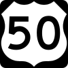 US 27 / US 50 in Cincinnati. US 27/US 52 travels concurrently through the city.
 - I‑275 in Cincinnati. The highways travel concurrently to Anderson Township.
-

 US 62 / US 68 in Ripley. US 52/US 62 travels concurrently to Aberdeen. US 52/US 68 travels concurrently to Huntington Township.
 -
 US 23 in Portsmouth
 - West Virginia
-
 US 60 in Huntington
 -
 I‑64 in Huntington. The highways travel concurrently to Kenova.
 -
 US 119 northeast of Nolan. The highways travel concurrently to Williamson.
 - Kentucky
- No major intersections
- West Virginia
- No major intersections
- Kentucky
- No major intersections
- West Virginia
-
 US 19 in Bluefield. The highways travel concurrently through the city.
 -
 US 460 in Bluefield. The highways travel concurrently through the city.
 -
 I‑77 in Bluefield. The highways travel concurrently to north-northwest of Rocky Gap, Virginia.
 - Virginia
- I‑77 in Rocky Gap
- I‑77 west of Bland
-

 I‑81 / US 21 in Wytheville. I-81/US 52 travel concurrently to Fort Chiswell.
 - I‑77 in Wytheville. The highways travel concurrently to Fort Chiswell.
-
 US 11 in Wytheville. The highways travel concurrently to Fort Chiswell.
 -
 US 221 in Hillsville
 -
 US 58 in Hillsville
 - North Carolina
-
 US 601 in Mount Airy
 - I‑74 southeast of Mount Airy
-
.svg.png) Future I‑74 in Winston-Salem
Future I‑74 in Winston-Salem -
 US 311 in Winston-Salem. The highways travel concurrently through the city.
 -
 US 158 / US 421 in Winston-Salem
 -
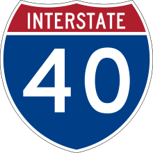
.svg.png) I‑40 / Future I‑285 / US 311 in Winston-Salem. I-285/US 52 will travel concurrently to Lexington.
I‑40 / Future I‑285 / US 311 in Winston-Salem. I-285/US 52 will travel concurrently to Lexington. -
 US 64 in Lexington
 -

 US 29 / US 70 in Lexington. The highways travel concurrently to northeast of Spencer.
 -
 I‑85 / Future I‑285 in Lexington. I-85/US 52 travel concurrently to Salisbury.
 -
 US 74 in Wadesboro. The highways travel concurrently through the city.
 - South Carolina
-
 US 1 in Cheraw. The highways travel concurrently to south-southwest of Cheraw.
 -

 US 15 / US 401 in Society Hill. US 15/US 52 travels concurrently to southwest of Society Hill. US 52/US 401 travels concurrently to Darlington.
 -
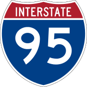 I‑95 northwest of Florence
 -
 US 76 in Florence
 -
 US 301 in Florence. The highways travel concurrently to Effingham.
 -
 US 378 north of Lake City
 -
 US 521 east of Greeleyville
 -
 US 176 in Goose Creek
 -
 US 78 in North Charleston. The highways travel concurrently through the city.
 -
 I‑26 in North Charleston
 -
 I‑526 in North Charleston
 -
 I‑26 / US 17 in Charleston
 - I‑26 / US 17 in Charleston
- Line Street/Meeting Street in Charleston
Future
Long term plans call for Interstate 74 to be expanded eastward along the current US 52 corridor from its current eastern Terminus of Interstate 75 in Cincinnati to U.S. Route 23 which is proposed to be upgraded to Interstate Highway standards and be signed as Interstate 73 in Portsmouth, Ohio. Funding concerns have prevented the construction of both freeways to begin in Ohio.
See also
Related routes
Bannered and suffixed routes
References
- 1 2 Droz, Robert V. "U.S. Highways: From US 1 to (US 830)". Archived from the original on June 28, 2006. Retrieved July 4, 2006.
- ↑ "Iowa Highways Page US 52". Retrieved October 4, 2014.
- ↑ Clay, Jarrod (April 12, 2015). "US 52 Reopened After Crews Clear Debris From 1,500 Ton Boulder". Charleston, WV: WCHS-TV. Archived from the original on July 27, 2015. Retrieved July 26, 2015.
- ↑ "NCRoads.com: US 21". Retrieved February 28, 2011.
- ↑ "US Numbered Highways". Archived from the original on November 29, 2010. Retrieved February 28, 2011.
- ↑ "US 52 Charleston, South Carolina, to Portal, North Dakota". Retrieved February 28, 2011.
External links
| Wikimedia Commons has media related to U.S. Route 52. |
| Browse numbered routes | ||||
|---|---|---|---|---|
| ← | ND | ND 53 | ||
| ← | IL | IL 53 | ||
| ← | IN | SR 53 | ||
| ← | OH | SR 52 | ||
| ← | KY | KY 52 | ||
Routes in italics are no longer a part of the system. Highlighted routes are considered main routes of the system. |