| [2] |
Name[3] |
Patron |
Date[3] |
Location[3][4] |
County[3] |
Photograph |
|---|
| 1 |
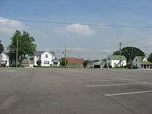
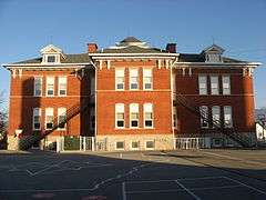
Botkins Elementary School |
N/A |
1921 |
Botkins: Main St.
40°28′8.8″N 84°10′57.5″W / 40.469111°N 84.182639°W / 40.469111; -84.182639 (Botkins Elementary School) |
Shelby |
 |
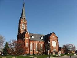
| 2 |
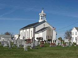
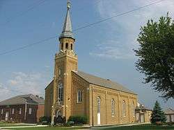
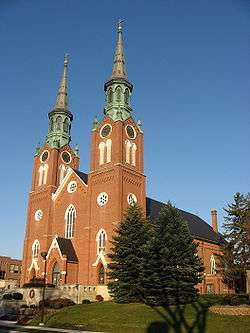
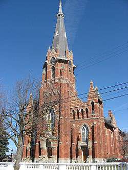
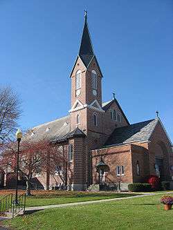
Cassella Catholic Church and Rectory |
Nativity of the Blessed Virgin Mary |
1858 |
Marion Township: State Route 119 in Cassella
40°24′24″N 84°33′3″W / 40.40667°N 84.55083°W / 40.40667; -84.55083 (Cassella Catholic Church and Rectory) |
Mercer |
 |
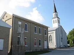
| 3 |
Chickasaw School and Rectory |
N/A |
1904 |
Chickasaw: Maple St.
40°26′10″N 84°29′35″W / 40.43611°N 84.49306°W / 40.43611; -84.49306 (Chickasaw School and Rectory) |
Mercer |
 |
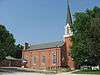
| 4 |
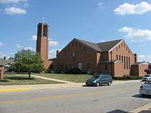
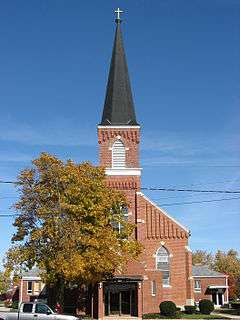
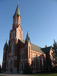
Coldwater Catholic Church Complex |
Holy Trinity |
1899 |
Coldwater: E. Main and 2nd Sts.
40°28′49″N 84°37′42″W / 40.48028°N 84.62833°W / 40.48028; -84.62833 (Coldwater Catholic Church Complex) |
Mercer |
 |
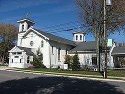
| 5 |
Egypt Catholic Church and Rectory |
St. Joseph |
1887 |
Jackson Township: junction of Minster-Egypt Rd. and State Route 364 at Egypt
40°23′5″N 84°26′4″W / 40.38472°N 84.43444°W / 40.38472; -84.43444 (Egypt Catholic Church and Rectory) |
Auglaize |
 |
| 6 |
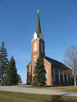
Glynnwood Catholic Church |
St. Patrick |
1883 |
Moulton Township: 6 miles northeast of St. Marys on Glynnwood Rd. in Glynnwood
40°34′59″N 84°19′5″W / 40.58306°N 84.31806°W / 40.58306; -84.31806 (Glynnwood Catholic Church) |
Auglaize |
 |
| 7 |
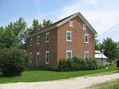
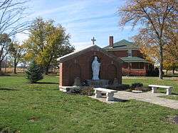
Gruenwald Convent |
N/A |
1854 |
Marion Township: 0.5 miles south of Cassella
40°24′1″N 84°33′3″W / 40.40028°N 84.55083°W / 40.40028; -84.55083 (Gruenwald Convent) |
Mercer |
 |
| 8 |
Holy Family Catholic Church |
Holy Family |
1866 |
Wayne Township: State Route 185 at Frenchtown
40°14′46″N 84°31′25″W / 40.24611°N 84.52361°W / 40.24611; -84.52361 (Holy Family Catholic Church) |
Darke |
 |
| 9 |
Holy Rosary Catholic Church |
Holy Rosary |
1867 |
St. Marys: junction of E. Spring and S. Pine Sts.
40°32′42″N 84°22′58″W / 40.54500°N 84.38278°W / 40.54500; -84.38278 (Holy Rosary Catholic Church) |
Auglaize |
 |
| 10 |
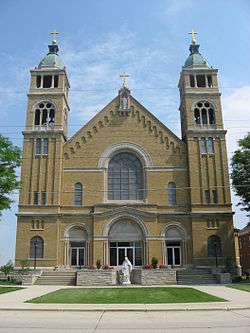
Immaculate Conception Catholic Church Complex |
Immaculate Conception |
1903 |
Celina: Anthony and Walnut Sts.
40°33′7″N 84°34′22″W / 40.55194°N 84.57278°W / 40.55194; -84.57278 (Immaculate Conception Catholic Church Complex) |
Mercer |
 |
| 11 |
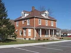
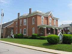
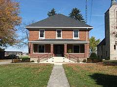
Immaculate Conception Rectory at Botkins |
Immaculate Conception |
1887 |
Botkins: 116 N. Mill St.
40°28′9.6″N 84°10′57.8″W / 40.469333°N 84.182722°W / 40.469333; -84.182722 (Immaculate Conception Rectory at Botkins) |
Shelby |
 |
| 12 |
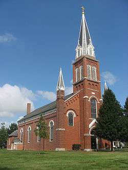
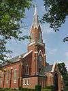
Maria Stein Catholic Church and Rectory |
St. John the Baptist |
1889 |
Marion Township: St. John's Rd. and State Route 119 in Maria Stein
40°24′29″N 84°28′22″W / 40.40806°N 84.47278°W / 40.40806; -84.47278 (Maria Stein Catholic Church and Rectory) |
Mercer |
 |
| 13 |
Maria Stein Convent |
N/A |
1846 |
Marion Township: St. John's and Rolfes Rd. in Maria Stein
40°24′57″N 84°28′34″W / 40.41583°N 84.47611°W / 40.41583; -84.47611 (Maria Stein Convent) |
Mercer |
 |
| 14 |
Minster Elementary School |
N/A |
1904 |
Minster: Lincoln St.
40°23′42″N 84°22′44″W / 40.39500°N 84.37889°W / 40.39500; -84.37889 (Minster Elementary School) |
Auglaize |
 |
| 15 |
Philothea Catholic Church and Priest House |
St. Mary |
1871 |
Butler Township: Philothea Rd. in Philothea, between St. Henry and Coldwater
40°27′3″N 84°39′18″W / 40.45083°N 84.65500°W / 40.45083; -84.65500 (Philothea Catholic Church and Priest House) |
Mercer |
 |
| 16 |
Sacred Heart of Jesus Rectory |
Sacred Heart of Jesus |
1911 |
Van Buren Township: State Routes 29 and 119 at McCartyville
40°23′42.4″N 84°15′16.6″W / 40.395111°N 84.254611°W / 40.395111; -84.254611 (Sacred Heart of Jesus Rectory) |
Shelby |
 |
| 17 |
St. Aloysius Catholic Church |
St. Aloysius |
1875 |
Marion Township: U.S. Route 127 and State Route 274, west of Carthagena
40°26′11″N 84°34′12″W / 40.43639°N 84.57000°W / 40.43639; -84.57000 (St. Aloysius Catholic Church) |
Mercer |
 |
| 18 |
St. Anthony Catholic Church, Padua |
St. Anthony |
1869 |
Washington Township: State Route 49 and St. Anthony Rd. in Padua
40°30′32″N 84°47′7″W / 40.50889°N 84.78528°W / 40.50889; -84.78528 (St. Anthony Catholic Church, Padua) |
Mercer |
 |
| 19 |
St. Augustine Catholic Church |
St. Augustine |
1848 |
Minster: N. Hanover St.
40°23′40″N 84°22′47″W / 40.39444°N 84.37972°W / 40.39444; -84.37972 (St. Augustine Catholic Church) |
Auglaize |
 |
| 20 |
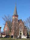
St. Bernard Catholic Church and Rectory |
St. Bernard |
1906 |
Burkettsville: Main St.
40°21′8″N 84°38′45″W / 40.35222°N 84.64583°W / 40.35222; -84.64583 (St. Bernard Catholic Church and Rectory) |
Mercer |
 |
| 21 |
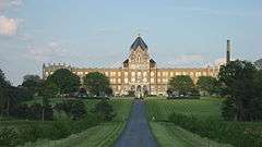
St. Charles Seminary and Chapel |
St. Charles |
1906 |
Marion Township: 0.5 miles south of Carthagena, off U.S. Route 127
40°25′57″N 84°33′48″W / 40.43250°N 84.56333°W / 40.43250; -84.56333 (St. Charles Seminary and Chapel) |
Mercer |
 |
| 22 |
St. Francis Catholic Church and Rectory |
St. Francis |
1906 |
Granville Township: Cranberry and Ft. Recovery-Minster Rd. in Cranberry Prairie
40°23′34″N 84°34′55″W / 40.39278°N 84.58194°W / 40.39278; -84.58194 (St. Francis Catholic Church and Rectory) |
Mercer |
 |
| 23 |
St. Henry Catholic Church |
St. Henry |
1897 |
St. Henry: Main St.
40°25′3″N 84°38′19″W / 40.41750°N 84.63861°W / 40.41750; -84.63861 (St. Henry Catholic Church) |
Mercer |
 |
| 24 |
St. John Catholic Church and Parish Hall |
St. John |
1850 |
Pusheta Township: southwestern corner of Schlemel and Van Buren Sts. in Fryburg
40°30′57.5″N 84°8′54.6″W / 40.515972°N 84.148500°W / 40.515972; -84.148500 (St. John Catholic Church and Parish Hall) |
Auglaize |
 |
| 25 |
St. Joseph Catholic Church and Rectory |
St. Joseph |
1866 |
Recovery Township: Sawmill and St. Joe Rds. in St. Joe
40°25′41″N 84°44′19″W / 40.42806°N 84.73861°W / 40.42806; -84.73861 (St. Joseph Catholic Church and Rectory) |
Mercer |
 |
| 26 |
St. Joseph Catholic Church and School |
St. Joseph |
1899 |
Wapakoneta: 309 S. Perry St.
40°34′4″N 84°11′43″W / 40.56778°N 84.19528°W / 40.56778; -84.19528 (St. Joseph Catholic Church and School) |
Auglaize |
 |
| 27 |
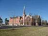
St. Louis Catholic Church and Rectory |
St. Louis |
1914 |
North Star: east of U.S. Route 127
40°19′29″N 84°34′13″W / 40.32472°N 84.57028°W / 40.32472; -84.57028 (St. Louis Catholic Church and Rectory) |
Darke |
 |
| 28 |
St. Michael Catholic Church Complex |
St. Michael |
1849 |
Fort Loramie: State Route 705 east of State Route 66
40°21′5″N 84°22′19″W / 40.35139°N 84.37194°W / 40.35139; -84.37194 (St. Michael Catholic Church Complex) |
Shelby |
 |
| 29 |
St. Nicholas Catholic Church and Rectory |
St. Nicholas |
1907 |
Osgood: State Route 705 and Washington St.
40°20′26″N 84°29′33″W / 40.34056°N 84.49250°W / 40.34056; -84.49250 (St. Nicholas Catholic Church and Rectory) |
Darke |
 |
| 30 |
St. Patrick Catholic Church and Rectory |
St. Patrick |
1915 |
Van Buren Township: Hoying and Wright-Puthoff Rds. in St. Patrick
40°22′13.1″N 84°17′19″W / 40.370306°N 84.28861°W / 40.370306; -84.28861 (St. Patrick Catholic Church and Rectory) |
Shelby |
 |
| 31 |
St. Paul's Catholic Church and Rectory |
St. Paul |
1889 |
Gibson Township: junction of Sharpsburg and Meiring Rds. in Sharpsburg
40°22′2″N 84°42′41″W / 40.36722°N 84.71139°W / 40.36722; -84.71139 (St. Paul's Catholic Church and Rectory) |
Mercer |
 |
| 32 |
St. Peter Catholic Church and Rectory |
St. Peter |
1904 |
Recovery Township: St. Peter and Philothea Rds. in St. Peter
40°27′3″N 84°44′48″W / 40.45083°N 84.74667°W / 40.45083; -84.74667 (St. Peter Catholic Church and Rectory) |
Mercer |
 |
| 33 |
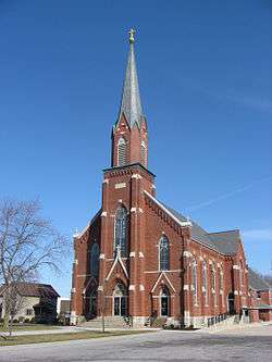
St. Remy Catholic Church |
St. Remy |
1890 |
Russia: Main St. and Russia-Versailles Rd.
40°14′0.68″N 84°24′53.25″W / 40.2335222°N 84.4147917°W / 40.2335222; -84.4147917 (St. Remy Catholic Church) |
Shelby |
 |
| 34 |
St. Rose Catholic Church Complex |
St. Rose |
1892 |
Marion Township: Main St. in St. Rose
40°24′26″N 84°30′53″W / 40.40722°N 84.51472°W / 40.40722; -84.51472 (St. Rose Catholic Church Complex) |
Mercer |
 |
| 35 |
St. Sebastian Catholic Church and Rectory |
St. Sebastian |
1904 |
Marion Township: Sebastian Rd. and State Route 716A in Sebastian
40°26′41.65″N 84°31′1.13″W / 40.4449028°N 84.5169806°W / 40.4449028; -84.5169806 (St. Sebastian Catholic Church and Rectory) |
Mercer |
 |
| 36 |
St. Wendelin Catholic Church, School, and Rectory |
St. Wendelin |
1870 |
Recovery Township: Ft. Recovery-Minster Rd. and Township Line in Wendelin
40°24′0″N 84°41′27″W / 40.40000°N 84.69083°W / 40.40000; -84.69083 (St. Wendelin Catholic Church, School, and Rectory) |
Mercer |
 |