Madison County, Nebraska
| Madison County, Nebraska | |
|---|---|
_2.JPG) Madison County courthouse in Madison | |
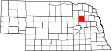 Location in the U.S. state of Nebraska | |
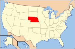 Nebraska's location in the U.S. | |
| Founded | 1867 |
| Seat | Madison |
| Largest city | Norfolk |
| Area | |
| • Total | 575 sq mi (1,489 km2) |
| • Land | 573 sq mi (1,484 km2) |
| • Water | 2.7 sq mi (7 km2), 0.5% |
| Population | |
| • (2010) | 34,876 |
| • Density | 61/sq mi (24/km²) |
| Congressional district | 1st |
| Time zone | Central: UTC-6/-5 |
| Website |
www |
Madison County is a county located in the U.S. state of Nebraska. As of the 2010 census, the population was 34,876.[1] Its county seat is Madison.[2] Madison County was named for James Madison, 4th President of the United States.[3]
Madison County is part of the Norfolk, NE Micropolitan Statistical Area.
In the Nebraska license plate system, Madison County is represented by the prefix 7 (the county had the seventh-largest number of vehicles registered in the state when the license plate system was established in 1922).
Geography
According to the U.S. Census Bureau, the county has a total area of 575 square miles (1,490 km2), of which 573 square miles (1,480 km2) is land and 2.7 square miles (7.0 km2) (0.5%) is water.[4]
Major highways
-
 U.S. Highway 81
 -
 U.S. Highway 275
 -
 Nebraska Highway 24
 -
 Nebraska Highway 32
 -
 Nebraska Highway 35
 -
 Nebraska Highway 45
 -
 Nebraska Highway 121
Adjacent counties
- Stanton County (east)
- Platte County (south)
- Boone County (southwest)
- Antelope County (northwest)
- Pierce County (north)
Demographics
| Historical population | |||
|---|---|---|---|
| Census | Pop. | %± | |
| 1870 | 1,133 | — | |
| 1880 | 5,589 | 393.3% | |
| 1890 | 13,669 | 144.6% | |
| 1900 | 16,976 | 24.2% | |
| 1910 | 19,101 | 12.5% | |
| 1920 | 22,511 | 17.9% | |
| 1930 | 26,037 | 15.7% | |
| 1940 | 24,269 | −6.8% | |
| 1950 | 24,338 | 0.3% | |
| 1960 | 25,145 | 3.3% | |
| 1970 | 27,402 | 9.0% | |
| 1980 | 31,382 | 14.5% | |
| 1990 | 32,655 | 4.1% | |
| 2000 | 35,226 | 7.9% | |
| 2010 | 34,876 | −1.0% | |
| Est. 2015 | 35,039 | [5] | 0.5% |
| U.S. Decennial Census[6] 1790-1960[7] 1900-1990[8] 1990-2000[9] 2010-2013[1] | |||
As of the census[10] of 2000, there were 35,226 people, 13,436 households, and 8,894 families residing in the county. The population density was 62 people per square mile (24/km²). There were 14,432 housing units at an average density of 25 per square mile (10/km²). The racial makeup of the county was 91.35% White, 0.94% Black or African American, 1.19% Native American, 0.40% Asian, 0.03% Pacific Islander, 5.06% from other races, and 1.03% from two or more races. 8.64% of the population were Hispanic or Latino of any race.
There were 13,436 households out of which 33.20% had children under the age of 18 living with them, 54.70% were married couples living together, 8.40% had a female householder with no husband present, and 33.80% were non-families. 27.90% of all households were made up of individuals and 12.40% had someone living alone who was 65 years of age or older. The average household size was 2.52 and the average family size was 3.12.
In the county the population was spread out with 26.80% under the age of 18, 11.60% from 18 to 24, 27.10% from 25 to 44, 20.10% from 45 to 64, and 14.40% who were 65 years of age or older. The median age was 35 years. For every 100 females there were 98.50 males. For every 100 females age 18 and over, there were 94.80 males.
The median income for a household in the county was $35,807, and the median income for a family was $45,073. Males had a median income of $30,631 versus $21,343 for females. The per capita income for the county was $16,804. About 7.50% of families and 11.20% of the population were below the poverty line, including 13.00% of those under age 18 and 11.50% of those age 65 or over.
Communities
- Battle Creek
- Emerick
- Enola
- Kalamazoo
- Madison (county seat)
- Meadow Grove
- Newman Grove (partial)
- Norfolk
- Tilden (partial)
- Warnerville
See also
Coordinates: 41°55′N 97°36′W / 41.92°N 97.60°W
References
- 1 2 "State & County QuickFacts". United States Census Bureau. Retrieved September 21, 2013.
- ↑ "Find a County". National Association of Counties. Retrieved 2011-06-07.
- ↑ Chicago and North Western Railway Company (1908). A History of the Origin of the Place Names Connected with the Chicago & North Western and Chicago, St. Paul, Minneapolis & Omaha Railways. p. 162.
- ↑ "2010 Census Gazetteer Files". United States Census Bureau. August 22, 2012. Retrieved December 9, 2014.
- ↑ "County Totals Dataset: Population, Population Change and Estimated Components of Population Change: April 1, 2010 to July 1, 2015". Retrieved July 2, 2016.
- ↑ "U.S. Decennial Census". United States Census Bureau. Retrieved December 9, 2014.
- ↑ "Historical Census Browser". University of Virginia Library. Retrieved December 9, 2014.
- ↑ "Population of Counties by Decennial Census: 1900 to 1990". United States Census Bureau. Retrieved December 9, 2014.
- ↑ "Census 2000 PHC-T-4. Ranking Tables for Counties: 1990 and 2000" (PDF). United States Census Bureau. Retrieved December 9, 2014.
- ↑ "American FactFinder". United States Census Bureau. Retrieved 2008-01-31.
 |
Antelope County | Pierce County | | |
| |
Stanton County | |||
| ||||
| | ||||
| Boone County | Platte County |
Municipalities and communities of Madison County, Nebraska, United States | ||
|---|---|---|
| Cities | ||
| Village | ||
| Unincorporated communities | ||
| Footnotes | ‡This populated place also has portions in an adjacent county or counties | |