Clay County, Nebraska
| Clay County, Nebraska | |
|---|---|
_6.jpg) Clay County courthouse in Clay Center | |
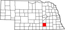 Location in the U.S. state of Nebraska | |
 Nebraska's location in the U.S. | |
| Founded | 1871 |
| Named for | Henry Clay |
| Seat | Clay Center |
| Largest city | Sutton |
| Area | |
| • Total | 574 sq mi (1,487 km2) |
| • Land | 572 sq mi (1,481 km2) |
| • Water | 1.2 sq mi (3 km2), 0.2% |
| Population | |
| • (2010) | 6,542 |
| • Density | 11/sq mi (4/km²) |
| Congressional district | 3rd |
| Time zone | Central: UTC-6/-5 |
| Website |
www |
Clay County is a county in the U.S. state of Nebraska. As of the 2010 census, the population was 6,542.[1] Its county seat is Clay Center.[2] The county was formed in 1855[3] and later organized in 1871.[4][5] It was named after Henry Clay, a member of the United States Senate from Kentucky and United States Secretary of State in the 19th century.[6]
In the Nebraska license plate system, Clay County is represented by the prefix 30 (it had the thirtieth-largest number of vehicles registered in the county when the license plate system was established in 1922).
Geography
According to the U.S. Census Bureau, the county has an area of 574 square miles (1,490 km2), of which 572 square miles (1,480 km2) is land and 1.2 square miles (3.1 km2) (0.2%) is water.[7]
Major highways
Adjacent counties
- Fillmore County, Nebraska (east)
- Nuckolls County, Nebraska (south)
- Adams County, Nebraska (west)
- Hamilton County, Nebraska (north)
Demographics
| Historical population | |||
|---|---|---|---|
| Census | Pop. | %± | |
| 1860 | 165 | — | |
| 1870 | 54 | −67.3% | |
| 1880 | 11,294 | 20,814.8% | |
| 1890 | 16,310 | 44.4% | |
| 1900 | 15,735 | −3.5% | |
| 1910 | 15,729 | 0.0% | |
| 1920 | 14,486 | −7.9% | |
| 1930 | 13,571 | −6.3% | |
| 1940 | 10,445 | −23.0% | |
| 1950 | 8,700 | −16.7% | |
| 1960 | 8,717 | 0.2% | |
| 1970 | 8,266 | −5.2% | |
| 1980 | 8,106 | −1.9% | |
| 1990 | 7,213 | −11.0% | |
| 2000 | 7,039 | −2.4% | |
| 2010 | 6,542 | −7.1% | |
| Est. 2015 | 6,309 | [8] | −3.6% |
| U.S. Decennial Census[9] 1790-1960[10] 1900-1990[11] 1990-2000[12] 2010-2013[1] | |||
As of the census[13] of 2000, there were 7,039 people, 2,756 households, and 1,981 families residing in the county. The population density was 12 people per square mile (5/km²). There were 3,066 housing units at an average density of 5 per square mile (2/km²). The racial makeup of the county was 97.57% White, 0.17% Black or African American, 0.31% Native American, 0.30% Asian, 1.24% from other races, and 0.41% from two or more races. 3.48% of the population were Hispanic or Latino of any race. 49.4% were of German, 7.2% English, 7.2% American, 5.4% Swedish and 5.3% Irish ancestry according to Census 2000.
There were 2,756 households out of which 32.90% had children under the age of 18 living with them, 63.70% were married couples living together, 5.50% had a female householder with no husband present, and 28.10% were non-families. 25.70% of all households were made up of individuals and 13.10% had someone living alone who was 65 years of age or older. The average household size was 2.52 and the average family size was 3.03.
In the county the population was spread out with 27.30% under the age of 18, 5.90% from 18 to 24, 25.30% from 25 to 44, 23.60% from 45 to 64, and 18.00% who were 65 years of age or older. The median age was 40 years. For every 100 females there were 95.10 males. For every 100 females age 18 and over, there were 95.00 males.
The median income for a household in the county was $34,259, and the median income for a family was $39,541. Males had a median income of $28,321 versus $19,870 for females. The per capita income for the county was $16,870. About 8.50% of families and 10.40% of the population were below the poverty line, including 13.40% of those under age 18 and 6.60% of those age 65 or over.
Communities
Cities
- Clay Center (county seat)
- Edgar
- Fairfield
- Harvard
- Sutton
Villages
- Deweese
- Glenvil
- Ong
- Saronville
- Trumbull (partial)
Census-designated place
Unincorporated communities
Townships
See also
References
- 1 2 "State & County QuickFacts". United States Census Bureau. Retrieved September 17, 2013.
- ↑ "Find a County". National Association of Counties. Archived from the original on 2011-05-31. Retrieved 2011-06-07.
- ↑ Fitzpatrick, Lilian Linder (1925). Nebraska Place-Names. Lincoln: University of Nebraska Studies in Language, Literature, and Criticism. p. 42. Retrieved December 14, 2014.
- ↑ "Clay County Nebraska Historic Buildings Survey" (PDF). Nebraska State Historical Society. Retrieved December 14, 2014.
- ↑ Andreas, A. T. (1882). "Andreas' History of the State of Nebraska". The Kansas Collection. Retrieved December 14, 2014.
- ↑ Gannett, Henry (1905). The Origin of Certain Place Names in the United States. Govt. Print. Off. p. 83.
- ↑ "2010 Census Gazetteer Files". United States Census Bureau. August 22, 2012. Retrieved December 6, 2014.
- ↑ "County Totals Dataset: Population, Population Change and Estimated Components of Population Change: April 1, 2010 to July 1, 2015". Retrieved July 2, 2016.
- ↑ "U.S. Decennial Census". United States Census Bureau. Archived from the original on May 11, 2015. Retrieved December 6, 2014.
- ↑ "Historical Census Browser". University of Virginia Library. Retrieved December 6, 2014.
- ↑ "Population of Counties by Decennial Census: 1900 to 1990". United States Census Bureau. Retrieved December 6, 2014.
- ↑ "Census 2000 PHC-T-4. Ranking Tables for Counties: 1990 and 2000" (PDF). United States Census Bureau. Retrieved December 6, 2014.
- ↑ "American FactFinder". United States Census Bureau. Archived from the original on 2013-09-11. Retrieved 2008-01-31.
External links
| Wikimedia Commons has media related to Clay County, Nebraska. |
 |
Hamilton County | | ||
| Adams County | |
Fillmore County | ||
| ||||
| | ||||
| Nuckolls County |
Municipalities and communities of Clay County, Nebraska, United States | ||
|---|---|---|
| Cities | ||
| Villages | ||
| Townships | ||
| CDP | ||
| Other unincorporated communities | ||
| Ghost town | ||
| Footnotes | ‡This populated place also has portions in an adjacent county or counties | |
Coordinates: 40°31′N 98°03′W / 40.52°N 98.05°W