Harlan County, Nebraska
| Harlan County, Nebraska | |
|---|---|
_5.jpg) Harlan County Courthouse in Alma | |
 Location in the U.S. state of Nebraska | |
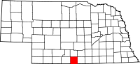
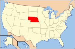 Nebraska's location in the U.S. | |
| Founded | 1871 |
| Seat | Alma |
| Largest city | Alma |
| Area | |
| • Total | 574 sq mi (1,487 km2) |
| • Land | 553 sq mi (1,432 km2) |
| • Water | 21 sq mi (54 km2), 3.6% |
| Population | |
| • (2010) | 3,423 |
| • Density | 6.2/sq mi (2/km²) |
| Congressional district | 3rd |
| Time zone | Central: UTC-6/-5 |
Harlan County is a county in the U.S. state of Nebraska. As of the 2010 census, the population was 3,423.[1] Its county seat is Alma.[2] The county is home to the Harlan County Reservoir.
In the Nebraska license plate system, Harlan County is represented by the prefix 51 (it had the fifty-first-largest number of vehicles registered in the county when the license plate system was established in 1922).
History
Prior to 1870, the portion of the Republican valley that now includes Harlan County was a prized hunting ground for the Native Americans; and the threat of attack deterred white settlement in the area. The defeat of the Sioux at the Battle of Summit Springs in 1869 largely eliminated this threat, and several parties were organized to explore the agricultural possibilities of the area.[3]
A party of forty men from eastern Nebraska settled near the site of present-day Orleans in August 1870. In 1871, a party from Cheyenne, Wyoming, led by Thomas Harlan, settled near Alma,[4] which was named after a daughter of one of the settlers.[5] In that year, Harlan County was separated from Lincoln County by the Nebraska state legislature. Accounts differ as to the county's namesake: either Thomas Harlan,[6] or James Harlan, who was U.S. Secretary of the Interior between 1865 and 1866.[5][7]
Geography
According to the U.S. Census Bureau, the county has a total area of 574 square miles (1,490 km2), of which 553 square miles (1,430 km2) is land and 21 square miles (54 km2) (3.6%) is water.[8]
Major highways
 U.S. Highway 6
 U.S. Highway 34
 U.S. Highway 183
 Nebraska Highway 4
 Nebraska Highway 46
 Nebraska Highway 89
Adjacent counties
- Phelps County - north
- Kearney County - northeast
- Franklin County - east
- Phillips County, Kansas - south
- Norton County, Kansas - southwest
- Furnas County - west
Demographics
| Historical population | |||
|---|---|---|---|
| Census | Pop. | %± | |
| 1880 | 6,086 | — | |
| 1890 | 8,158 | 34.0% | |
| 1900 | 9,370 | 14.9% | |
| 1910 | 9,578 | 2.2% | |
| 1920 | 9,220 | −3.7% | |
| 1930 | 8,951 | −2.9% | |
| 1940 | 7,130 | −20.3% | |
| 1950 | 7,189 | 0.8% | |
| 1960 | 5,081 | −29.3% | |
| 1970 | 4,357 | −14.2% | |
| 1980 | 4,292 | −1.5% | |
| 1990 | 3,810 | −11.2% | |
| 2000 | 3,786 | −0.6% | |
| 2010 | 3,423 | −9.6% | |
| Est. 2015 | 3,452 | [9] | 0.8% |
| U.S. Decennial Census[10] 1790-1960[11] 1900-1990[12] 1990-2000[13] 2010-2013[1] | |||
As of the census[14] of 2000, there were 3,786 people, 1,597 households, and 1,049 families residing in the county. The population density was 7 people per square mile (3/km²). There were 2,327 housing units at an average density of 4 per square mile (2/km²). The racial makeup of the county was 98.86% White, 0.13% Black or African American, 0.11% Native American, 0.08% Asian, 0.03% Pacific Islander, 0.16% from other races, and 0.63% from two or more races. 0.77% of the population were Hispanic or Latino of any race.
There were 1,597 households out of which 25.70% had children under the age of 18 living with them, 59.00% were married couples living together, 4.30% had a female householder with no husband present, and 34.30% were non-families. 30.80% of all households were made up of individuals and 16.70% had someone living alone who was 65 years of age or older. The average household size was 2.34 and the average family size was 2.93.
In the county the population was spread out with 24.20% under the age of 18, 5.00% from 18 to 24, 21.60% from 25 to 44, 26.20% from 45 to 64, and 23.00% who were 65 years of age or older. The median age was 44 years. For every 100 females there were 98.00 males. For every 100 females age 18 and over, there were 96.80 males.
The median income for a household in the county was $30,679, and the median income for a family was $36,875. Males had a median income of $27,580 versus $18,411 for females. The per capita income for the county was $15,618. About 7.00% of families and 10.10% of the population were below the poverty line, including 14.40% of those under age 18 and 9.10% of those age 65 or over.
Communities
City
- Alma (county seat)
Villages
Unincorporated communities
Townships
See also
References
- 1 2 "State & County QuickFacts". United States Census Bureau. Retrieved September 20, 2013.
- ↑ "Find a County". National Association of Counties. Retrieved 2011-06-07.
- ↑ Harlan County: First Settlements. Andreas's History of the State of Nebraska. Retrieved 2010-01-29.
- ↑ Harlan County, Nebraska: Historical Note. Film RG223. Nebraska State Historical Society. Retrieved 2010-01-29.
- 1 2 Fitzpatrick, Lilian Linder. "Harlan County". Nebraska Place-Names. University of Nebraska Studies in Language, Literature, and Criticism. 1925. Retrieved 2010-01-29.
- ↑ Harlan County, Nebraska. Film RG223. Nebraska State Historical Society. Retrieved 2010-01-29.
- ↑ Gannett, Henry (1905). The Origin of Certain Place Names in the United States. Govt. Print. Off. p. 150.
- ↑ "2010 Census Gazetteer Files". United States Census Bureau. August 22, 2012. Retrieved December 8, 2014.
- ↑ "County Totals Dataset: Population, Population Change and Estimated Components of Population Change: April 1, 2010 to July 1, 2015". Retrieved July 2, 2016.
- ↑ "U.S. Decennial Census". United States Census Bureau. Retrieved December 8, 2014.
- ↑ "Historical Census Browser". University of Virginia Library. Retrieved December 8, 2014.
- ↑ "Population of Counties by Decennial Census: 1900 to 1990". United States Census Bureau. Retrieved December 8, 2014.
- ↑ "Census 2000 PHC-T-4. Ranking Tables for Counties: 1990 and 2000" (PDF). United States Census Bureau. Retrieved December 8, 2014.
- ↑ "American FactFinder". United States Census Bureau. Retrieved 2008-01-31.
Further reading
- Field Guide to the Geology of the Harlan County Lake Area, Harlan County, Nebraska — with a History of Events Leading to Construction of Harlan County Dam online pdf
- Rogers, Jean McKee. History of Harlan County 1870-1967.
External links
| Wikimedia Commons has media related to Harlan County, Nebraska. |
 |
Phelps County | Kearney County | | |
| Furnas County | |
Franklin County | ||
| ||||
| | ||||
| Norton County, Kansas | Phillips County, Kansas |
Municipalities and communities of Harlan County, Nebraska, United States | ||
|---|---|---|
| City | ||
| Villages | ||
| Townships | ||
| Unincorporated communities | ||
| Footnotes | ‡This populated place also has portions in an adjacent county or counties | |
Coordinates: 40°10′N 99°24′W / 40.17°N 99.40°W