Saline County, Nebraska
| Saline County, Nebraska | |
|---|---|
 Saline County courthouse in Wilber | |
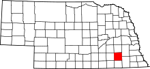 Location in the U.S. state of Nebraska | |
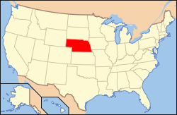 Nebraska's location in the U.S. | |
| Founded | 1867 |
| Seat | Wilber |
| Largest city | Crete |
| Area | |
| • Total | 576 sq mi (1,492 km2) |
| • Land | 574 sq mi (1,487 km2) |
| • Water | 2.3 sq mi (6 km2), 0.4% |
| Population | |
| • (2010) | 14,200 |
| • Density | 25/sq mi (10/km²) |
| Congressional district | 3rd |
| Time zone | Central: UTC-6/-5 |
| Website |
www |
Saline County is a county in the U.S. state of Nebraska. As of the 2010 census, the population was 14,200.[1] Its county seat is Wilber.[2]
In the Nebraska license plate system, Saline County is represented by the prefix 22 (it had the twenty-second-largest number of vehicles registered in the county when the license plate system was established in 1922).
History
Saline County was formed in 1855 and organized in 1867.[3][4] The first permanent settler arrived in 1858.[5]
Geography
According to the U.S. Census Bureau, the county has an area of 576 square miles (1,490 km2), of which 574 square miles (1,490 km2) is land and 2.3 square miles (6.0 km2) (0.4%) is water.[6]
Major highways
-
 U.S. Highway 6
 -
 Nebraska Highway 15
 -
 Nebraska Highway 33
 -
 Nebraska Highway 41
 -
 Nebraska Highway 74
 -
 Nebraska Highway 103
Adjacent counties
- Lancaster County (northeast)
- Gage County (southeast)
- Jefferson County (south)
- Fillmore County (west)
- Seward County (north)
Demographics
| Historical population | |||
|---|---|---|---|
| Census | Pop. | %± | |
| 1860 | 39 | — | |
| 1870 | 3,106 | 7,864.1% | |
| 1880 | 14,491 | 366.5% | |
| 1890 | 20,097 | 38.7% | |
| 1900 | 18,252 | −9.2% | |
| 1910 | 17,866 | −2.1% | |
| 1920 | 16,514 | −7.6% | |
| 1930 | 16,536 | 0.1% | |
| 1940 | 15,010 | −9.2% | |
| 1950 | 14,046 | −6.4% | |
| 1960 | 12,542 | −10.7% | |
| 1970 | 12,809 | 2.1% | |
| 1980 | 13,131 | 2.5% | |
| 1990 | 12,715 | −3.2% | |
| 2000 | 13,843 | 8.9% | |
| 2010 | 14,200 | 2.6% | |
| Est. 2015 | 14,282 | [7] | 0.6% |
| U.S. Decennial Census[8] 1790-1960[9] 1900-1990[10] 1990-2000[11] 2010-2013[1] | |||
As of the census[12] of 2000, there were 13,843 people, 5,188 households, and 3,507 families residing in the county. The population density was 24 people per square mile (9/km²). There were 5,611 housing units at an average density of 10 per square mile (4/km²). The racial makeup of the county was 92.99% White, 0.36% Black or African American, 0.38% Native American, 1.70% Asian, 0.03% Pacific Islander, 3.40% from other races, and 1.15% from two or more races. 6.58% of the population were Hispanic or Latino of any race.
There were 5,188 households out of which 32.80% had children under the age of 18 living with them, 56.50% were married couples living together, 7.20% had a female householder with no husband present, and 32.40% were non-families. 27.50% of all households were made up of individuals and 14.30% had someone living alone who was 65 years of age or older. The average household size was 2.50 and the average family size was 3.04.
In the county the population was spread out with 25.10% under the age of 18, 12.30% from 18 to 24, 25.00% from 25 to 44, 20.30% from 45 to 64, and 17.20% who were 65 years of age or older. The median age was 36 years. For every 100 females there were 97.80 males. For every 100 females age 18 and over, there were 95.10 males.
The median income for a household in the county was $35,914, and the median income for a family was $44,199. Males had a median income of $30,467 versus $22,690 for females. The per capita income for the county was $16,287. About 6.40% of families and 9.40% of the population were below the poverty line, including 8.90% of those under age 18 and 9.00% of those age 65 or over.
Communities
See also
References
- 1 2 "State & County QuickFacts". United States Census Bureau. Retrieved September 22, 2013.
- ↑ "Find a County". National Association of Counties. Retrieved 2011-06-07.
- ↑ Fitzpatrick, Lilian Linder (1925). Nebraska Place-Names. Lincoln: University of Nebraska Studies in Language, Literature, and Criticism. p. 122. Retrieved December 17, 2014.
- ↑ "Saline County". Nebraska Association of County Officials. Retrieved December 17, 2014.
- ↑ Burr, George L. (1921). History of Hamilton and Clay Counties, Nebraska, Volume 1. S.J. Clarke Publishing Company. p. 135.
- ↑ "2010 Census Gazetteer Files". United States Census Bureau. August 22, 2012. Retrieved December 11, 2014.
- ↑ "County Totals Dataset: Population, Population Change and Estimated Components of Population Change: April 1, 2010 to July 1, 2015". Retrieved July 2, 2016.
- ↑ "U.S. Decennial Census". United States Census Bureau. Retrieved December 11, 2014.
- ↑ "Historical Census Browser". University of Virginia Library. Retrieved December 11, 2014.
- ↑ "Population of Counties by Decennial Census: 1900 to 1990". United States Census Bureau. Retrieved December 11, 2014.
- ↑ "Census 2000 PHC-T-4. Ranking Tables for Counties: 1990 and 2000" (PDF). United States Census Bureau. Retrieved December 11, 2014.
- ↑ "American FactFinder". United States Census Bureau. Retrieved 2008-01-31.
External links
 |
Seward County | Lancaster County | | |
| Fillmore County | |
|||
| ||||
| | ||||
| Jefferson County | Gage County |
Municipalities and communities of Saline County, Nebraska, United States | ||
|---|---|---|
| Cities | ||
| Villages | ||
| Unincorporated communities | ||
| Footnotes | ‡This populated place also has portions in an adjacent county or counties | |
Coordinates: 40°32′N 97°08′W / 40.53°N 97.14°W