Sherman County, Nebraska
| Sherman County, Nebraska | |
|---|---|
_from_SE_2.JPG) Sherman County Courthouse in Loup City | |
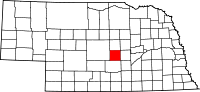 Location in the U.S. state of Nebraska | |
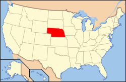 Nebraska's location in the U.S. | |
| Founded | 1873 |
| Named for | William Tecumseh Sherman |
| Seat | Loup City |
| Largest city | Loup City |
| Area | |
| • Total | 572 sq mi (1,481 km2) |
| • Land | 566 sq mi (1,466 km2) |
| • Water | 5.8 sq mi (15 km2), 1.0% |
| Population | |
| • (2010) | 3,152 |
| • Density | 5.6/sq mi (2/km²) |
| Congressional district | 3rd |
| Time zone | Central: UTC-6/-5 |
Sherman County is a county located in the U.S. state of Nebraska. As of the 2010 census, the population was 3,152.[1] Its county seat is Loup City.[2] The county was created in 1871 and later organized in 1873.[3][4][5] It was named after American Civil War General William Tecumseh Sherman.[6]
In the Nebraska license plate system, Sherman County is represented by the prefix 56 (it had the fifty-sixth-largest number of vehicles registered in the county when the license plate system was established in 1922).
Geography
According to the U.S. Census Bureau, the county has a total area of 572 square miles (1,480 km2), of which 566 square miles (1,470 km2) is land and 5.8 square miles (15 km2) (1.0%) is water.[7]
Major highways
-
 Nebraska Highway 2
 -
 Nebraska Highway 10
 -
 Nebraska Highway 58
 -
 Nebraska Highway 68
 -
 Nebraska Highway 92
Adjacent counties
- Howard County (east)
- Buffalo County (south)
- Custer County (west)
- Valley County (north)
- Greeley County (northeast)
Demographics
| Historical population | |||
|---|---|---|---|
| Census | Pop. | %± | |
| 1880 | 2,061 | — | |
| 1890 | 6,399 | 210.5% | |
| 1900 | 6,550 | 2.4% | |
| 1910 | 8,278 | 26.4% | |
| 1920 | 8,877 | 7.2% | |
| 1930 | 9,122 | 2.8% | |
| 1940 | 7,764 | −14.9% | |
| 1950 | 6,421 | −17.3% | |
| 1960 | 5,382 | −16.2% | |
| 1970 | 4,725 | −12.2% | |
| 1980 | 4,226 | −10.6% | |
| 1990 | 3,718 | −12.0% | |
| 2000 | 3,318 | −10.8% | |
| 2010 | 3,152 | −5.0% | |
| Est. 2015 | 3,091 | [8] | −1.9% |
| U.S. Decennial Census[9] 1790-1960[10] 1900-1990[11] 1990-2000[12] 2010-2013[1] | |||
As of the census[13] of 2010, there were 3,152 people, 1,392 households, and 903 families residing in the county. The population density was 5.6 people per square mile (2/km²). There were 1,392 occupied housing units and 1,941 total housing units. The racial makeup of the county was 99% White, 0.1% Black or African American, 0.1% Native American, 0.3% Asian, 0.1% from other races, and 0.4% from two or more races. 1% of the population were Hispanic or Latino of any race.
There were 1,392 households out of which 27.6% had children under the age of 18 living with them, 59.2% were married couples living together, 5.7% had a female householder with no husband present, and 32.9% were non-families. 30.4% of all households were made up of individuals and 16.7% had someone living alone who was 65 years of age or older. The average household size was 2.22 and the average family size was 2.78.
In the county the population was spread out with 22.4% under the age of 18, 54.2% from 18 to 64, and 23.4% 65 years of age or older. The median age was 47.8 years. 50.9% of the population were female and 49.1% were male.
The median income for a household in the county was $39,041, and the median income for a family was $34,821. Males had a median income of $23,065 versus $17,269 for females. The per capita income for the county was $26,416. About 14.1% of the population were below the poverty line.
Sherman County is one of the main Polish-American communities in the state and in the country. Americans of Polish ancestry are 29.6% of all population.
Communities
- Ashton
- Hazard
- Litchfield
- Loup City (county seat)
- Rockville
See also
References
- 1 2 "State & County QuickFacts". United States Census Bureau. Retrieved September 22, 2013.
- ↑ "Find a County". National Association of Counties. Retrieved 2011-06-07.
- ↑ Fitzpatrick, Lilian Linder (1925). Nebraska Place-Names. Lincoln: University of Nebraska Studies in Language, Literature, and Criticism. p. 135. Retrieved December 17, 2014.
- ↑ Andreas, A. T. (1882). "Andreas' History of the State of Nebraska". The Kansas Collection. Retrieved December 17, 2014.
- ↑ "Sherman County". Nebraska Association of County Officials. Retrieved December 17, 2014.
- ↑ Retrieved on March 14, 2008.
- ↑ "2010 Census Gazetteer Files". United States Census Bureau. August 22, 2012. Retrieved December 11, 2014.
- ↑ "County Totals Dataset: Population, Population Change and Estimated Components of Population Change: April 1, 2010 to July 1, 2015". Retrieved July 2, 2016.
- ↑ "U.S. Decennial Census". United States Census Bureau. Retrieved December 11, 2014.
- ↑ "Historical Census Browser". University of Virginia Library. Retrieved December 11, 2014.
- ↑ "Population of Counties by Decennial Census: 1900 to 1990". United States Census Bureau. Retrieved December 11, 2014.
- ↑ "Census 2000 PHC-T-4. Ranking Tables for Counties: 1990 and 2000" (PDF). United States Census Bureau. Retrieved December 11, 2014.
- ↑ "American FactFinder". United States Census Bureau. Retrieved 2008-01-31.
 |
Valley County | Greeley County | | |
| Custer County | |
Howard County | ||
| ||||
| | ||||
| Buffalo County |
Municipalities and communities of Sherman County, Nebraska, United States | ||
|---|---|---|
| City | ||
| Villages | ||
Coordinates: 41°13′N 98°58′W / 41.22°N 98.97°W