Banner County, Nebraska
| Banner County, Nebraska | |
|---|---|
|
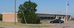
Banner County Courthouse in Harrisburg | |
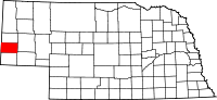 Location in the U.S. state of Nebraska | |
 Nebraska's location in the U.S. | |
| Founded | 1888 |
| Seat | Harrisburg |
| Largest community | Harrisburg |
| Area | |
| • Total | 746 sq mi (1,932 km2) |
| • Land | 746 sq mi (1,932 km2) |
| • Water | 0.2 sq mi (1 km2), 0.02% |
| Population | |
| • (2010) | 690 |
| • Density | 0.9/sq mi (0/km²) |
| Congressional district | 3rd |
| Time zone | Mountain: UTC-7/-6 |
| Website |
www |
Banner County is a county in the western part of the state of Nebraska in the Great Plains region of the United States. As of the 2010 census, its population was 690.[1] Its county seat is Harrisburg;[2] there are no incorporated municipalities within the county.
Banner County is part of the Scottsbluff, NE Micropolitan Statistical Area.
History
When Nebraska became a state in 1867, a single county encompassed the entire Panhandle.[3] In 1870, the Panhandle's southern half was organized as Cheyenne County. The arrival of increasing numbers of settlers led to the partitioning of the county in 1888: the eastern third became Deuel County; the middle third became present-day Cheyenne County; and the western third became Kimball, Scotts Bluff, and Banner Counties.[4] The last of these was named by citizens who declared it would become the state's "banner county", and "the brightest star in the constellation of Nebraska counties".[5]
The initial settlement of the area was by cattle ranchers, drawn by good pastures in the Pumpkin Creek valley. In the late 1880s, these open-range ranchers were displaced by an influx of settlers; by 1890, almost every quarter-section (160 acres, or 65 ha) was claimed by homesteaders. However, the good moisture years that had attracted these settlers were followed by a severe drought in 1893 and 1894, which drove many of the new settlers away again; the number of farms in the county declined by more than half, from 565 in 1890 to 226 in 1900. The land thus vacated was again used by ranchers, who raised both crops and cattle. The 1904 passage of the Kinkaid Act, which allowed homesteaders to claim 640 acres (260 ha) brought a new wave of settlers; however, even these larger tracts were often insufficient to support a family, and many of the Kinkaid claims were eventually sold to established cattle ranchers.[3][6]
The county's growth was hindered by the absence of railroads: the nearest lines ran through Kimball, 11 miles (18 km) to the south, and Gering, 8 miles (13 km) to the north. Roads were also slow to develop in the county: in 1921, only dirt roads existed. The difficulty of reaching markets tended to discourage commercial crop farming in the county.[7]
Irrigation
Rainfall in Banner County is light and variable; the average yearly precipitation at the Harrisburg weather station is 14.3 inches (360 mm).[8] Farmers responded by resorting to irrigation. The first irrigation well was drilled by the late 1920s, and others quickly followed. By the late 20th century, center-pivot irrigation systems were in use through much of the county.[3] By 2000, the Pumpkin Creek basin had approximately 500 registered irrigation wells.[9] Groundwater pumping combined with drought conditions ended surface flow in Pumpkin Creek by 1993, and significantly reduced the valley's groundwater levels.[10] In 2001, the North Platte Natural Resources District, which regulates water use in the watershed, declared a moratorium on the drilling of new wells, and limited existing operations to 14 inches (360 mm) of irrigation water per year.[9] Complicating matters, lawsuits were filed contending water use in the Pumpkin Creek valley depleted flows into Lake McConaughy and interfered with the prior water rights of downstream irrigators.[11]
ICBMs
Beginning in the early 1960s, intercontinental ballistic missiles (ICBMs), based at Warren Air Force Base near Cheyenne, Wyoming, were installed in a region of western Nebraska, Wyoming, and Colorado. From 1960 to 1963, 90 Atlas sites were constructed in Nebraska. Construction of the launch sites, and upgrading of the roads leading to them, led to an economic boom in western Nebraska. Beginning in 1963, the Atlas series was replaced by Minuteman missiles, which used solid instead of liquid fuel, and which were launched from underground silos. In the 1970s, there were 82 Minuteman III sites in the Panhandle, of which 20 were located in Banner County.[3]
Geography
According to the U.S. Census Bureau, the county has an area of 746 square miles (1,930 km2), of which 746 square miles (1,930 km2) is land and 0.2 square miles (0.52 km2) (0.02%) is water.[12]
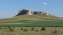
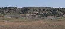
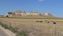
Banner County lies on what was once a tableland sloping away from the Rocky Mountains. Over geologic history, it was eroded by Pumpkin Creek and other watercourses, and much of the county now lies below the original High Plains level. The county can be divided into four major geographic divisions: the low-lying and relatively flat valley of Pumpkin Creek, which occupies about 40% of the county's area; a tableland, in places smooth and in others deeply dissected, occupying the southern one-third of the county; the Wildcat Hills, a highly dissected escarpment that crosses the county's northwestern portion; and a small portion of the North Platte River valley in the county's northeastern corner.[13]
Adjacent counties
- Scotts Bluff County, Nebraska - north
- Morrill County, Nebraska - east
- Cheyenne County, Nebraska - southeast
- Kimball County, Nebraska - south
- Laramie County, Wyoming - west
- Goshen County, Wyoming - northwest
Demographics
| Historical population | |||
|---|---|---|---|
| Census | Pop. | %± | |
| 1890 | 2,435 | — | |
| 1900 | 1,114 | −54.3% | |
| 1910 | 1,444 | 29.6% | |
| 1920 | 1,435 | −0.6% | |
| 1930 | 1,676 | 16.8% | |
| 1940 | 1,403 | −16.3% | |
| 1950 | 1,325 | −5.6% | |
| 1960 | 1,269 | −4.2% | |
| 1970 | 1,034 | −18.5% | |
| 1980 | 918 | −11.2% | |
| 1990 | 852 | −7.2% | |
| 2000 | 819 | −3.9% | |
| 2010 | 690 | −15.8% | |
| Est. 2015 | 788 | [14] | 14.2% |
| U.S. Decennial Census[15] 1790-1960[16] 1900-1990[17] 1990-2000[18] 2010-2013[1] | |||
Banner County's population peaked at 2,435 in 1890 and has steadily declined. It is one of the least populated counties of Nebraska
As of the census[19] of 2000, there were 819 people, 311 households, and 237 families residing in the county. The population density was 1 people per square mile (0.42/km²). There were 375 housing units at an average density of 0 per square mile (0/km²). The racial makeup of the county was 95.85% White, 0.12% Black or African American, 0.24% Native American, 0.12% Asian, 3.05% from other races, and 0.61% from two or more races. 5.62% of the population were Hispanic or Latino of any race. 31.2% were of German, 14.4% English, 14.1% American, 8.0% Swedish, 6.8% Irish and 5.0% Norwegian ancestry according to Census 2000.
There were 311 households out of which 30.20% had children under the age of 18 living with them, 70.10% were married couples living together, 4.20% had a female householder with no husband present, and 23.50% were non-families. 19.90% of all households were made up of individuals and 9.60% had someone living alone who was 65 years of age or older. The average household size was 2.63 and the average family size was 3.06.
In the county the population was spread out with 28.80% under the age of 18, 3.70% from 18 to 24, 24.30% from 25 to 44, 27.20% from 45 to 64, and 16.00% who were 65 years of age or older. The median age was 40 years. For every 100 females there were 108.40 males. For every 100 females age 18 and over, there were 101.00 males.
The median income for a household in the county was $31,339, and the median income for a family was $41,538. Males had a median income of $25,250 versus $18,750 for females. The per capita income for the county was $17,149. About 12.30% of families and 13.60% of the population were below the poverty line, including 19.00% of those under age 18 and 11.10% of those age 65 or over.
Economy
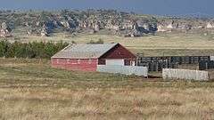
About 60% of Banner County is given over to farming: chiefly winter wheat and rangeland,[20] but also corn, beans, sugar beets, potatoes, sunflowers, rapeseed, and millet.[3] In response to groundwater depletion and drought, the Natural Resources Conservation Service has developed a system of cash incentives for farmers in the Pumpkin Creek watershed who convert irrigated cropland to dryland farming.[10]
Oil was discovered in Banner County in 1919, but the deposits were too deep to be commercially viable. Production of oil in the county began in 1951, and peaked in 1960, when 7,000,000 barrels (1,100,000 m3) [3] was produced from 397 wells.[20] By 2009, the number of wells had fallen to about 200;[20] but new discoveries in Weld County, Colorado prompted interest in exploring the Niobrara shale, which lies beneath western Nebraska, northeastern Colorado, and southeastern Wyoming. A 2010 sale of oil leases yielded record prices in Banner and Kimball counties.[21]
Transportation
Two state highways cross Banner County. Nebraska Highway 88 runs generally east-west, from Bridgeport, Nebraska to La Grange, Wyoming, passing north of Harrisburg. Nebraska Highway 71 runs north-south, from Kimball to Gering, passing east of Harrisburg.[22]
In the Nebraska license plate system, Banner County is represented by the prefix 85: when the state began using county numbers on its license plates in 1922, it had the 85th-largest number of registered vehicles.[23][24]
Education
Banner County is covered by a single school district, with a K–12 school located in Harrisburg. As of 2016, the school's enrollment was about 150.[25]
Communities
- Ashford
- Harrisburg (county seat)
See also
- Big Horn Mountain
- National Register of Historic Places listings in Banner County, Nebraska
- Banner County Wind Farm
Notes
- 1 2 "State & County QuickFacts". United States Census Bureau. Retrieved September 17, 2013.
- ↑ "Find a County". National Association of Counties. Archived from the original on May 31, 2011. Retrieved 2011-06-07.
- 1 2 3 4 5 6 Nebraska Historic Buildings Survey—Banner County. Nebraska State Historical Society. Retrieved 2010-06-22.
- ↑ Nebraska Historic Buildings Survey—Reconnaissance Final Report of Cheyenne County, Nebraska. Nebraska State Historical Society. Retrieved 2010-06-22.
- ↑ Fitzpatrick, Lilian Linder (1925). "Banner County". Nebraska Place-Names. Retrieved 2010-06-29.
- ↑ Hayes and Bedell (1921), p. 11.
- ↑ Hayes and Bedell (1921), p. 9.
- ↑ "Harrisburg 10NW, Banner County, Nebraska USA". WorldClimate.com Retrieved 2010-08-31.
- 1 2 "Pumpkin Creek Basin (PCB) Sub-Area". North Platte Natural Resources District. Retrieved 2010-08-31.
- 1 2 Pope, Joanna. "Conservation Takes Pressure Off Pumpkin Creek". NRCS-Nebraska. Retrieved 2010-08-31.
- ↑ Hansen, Sandra. "Lawsuit roils waters in Platte River irrigation fight". Scottsbluff Star-Herald. 2009-03-10. Retrieved 2010-08-31.
- ↑ "2010 Census Gazetteer Files". United States Census Bureau. August 22, 2012. Retrieved December 6, 2014.
- ↑ Hayes and Bedell (1921), pp. 5–6.
- ↑ "County Totals Dataset: Population, Population Change and Estimated Components of Population Change: April 1, 2010 to July 1, 2015". Retrieved July 2, 2016.
- ↑ "U.S. Decennial Census". United States Census Bureau. Archived from the original on May 11, 2015. Retrieved December 6, 2014.
- ↑ "Historical Census Browser". University of Virginia Library. Retrieved December 6, 2014.
- ↑ "Population of Counties by Decennial Census: 1900 to 1990". United States Census Bureau. Retrieved December 6, 2014.
- ↑ "Census 2000 PHC-T-4. Ranking Tables for Counties: 1990 and 2000" (PDF). United States Census Bureau. Retrieved December 6, 2014.
- ↑ "American FactFinder". United States Census Bureau. Archived from the original on September 11, 2013. Retrieved 2008-01-31.
- ↑ Jenkins, Nate. "Oil frenzy spills into Nebraska; schools get the money". Lincoln Journal-Star. 2010-06-03. Retrieved 2010-08-31.
- ↑ Nebraska Atlas & Gazeteer. Delorme; Freeport, Maine. First edition, 1996. pp. 42-3.
- ↑ "Counties and county seats by license plate prefix numbers". Nebraska Department of Economic Development. Retrieved 2013-05-08.
- ↑ "History Of Nebraska Passenger Vehicle License Plates". Nebraska Department of Motor Vehicles. Retrieved 2013-05-08.
- ↑ Banner County Schools website and subpages thereof. Retrieved 2016-02-05.
References
- Hayes, F. A., and H. L. Bedell (1921). Soil Survey of Banner County, Nebraska. Washington, D.C.: Government Printing Office. Retrieved 2015-11-22.
External links
 |
Goshen County, Wyoming | Scotts Bluff County | | |
| Laramie County, Wyoming | |
Morrill County | ||
| ||||
| | ||||
| Kimball County | Cheyenne County |
Coordinates: 41°32′N 103°43′W / 41.54°N 103.72°W
Municipalities and communities of Banner County, Nebraska, United States | ||
|---|---|---|
| CDP | ||
| Other community | ||