| [2] |
Name on the Register |
Image |
Date listed[3] |
Location |
City or town |
Description |
|---|
| 1 |
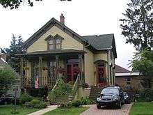
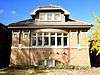
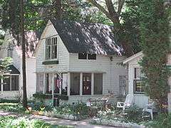
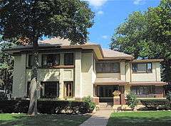
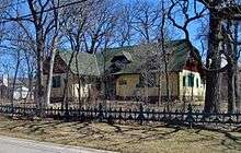
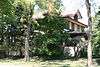
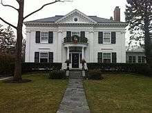
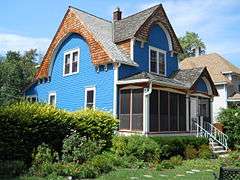
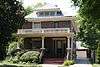
Mrs. Henry F. Akin House |
|
000000001992-05-22-0000May 22, 1992
(#92000487) |
901 S. 8th Ave.
41°52′46″N 87°50′31″W / 41.879444°N 87.841944°W / 41.879444; -87.841944 (Mrs. Henry F. Akin House) |
Maywood |
|
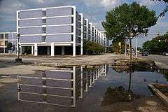
| 2 |
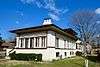
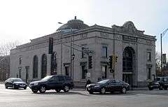
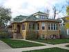
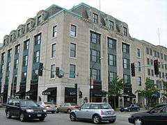
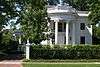
American State Bank |
|
000000002000-10-05-0000October 5, 2000
(#00000951) |
6801 W. Cermak Rd.
41°51′01″N 87°47′37″W / 41.850278°N 87.793611°W / 41.850278; -87.793611 (American State Bank) |
Berwyn |
|
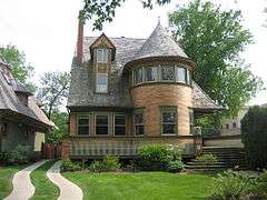
| 3 |
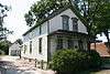
Arcade Building |
|
000000002016-03-08-0000March 8, 2016
(#16000055) |
1 Riverside Rd.
41°49′38″N 87°49′10″W / 41.827202°N 87.819348°W / 41.827202; -87.819348 (Arcade Building) |
Riverside |
|
| 4 |
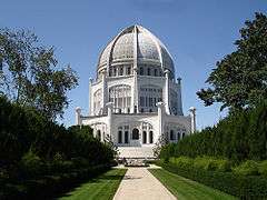
Baha'i Temple |
|
000000001978-05-23-0000May 23, 1978
(#78001140) |
100 Linden Ave.
42°04′27″N 87°41′03″W / 42.074167°N 87.684167°W / 42.074167; -87.684167 (Baha'i Temple) |
Wilmette |
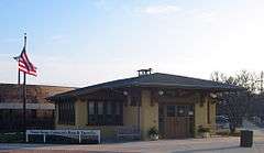
|
| 5 |
Bailey–Michelet House |
|
000000001982-08-12-0000August 12, 1982
(#82002533) |
1028 Sheridan Rd.
42°04′52″N 87°41′40″W / 42.081111°N 87.694444°W / 42.081111; -87.694444 (Bailey–Michelet House) |
Wilmette |
|
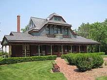
| 6 |
Frank J. Baker House |
|
000000001974-11-08-0000November 8, 1974
(#74000759) |
507 Lake Ave.
42°04′42″N 87°41′40″W / 42.078333°N 87.694444°W / 42.078333; -87.694444 (Frank J. Baker House) |
Wilmette |
|
| 7 |
Hiram Baldwin House |
|
000000001983-07-28-0000July 28, 1983
(#83000307) |
205 Essex Rd.
42°05′12″N 87°42′34″W / 42.086667°N 87.709444°W / 42.086667; -87.709444 (Hiram Baldwin House) |
Kenilworth |
|
| 8 |
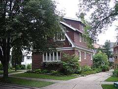
Nathaniel Moore Banta House |
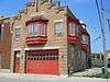
|
000000001998-05-20-0000May 20, 1998
(#98000465) |
514 N. Vail Ave.
42°05′17″N 87°59′04″W / 42.088056°N 87.984444°W / 42.088056; -87.984444 (Nathaniel Moore Banta House) |
Arlington Heights |
|
| 9 |
Barrington Historic District |
|
000000001986-05-16-0000May 16, 1986
(#86001047) |
Roughly bounded by Chicago & Northwestern RR, S. Spring and Grove Sts., E. Hillside and W. Coolidge, and Dundee Aves.
42°09′02″N 88°08′13″W / 42.150556°N 88.136944°W / 42.150556; -88.136944 (Barrington Historic District) |
Barrington |
|
| 10 |
Alfred Bersbach House |
|
000000002003-09-17-0000September 17, 2003
(#03000941) |
1120 Michigan Ave.
42°04′59″N 87°41′41″W / 42.083079°N 87.694697°W / 42.083079; -87.694697 (Alfred Bersbach House) |
Wilmette |
|
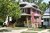
| 11 |
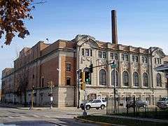
Berwyn Health Center |
|
000000002002-11-21-0000November 21, 2002
(#02001352) |
6600 W. 26th St.
41°50′36″N 87°47′17″W / 41.843444°N 87.788056°W / 41.843444; -87.788056 (Berwyn Health Center) |
Berwyn |
|
| 12 |
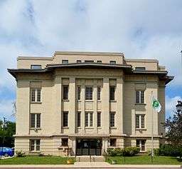
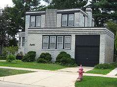
Berwyn Municipal Building |
|
000000002001-08-08-0000August 8, 2001
(#01000865) |
6700 W. 26th St.
41°50′35″N 87°47′28″W / 41.843056°N 87.791111°W / 41.843056; -87.791111 (Berwyn Municipal Building) |
Berwyn |
|
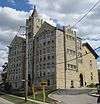
| 13 |
Bloom Township High School |
|
000000001982-06-03-0000June 3, 1982
(#82002527) |
10th St., Dixie Hwy. and Chicago Heights St.
41°30′52″N 87°38′37″W / 41.514444°N 87.643611°W / 41.514444; -87.643611 (Bloom Township High School) |
Chicago Heights |
|
| 14 |
Jacob Bohlander House |
|
000000001989-08-21-0000August 21, 1989
(#89001113) |
316 N. 4th Ave.
41°53′27″N 87°50′18″W / 41.890833°N 87.838333°W / 41.890833; -87.838333 (Jacob Bohlander House) |
Maywood |
|
| 15 |
Anita Willets Burnham Log House |
|
000000002005-06-02-0000June 2, 2005
(#04001297) |
1140 Willow Rd.
42°06′02″N 87°44′51″W / 42.100491°N 87.747386°W / 42.100491; -87.747386 (Anita Willets Burnham Log House) |
Winnetka |
|
| 16 |
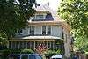
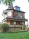
Mr. James Kent Calhoun House |
|
000000002010-06-07-0000June 7, 2010
(#09000780) |
740 Greenwood Ave.
42°08′03″N 87°45′45″W / 42.134164°N 87.762439°W / 42.134164; -87.762439 (Mr. James Kent Calhoun House) |
Glencoe |
|
| 17 |
Central Berwyn Bungalow Historic District |
|
000000002015-08-18-0000August 18, 2015
(#15000521) |
Roughly bounded by Cermak Rd., Home, Ridgeland & Cuyler Aves., 26th St.
41°50′47″N 87°47′22″W / 41.846486°N 87.789475°W / 41.846486; -87.789475 (Central Berwyn Bungalow Historic District) |
Berwyn |
|
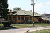
| 18 |
Chicago and Northwestern Depot |
|
000000001975-04-24-0000April 24, 1975
(#75000658) |
1135-1141 Wilmette Ave.
42°04′39″N 87°42′20″W / 42.0775°N 87.705556°W / 42.0775; -87.705556 (Chicago and Northwestern Depot) |
Wilmette |
|
| 19 |
Chicago Portage National Historic Site |
|
000000001966-10-15-0000October 15, 1966
(#66000108) |
S. Harlem Ave. at Chicago Sanitary and Ship Canal
41°48′39″N 87°48′28″W / 41.810833°N 87.807778°W / 41.810833; -87.807778 (Chicago Portage National Historic Site) |
Forest View |
|
| 20 |
Chicago Sanitary and Ship Canal Historic District |
|
000000002011-12-20-0000December 20, 2011
(#11000907) |
Illinois Waterway miles 290.0-321.7
41°50′05″N 87°41′42″W / 41.834669°N 87.694889°W / 41.834669; -87.694889 (Chicago Sanitary and Ship Canal Historic District) |
Cicero, Stickney, Forest View, Summit, Willow Springs, Lemont |
part of the Illinois Waterway Navigation System Facilities MPS; extends through the West Side of Chicago, DuPage County and Will County to Lockport
|
| 21 |
George Clayson House |
|
000000001979-03-21-0000March 21, 1979
(#79000835) |
224 E. Palatine Rd.
42°06′39″N 88°02′18″W / 42.110833°N 88.038333°W / 42.110833; -88.038333 (George Clayson House) |
Palatine |
|
| 22 |
Richard Cluever House |
|
000000001977-11-17-0000November 17, 1977
(#77000482) |
601 N. 1st Ave.
41°53′35″N 87°50′01″W / 41.893056°N 87.833611°W / 41.893056; -87.833611 (Richard Cluever House) |
Maywood |
|
| 23 |
Community House |
|
000000002007-08-30-0000August 30, 2007
(#07000854) |
620 Lincoln Ave.
42°06′29″N 87°44′00″W / 42.108056°N 87.733333°W / 42.108056; -87.733333 (Community House) |
Winnetka |
|
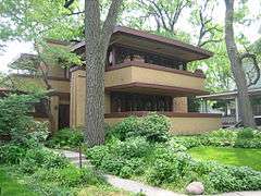
| 24 |
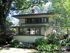
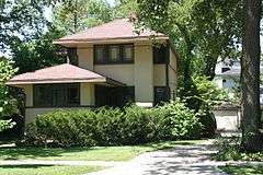
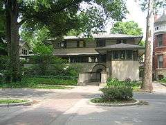
Avery Coonley House |
|
000000001970-12-30-0000December 30, 1970
(#70000243) |
290 and 300 Scottswood Rd., 281 Bloomingbank Rd., and 336 Coonley St.
41°49′14″N 87°49′43″W / 41.820556°N 87.828611°W / 41.820556; -87.828611 (Avery Coonley House) |
Riverside |
|
| 25 |
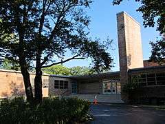
Crow Island School |
|
000000001989-10-27-0000October 27, 1989
(#89001730) |
1112 Willow Rd.
42°06′01″N 87°44′47″W / 42.100388°N 87.74626°W / 42.100388; -87.74626 (Crow Island School) |
Winnetka |
|
| 26 |
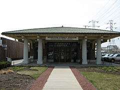
Dempster Street Station |
|
000000001996-02-28-0000February 28, 1996
(#95001005) |
5001 W. Dempster St.
42°02′25″N 87°45′08″W / 42.040278°N 87.752222°W / 42.040278; -87.752222 (Dempster Street Station) |
Skokie |
|
| 27 |
Des Plaines Methodist Camp Ground |
|
000000002005-05-22-0000May 22, 2005
(#05000429) |
1250 Campground Rd.
42°02′00″N 87°53′21″W / 42.033333°N 87.889167°W / 42.033333; -87.889167 (Des Plaines Methodist Camp Ground) |
Des Plaines |
|
| 28 |
Herbert A. Dilg House |
|
000000002009-09-30-0000September 30, 2009
(#09000781) |
8544 Callie Ave.
42°02′13″N 87°47′02″W / 42.036944°N 87.783889°W / 42.036944; -87.783889 (Herbert A. Dilg House) |
Morton Grove |
|
| 29 |
Dorhmann-Buckman House |
|
000000001995-01-24-0000January 24, 1995
(#94001598) |
8455 W. Grand Ave.
41°55′45″N 87°50′16″W / 41.929167°N 87.837778°W / 41.929167; -87.837778 (Dorhmann-Buckman House) |
River Grove |
|
| 30 |
Robert and Suzanne Drucker House |
|
000000002013-09-18-0000September 18, 2013
(#13000715) |
2801 Iroquois Rd.
42°04′54″N 87°44′41″W / 42.081725°N 87.744678°W / 42.081725; -87.744678 (Robert and Suzanne Drucker House) |
Wilmette |
|
| 31 |
William E. Drummond House |
|
000000001970-03-05-0000March 5, 1970
(#70000241) |
559 Edgewood Pl.
41°53′23″N 87°49′38″W / 41.889722°N 87.827222°W / 41.889722; -87.827222 (William E. Drummond House) |
River Forest |
|
| 32 |
Arthur J. Dunham House |
|
000000001982-02-11-0000February 11, 1982
(#82002524) |
3131 S. Wisconsin Ave.
41°50′06″N 87°48′01″W / 41.835°N 87.800278°W / 41.835; -87.800278 (Arthur J. Dunham House) |
Berwyn |
|
| 33 |
Edward Hines, Jr., Veterans Administration Hospital Historic District |
|
000000002013-10-09-0000October 9, 2013
(#13000814) |
5000 S. 5th Ave.
41°51′40″N 87°50′29″W / 41.861115°N 87.841371°W / 41.861115; -87.841371 (Edward Hines, Jr., Veterans Administration Hospital Historic District) |
Hines |
United States Second Generation Veterans Hospitals MPS
|
| 34 |
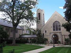
First Congregational Church of Western Springs |
|
000000002006-08-08-0000August 8, 2006
(#06000673) |
1106 Chestnut St.
41°48′53″N 87°54′11″W / 41.814722°N 87.903056°W / 41.814722; -87.903056 (First Congregational Church of Western Springs) |
Western Springs |
|
| 35 |
Flat Iron Building |
|
000000002003-09-13-0000September 13, 2003
(#03000917) |
1441-1449 Emerald Ave.
41°30′16″N 87°38′05″W / 41.504444°N 87.634722°W / 41.504444; -87.634722 (Flat Iron Building) |
Chicago Heights |
Demolished in 2009.[4]
|
| 36 |
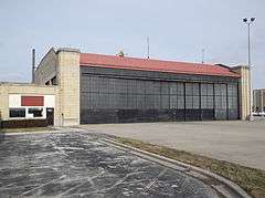
Ford Airport Hangar |
|
000000001985-05-09-0000May 9, 1985
(#85001009) |
Glenwood-Lansing Rd. and Burnahn Ave.
41°32′33″N 87°32′18″W / 41.5425°N 87.538333°W / 41.5425; -87.538333 (Ford Airport Hangar) |
Lansing |
|
| 37 |
William Frangenheim House |
|
000000001992-05-22-0000May 22, 1992
(#92000488) |
410 N. 3rd Ave.
41°53′29″N 87°50′14″W / 41.891389°N 87.837222°W / 41.891389; -87.837222 (William Frangenheim House) |
Maywood |
|
| 38 |
Mrs. Thomas H. Gale House |
|
000000001970-03-05-0000March 5, 1970
(#70000239) |
6 Elizabeth Ct.
41°53′31″N 87°47′54″W / 41.891944°N 87.798333°W / 41.891944; -87.798333 (Mrs. Thomas H. Gale House) |
Oak Park |
|
| 39 |
Walter Gale House |
|
000000001973-08-17-0000August 17, 1973
(#73000700) |
1031 W. Chicago Ave.
41°53′38″N 87°48′07″W / 41.893889°N 87.801944°W / 41.893889; -87.801944 (Walter Gale House) |
Oak Park |
|
| 40 |
William and Caroline Gibbs House |
|
000000001992-02-24-0000February 24, 1992
(#92000048) |
515 N. 3rd Ave.
41°53′32″N 87°50′12″W / 41.892222°N 87.836667°W / 41.892222; -87.836667 (William and Caroline Gibbs House) |
Maywood |
|
| 41 |
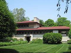
William A. Glasner House |
|
000000002005-02-28-0000February 28, 2005
(#05000105) |
850 Sheridan Rd.
42°08′29″N 87°45′19″W / 42.141389°N 87.755278°W / 42.141389; -87.755278 (William A. Glasner House) |
Glencoe |
|
| 42 |
Dr. Paul W. and Eunice Greeley House |
|
000000002011-02-25-0000February 25, 2011
(#11000048) |
545 Oak St.
42°06′17″N 87°43′31″W / 42.104722°N 87.725278°W / 42.104722; -87.725278 (Dr. Paul W. and Eunice Greeley House) |
Winnetka |
|
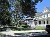
| 43 |
Gross Point Village Hall |
|
000000001991-08-05-0000August 5, 1991
(#91001001) |
609 Ridge Rd.
42°04′33″N 87°43′22″W / 42.075833°N 87.722778°W / 42.075833; -87.722778 (Gross Point Village Hall) |
Wilmette |
Home of the Wilmette Historical Museum
Gross Point Village Hall
|
| 44 |
Grossdale Station |
|
000000001982-06-15-0000June 15, 1982
(#82004912) |
8820½ Brookfield Ave.
41°49′23″N 87°50′33″W / 41.823056°N 87.8425°W / 41.823056; -87.8425 (Grossdale Station) |
Brookfield |
|
| 45 |
Caroline Grow House |
|
000000001992-05-22-0000May 22, 1992
(#92000489) |
603 N. 6th Ave.
41°53′34″N 87°50′25″W / 41.892778°N 87.840278°W / 41.892778; -87.840278 (Caroline Grow House) |
Maywood |
|
| 46 |
Gunderson Historic District |
|
000000002002-03-01-0000March 1, 2002
(#02000100) |
Oldest section, 1000 and 1100 South Home and Wenonah avenues. Later section bounded by Madison St, Harrison, Gunderson, and Ridgeland Aves.
41°52′34″N 87°47′08″W / 41.876111°N 87.785556°W / 41.876111; -87.785556 (Gunderson Historic District) |
Oak Park |
The first homes of steel-beamed construction and some of the first tract homes in the U.S., many historical occupants.
|
| 47 |
Hangar 1, Naval Air Station-Glenview |
|
000000001998-11-12-0000November 12, 1998
(#98001357) |
1901 Fourth St.
42°05′26″N 87°49′26″W / 42.090556°N 87.823889°W / 42.090556; -87.823889 (Hangar 1, Naval Air Station-Glenview) |
Glenview |
|
| 48 |
Harrer Building |
|
000000001983-02-17-0000February 17, 1983
(#83000310) |
8051 N. Lincoln Ave.
42°01′39″N 87°45′14″W / 42.0275°N 87.753889°W / 42.0275; -87.753889 (Harrer Building) |
Skokie |
|
| 49 |
William H. Hatch House |
|
000000002007-09-05-0000September 5, 2007
(#07000898) |
309 Keystone Ave.
41°53′12″N 87°49′05″W / 41.886667°N 87.818056°W / 41.886667; -87.818056 (William H. Hatch House) |
River Forest |
|
| 50 |
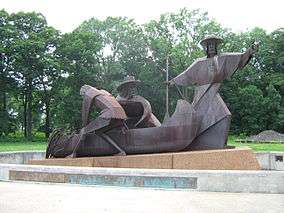
Haymarket Martyrs' Monument |
|
000000001997-02-18-0000February 18, 1997
(#97000343) |
863 S. Des Plaines Ave.
41°52′12″N 87°49′20″W / 41.87°N 87.822222°W / 41.87; -87.822222 (Haymarket Martyrs' Monument) |
Forest Park |
|
| 51 |
Arthur Heurtley House |
|
000000002000-02-16-0000February 16, 2000
(#00000258) |
318 N. Forest Avenue
41°53′35″N 87°48′01″W / 41.893056°N 87.800278°W / 41.893056; -87.800278 (Arthur Heurtley House) |
Oak Park |
|
| 52 |
Dr. Robert Hohf House |
|
000000002008-12-12-0000December 12, 2008
(#08001166) |
303 Sheridan Rd.
42°05′31″N 87°42′25″W / 42.091914°N 87.707053°W / 42.091914; -87.707053 (Dr. Robert Hohf House) |
Kenilworth vicinity |
|
| 53 |
Hofmann Tower |
|
000000001978-12-22-0000December 22, 1978
(#78001139) |
3910 Barry Point Rd.
41°49′14″N 87°49′19″W / 41.820556°N 87.821944°W / 41.820556; -87.821944 (Hofmann Tower) |
Lyons |
|
| 54 |
John Humphrey House |
|
000000002005-08-01-0000August 1, 2005
(#05000114) |
9830 W. 144th Pl.
41°37′48″N 87°51′34″W / 41.63°N 87.859444°W / 41.63; -87.859444 (John Humphrey House) |
Orland Park |
|
| 55 |
Hyatt House Hotel |
|
000000002013-07-31-0000July 31, 2013
(#13000553) |
4500 West Touhy Avenue
42°00′44″N 87°44′30″W / 42.012112°N 87.741710°W / 42.012112; -87.741710 (Hyatt House Hotel) |
Lincolnwood |
Demolished on August 27, 2013.[5]
|
| 56 |
Illinois Industrial School for Girls |
|
000000001998-08-06-0000August 6, 1998
(#98000978) |
733 N. Prospect Ave.
42°01′18″N 87°49′40″W / 42.021667°N 87.827778°W / 42.021667; -87.827778 (Illinois Industrial School for Girls) |
Park Ridge |
Currently the Youth Campus, administered by Maine Twp. H.S. Dist. 207
|
| 57 |
Kenilworth Club |
|
000000001979-03-21-0000March 21, 1979
(#79000832) |
410 Kenilworth Ave.
42°05′11″N 87°42′57″W / 42.086389°N 87.715833°W / 42.086389; -87.715833 (Kenilworth Club) |
Kenilworth |
|
| 58 |
Kennicott's Grove |
|
000000001973-08-13-0000August 13, 1973
(#73000698) |
Milwaukee and Lake Aves.
42°04′53″N 87°51′30″W / 42.081389°N 87.858333°W / 42.081389; -87.858333 (Kennicott's Grove) |
Glenview |
|
| 59 |
La Grange Village Historic District |
|
000000001979-08-08-0000August 8, 1979
(#79000834) |
U.S. 12
41°48′37″N 87°52′22″W / 41.810278°N 87.872778°W / 41.810278; -87.872778 (La Grange Village Historic District) |
La Grange |
|
| 60 |
Mads C. Larson House |
|
000000001992-05-22-0000May 22, 1992
(#92000490) |
318 S. 1st Ave.
41°53′05″N 87°50′05″W / 41.884722°N 87.834722°W / 41.884722; -87.834722 (Mads C. Larson House) |
Maywood |
|
| 61 |
Lemont Central Grade School |
|
000000001975-03-07-0000March 7, 1975
(#75000656) |
410 McCarthy Rd.
41°40′21″N 87°59′50″W / 41.6725°N 87.997222°W / 41.6725; -87.997222 (Lemont Central Grade School) |
Lemont |
|
| 62 |
Lemont Downtown Historic District |
Upload image |
000000002016-09-06-0000September 6, 2016
(#16000582) |
Roughly bounded by Main, Stephen, Illinois, River and Front Sts.
41°40′28″N 88°00′01″W / 41.674437°N 88.000175°W / 41.674437; -88.000175 (Lemont Downtown Historic District) |
Lemont |
|
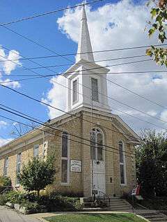
| 63 |
Lemont Methodist Episcopal Church |
|
000000001986-05-05-0000May 5, 1986
(#86001031) |
306 Lemont St.
41°40′23″N 88°00′00″W / 41.673056°N 88.0°W / 41.673056; -88.0 (Lemont Methodist Episcopal Church) |
Lemont |
|
| 64 |
Linden Avenue Terminal |
|
000000001984-02-08-0000February 8, 1984
(#84001002) |
330 Linden Ave.
42°04′25″N 87°41′30″W / 42.073611°N 87.691667°W / 42.073611; -87.691667 (Linden Avenue Terminal) |
Wilmette |
|
| 65 |
Henry Demarest Lloyd House |
|
000000001966-11-13-0000November 13, 1966
(#66000320) |
830 Sheridan Rd.
42°06′51″N 87°43′56″W / 42.114167°N 87.732222°W / 42.114167; -87.732222 (Henry Demarest Lloyd House) |
Winnetka |
NHL name is The Wayside
|
| 66 |
Timothy J. Lynch House |
|
000000001992-02-24-0000February 24, 1992
(#92000047) |
416 N. 4th Ave.
41°53′29″N 87°50′18″W / 41.891389°N 87.838333°W / 41.891389; -87.838333 (Timothy J. Lynch House) |
Maywood |
|
| 67 |
Lyons Township Hall |
|
000000001978-11-30-0000November 30, 1978
(#78001138) |
53 S. LaGrange Rd.
41°48′50″N 87°52′09″W / 41.813889°N 87.869167°W / 41.813889; -87.869167 (Lyons Township Hall) |
La Grange |
Known as the LaGrange Village Hall
|
| 68 |
George W. Maher House |
|
000000001979-03-21-0000March 21, 1979
(#79000833) |
424 Warwick Rd.
42°05′24″N 87°42′47″W / 42.09°N 87.713056°W / 42.09; -87.713056 (George W. Maher House) |
Kenilworth |
|
| 69 |
Marshall Field and Company Store |
|
000000001988-01-21-0000January 21, 1988
(#87002510) |
1144 W. Lake St.
41°53′21″N 87°48′16″W / 41.889167°N 87.804444°W / 41.889167; -87.804444 (Marshall Field and Company Store) |
Oak Park |
|
| 70 |
Masonic Temple Building |
|
000000001992-05-22-0000May 22, 1992
(#92000491) |
200 S. 5th Ave.
41°53′09″N 87°50′22″W / 41.885833°N 87.839444°W / 41.885833; -87.839444 (Masonic Temple Building) |
Maywood |
|
| 71 |
Masonic Temple Building |
|
000000001982-02-11-0000February 11, 1982
(#82002532) |
119-137 N. Oak Park Ave.
41°53′17″N 87°47′41″W / 41.888056°N 87.794722°W / 41.888056; -87.794722 (Masonic Temple Building) |
Oak Park |
|
| 72 |
Lola Maverick Lloyd House |
|
000000002006-02-01-0000February 1, 2006
(#05001606) |
455 Birch St.
42°06′21″N 87°44′12″W / 42.105833°N 87.736667°W / 42.105833; -87.736667 (Lola Maverick Lloyd House) |
Winnetka |
|
| 73 |
Maywood Fire Department Building |
|
000000001992-05-22-0000May 22, 1992
(#92000492) |
511 St. Charles Rd.
41°53′17″N 87°50′24″W / 41.888056°N 87.84°W / 41.888056; -87.84 (Maywood Fire Department Building) |
Maywood |
|
| 74 |
William McJunkin House |
|
000000002006-03-02-0000March 2, 2006
(#06000104) |
151 Sheridan Rd.
42°05′44″N 87°42′43″W / 42.095556°N 87.711944°W / 42.095556; -87.711944 (William McJunkin House) |
Winnetka |
|
| 75 |
Caroline Millward House |
|
000000001992-05-22-0000May 22, 1992
(#92000493) |
502 N. 5th Ave.
41°53′31″N 87°50′22″W / 41.891944°N 87.839444°W / 41.891944; -87.839444 (Caroline Millward House) |
Maywood |
|
| 76 |
John Rogerson Montgomery House |
|
000000002004-09-15-0000September 15, 2004
(#04000974) |
15 Old Green Bay Rd.
42°07′20″N 87°44′32″W / 42.122222°N 87.742222°W / 42.122222; -87.742222 (John Rogerson Montgomery House) |
Glencoe |
|
| 77 |
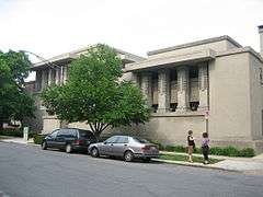
J. Sterling Morton High School East Auditorium |
|
000000001983-05-09-0000May 9, 1983
(#83000312) |
2423 S. Austin Blvd.
41°50′47″N 87°46′23″W / 41.846389°N 87.773056°W / 41.846389; -87.773056 (J. Sterling Morton High School East Auditorium) |
Cicero |
|
| 78 |
Muller House |
|
000000001979-03-26-0000March 26, 1979
(#79000819) |
500 N. Vail Ave.
42°05′15″N 87°59′04″W / 42.0875°N 87.984444°W / 42.0875; -87.984444 (Muller House) |
Arlington Heights |
|
| 79 |
Harry H. Nichols House |
|
000000001992-02-24-0000February 24, 1992
(#92000045) |
216 S. 4th Ave.
41°53′08″N 87°50′17″W / 41.885556°N 87.838056°W / 41.885556; -87.838056 (Harry H. Nichols House) |
Maywood |
|
| 80 |
Mr. J. William de Coursey O'Grady House |
|
000000002008-12-12-0000December 12, 2008
(#08001167) |
149 Kenilworth Ave.
42°05′29″N 87°42′43″W / 42.091472°N 87.711875°W / 42.091472; -87.711875 (Mr. J. William de Coursey O'Grady House) |
Kenilworth |
|
| 81 |
Oak Circle Historic District |
|
000000002001-06-21-0000June 21, 2001
(#01000668) |
318-351 Oak Circle
42°04′20″N 87°42′39″W / 42.072222°N 87.710833°W / 42.072222; -87.710833 (Oak Circle Historic District) |
Wilmette |
|
| 82 |
Oak Lawn (Cook) School |
|
000000001990-11-02-0000November 2, 1990
(#90001725) |
9526 S. Cook Ave.
41°43′08″N 87°45′07″W / 41.718889°N 87.751944°W / 41.718889; -87.751944 (Oak Lawn (Cook) School) |
Oak Lawn |
Demolished in 2003.[6]
|
| 83 |
Oak Park Conservatory |
|
000000002005-03-08-0000March 8, 2005
(#04001298) |
615 Garfield St.
41°52′18″N 87°47′23″W / 41.871667°N 87.789722°W / 41.871667; -87.789722 (Oak Park Conservatory) |
Oak Park |
|
| 84 |
Oak Park Village Hall |
|
000000002014-08-25-0000August 25, 2014
(#14000505) |
123 Madison St.
41°52′46″N 87°46′44″W / 41.879515°N 87.77889°W / 41.879515; -87.77889 (Oak Park Village Hall) |
Oak Park |
|
| 85 |
Octagon House |
|
000000001979-03-21-0000March 21, 1979
(#79000820) |
223 W. Main St.
42°09′14″N 88°08′20″W / 42.153889°N 88.138889°W / 42.153889; -88.138889 (Octagon House) |
Barrington |
|
| 86 |
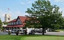
Olympia Fields Country Club |
|
000000002001-02-09-0000February 9, 2001
(#01000082) |
2800 Country Club Dr.
41°30′57″N 87°41′06″W / 41.515833°N 87.685°W / 41.515833; -87.685 (Olympia Fields Country Club) |
Olympia Fields |
|
| 87 |
Orth House |
|
000000001976-10-08-0000October 8, 1976
(#76000708) |
42 Abbotsford Rd.
42°05′31″N 87°43′10″W / 42.091944°N 87.719444°W / 42.091944; -87.719444 (Orth House) |
Winnetka |
|
| 88 |
Ouilmette North Historic District |
|
000000002005-12-06-0000December 6, 2005
(#05001370) |
46 blocks: Chesnut Ave, Sheridan Road, Lake Ave. and 13th St.
42°04′55″N 87°42′03″W / 42.081944°N 87.700833°W / 42.081944; -87.700833 (Ouilmette North Historic District) |
Wilmette |
Named for Antoine Ouilmette (1760–1841)
|
| 89 |
Pacesetter Gardens Historic District |
|
000000002005-11-16-0000November 16, 2005
(#05001252) |
13604-13736 S. Lowe Ave.
41°38′48″N 87°38′14″W / 41.646667°N 87.637222°W / 41.646667; -87.637222 (Pacesetter Gardens Historic District) |
Riverdale |
|
| 90 |
Charles H. Patten House |
|
000000002006-11-08-0000November 8, 2006
(#06001018) |
117 N. Benton St.
42°06′45″N 88°02′28″W / 42.1125°N 88.041111°W / 42.1125; -88.041111 (Charles H. Patten House) |
Palatine |
|
| 91 |
Pickwick Theater Building |
|
000000001975-02-24-0000February 24, 1975
(#75000657) |
5 S. Prospect Ave.
42°00′38″N 87°49′45″W / 42.010556°N 87.829167°W / 42.010556; -87.829167 (Pickwick Theater Building) |
Park Ridge |
|
| 92 |
Pleasant Home |
|
000000001972-06-19-0000June 19, 1972
(#72000454) |
217 Home Ave.
41°53′08″N 87°48′00″W / 41.885667°N 87.800028°W / 41.885667; -87.800028 (Pleasant Home) |
Oak Park |
NHL name is John Farson House
|
| 93 |
George E. Purple House |
|
000000002005-08-12-0000August 12, 2005
(#05000845) |
338 Sunset Ave.
41°48′36″N 87°53′02″W / 41.81°N 87.883889°W / 41.81; -87.883889 (George E. Purple House) |
LaGrange |
|
| 94 |
Charles N. Ramsey and Herry E. Weese House |
|
000000002009-04-01-0000April 1, 2009
(#09000167) |
141 Kenilworth Avenue
42°05′30″N 87°42′39″W / 42.091758°N 87.710911°W / 42.091758; -87.710911 (Charles N. Ramsey and Herry E. Weese House) |
Kenilworth |
|
| 95 |
Ridgeland-Oak Park Historic District |
|
000000001983-12-08-0000December 8, 1983
(#83003564) |
Roughly bounded by Austin Blvd., Harlem, Ridgeland, and Chicago Aves., Lake and Madison Sts.
41°53′07″N 87°47′18″W / 41.885278°N 87.788333°W / 41.885278; -87.788333 (Ridgeland-Oak Park Historic District) |
Oak Park |
|
| 96 |
River Forest Historic District |
|
000000001977-08-26-0000August 26, 1977
(#77000483) |
Between Harlem Ave. and Des Plaines River with 2 extensions N of Chicago Ave. and 2 extensions S of Lake St.
41°53′31″N 87°49′09″W / 41.891944°N 87.819167°W / 41.891944; -87.819167 (River Forest Historic District) |
River Forest |
|
| 97 |
Riverside Landscape Architecture District |
|
000000001969-09-15-0000September 15, 1969
(#69000055) |
Bounded by 26th St., Harlem and Ogden Aves., the Des Plaines River, and Forbes Rd.
41°49′39″N 87°49′15″W / 41.8275°N 87.820833°W / 41.8275; -87.820833 (Riverside Landscape Architecture District) |
Riverside |
NHL name is Riverside Historic District
|
| 98 |
John Robertson, Jr., House |
|
000000002014-12-22-0000December 22, 2014
(#14001064) |
145 W. Main St.
42°09′14″N 88°08′17″W / 42.153897°N 88.138096°W / 42.153897; -88.138096 (John Robertson, Jr., House) |
Barrington |
|
| 99 |
Robinson House |
|
000000001992-02-24-0000February 24, 1992
(#92000046) |
602 N. 3rd Ave.
41°53′35″N 87°50′14″W / 41.893056°N 87.837222°W / 41.893056; -87.837222 (Robinson House) |
Maywood |
|
| 100 |
Root-Badger House |
|
000000001992-05-19-0000May 19, 1992
(#92000550) |
326 Essex Rd.[7]
42°05′18″N 87°42′46″W / 42.08833°N 87.71277°W / 42.08833; -87.71277 (Root-Badger House) |
Kenilworth |
|
| 101 |
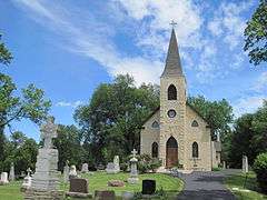
St. James Catholic Church and Cemetery |
|
000000001984-08-16-0000August 16, 1984
(#84001047) |
106th St. and Archer Ave.
41°41′55″N 87°55′57″W / 41.698611°N 87.9325°W / 41.698611; -87.9325 (St. James Catholic Church and Cemetery) |
Lemont |
|
| 102 |
Paul Schweikher House and Studio |
Upload image |
000000001987-02-17-0000February 17, 1987
(#87000098) |
645 S. Meacham Rd.
42°00′51″N 88°02′36″W / 42.014167°N 88.043333°W / 42.014167; -88.043333 (Paul Schweikher House and Studio) |
Schaumburg |
|
| 103 |
Scoville Place |
|
000000002002-11-21-0000November 21, 2002
(#02001351) |
Jct. of Lake St. and Oak Park Ave.
41°53′23″N 87°47′42″W / 41.889722°N 87.795°W / 41.889722; -87.795 (Scoville Place) |
Oak Park |
|
| 104 |
Mr. Robert Silhan House |
|
000000002007-02-20-0000February 20, 2007
(#07000062) |
3728 S. Cuyler Ave.
41°49′28″N 87°46′53″W / 41.824444°N 87.781389°W / 41.824444; -87.781389 (Mr. Robert Silhan House) |
Berwyn |
|
| 105 |
Albert Soffel House |
|
000000001992-05-22-0000May 22, 1992
(#92000494) |
508 N. 5th Ave.
41°53′32″N 87°50′23″W / 41.892222°N 87.839722°W / 41.892222; -87.839722 (Albert Soffel House) |
Maywood |
|
| 106 |
Jesse L. Strauss Estate |
|
000000002014-12-22-0000December 22, 2014
(#14001065) |
110 Maple Hill Rd.
42°08′33″N 87°45′19″W / 42.142533°N 87.755170°W / 42.142533; -87.755170 (Jesse L. Strauss Estate) |
Glencoe |
|
| 107 |
Joseph P. O. Sullivan House |
|
000000001992-05-22-0000May 22, 1992
(#92000495) |
142 S. 17th Ave.
41°53′10″N 87°51′15″W / 41.886249°N 87.854277°W / 41.886249; -87.854277 (Joseph P. O. Sullivan House) |
Maywood |
|
| 108 |
Sunderlage Farm Smokehouse |
|
000000001990-02-20-0000February 20, 1990
(#89001210) |
1775 Vista Walk
42°03′05″N 88°07′24″W / 42.051389°N 88.123333°W / 42.051389; -88.123333 (Sunderlage Farm Smokehouse) |
Hoffman Estates |
|
| 109 |
Sylvan Road Bridge |
|
000000001978-06-23-0000June 23, 1978
(#78001137) |
Sylvan Rd.
42°08′40″N 87°45′48″W / 42.144444°N 87.763333°W / 42.144444; -87.763333 (Sylvan Road Bridge) |
Glencoe |
Demolished.[8]
|
| 110 |
Frank Thomas House |
|
000000001972-09-14-0000September 14, 1972
(#72000455) |
210 Forest Ave.
41°53′28″N 87°47′48″W / 41.891111°N 87.796667°W / 41.891111; -87.796667 (Frank Thomas House) |
Oak Park |
|
| 111 |
Jennie S. Thompkins House |
|
000000001992-05-22-0000May 22, 1992
(#92000496) |
503 N. 4th Ave.
41°53′28″N 87°50′23″W / 41.891111°N 87.839722°W / 41.891111; -87.839722 (Jennie S. Thompkins House) |
Maywood |
|
| 112 |
George R. Thorne House |
|
000000001997-05-02-0000May 2, 1997
(#97000381) |
7 Cottage Row
41°37′58″N 87°45′03″W / 41.632778°N 87.750833°W / 41.632778; -87.750833 (George R. Thorne House) |
Midlothian |
|
| 113 |
F.F. Tomek House |
|
000000001999-01-20-0000January 20, 1999
(#99000632) |
150 Nuttall Road
41°49′56″N 87°49′02″W / 41.832222°N 87.817222°W / 41.832222; -87.817222 (F.F. Tomek House) |
Riverside |
|
| 114 |
Twin Tower Sanctuary |
|
000000001988-11-16-0000November 16, 1988
(#88002235) |
9967 W. 144th St.
41°37′43″N 87°51′46″W / 41.628611°N 87.862778°W / 41.628611; -87.862778 (Twin Tower Sanctuary) |
Orland Park |
|
| 115 |
Unity Temple |
|
000000001970-04-17-0000April 17, 1970
(#70000240) |
875 Lake St.
41°53′18″N 87°47′48″W / 41.888333°N 87.796667°W / 41.888333; -87.796667 (Unity Temple) |
Oak Park |
|
| 116 |
Robert Vial House |
|
000000002007-08-31-0000August 31, 2007
(#07000853) |
7425 S. Wolf Rd.
41°45′17″N 87°53′45″W / 41.754722°N 87.895833°W / 41.754722; -87.895833 (Robert Vial House) |
Burr Ridge |
|
| 117 |
Karl Vogt Building |
|
000000001988-01-21-0000January 21, 1988
(#87002499) |
6811 Hickory St.
41°34′29″N 87°47′04″W / 41.574722°N 87.784444°W / 41.574722; -87.784444 (Karl Vogt Building) |
Tinley Park |
|
| 118 |
Western Springs Water Tower |
|
000000001981-06-04-0000June 4, 1981
(#81000219) |
914 Hillgrove Ave.
41°48′35″N 87°54′03″W / 41.809722°N 87.900833°W / 41.809722; -87.900833 (Western Springs Water Tower) |
Western Springs |
|
| 119 |
Wheeler-Magnus Round Barn |
|
000000001992-08-18-0000August 18, 1992
(#92001017) |
811 E. Central Rd.
42°03′53″N 87°58′19″W / 42.064722°N 87.971944°W / 42.064722; -87.971944 (Wheeler-Magnus Round Barn) |
Arlington Heights |
|
| 120 |
Wild Flower and Bird Sanctuary in Mahoney Park |
|
000000001985-04-10-0000April 10, 1985
(#85000772) |
Sheridan Rd..
42°05′21″N 87°42′12″W / 42.089167°N 87.703333°W / 42.089167; -87.703333 (Wild Flower and Bird Sanctuary in Mahoney Park) |
Kenilworth |
|
| 121 |
William H. Winslow House and Stable |
|
000000001970-04-17-0000April 17, 1970
(#70000242) |
515 Auvergne Pl.
41°53′19″N 87°49′44″W / 41.888611°N 87.828889°W / 41.888611; -87.828889 (William H. Winslow House and Stable) |
River Forest |
|
| 122 |
Frank Lloyd Wright House and Studio |
|
000000001972-09-14-0000September 14, 1972
(#72000456) |
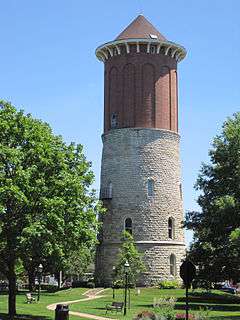
428 Forest Ave. (house), 951 Chicago Ave. (studio)
41°53′39″N 87°48′00″W / 41.894167°N 87.8°W / 41.894167; -87.8 (Frank Lloyd Wright House and Studio) |
Oak Park |
|
| 123 |
Frank Lloyd Wright-Prairie School of Architecture Historic District |
|
000000001973-12-04-0000December 4, 1973
(#73000699) |
Bounded roughly by Harlem Ave., Division, Clyde, and Lake Sts.; also roughly bounded by Division St. on the north, Cuyler Ave. on the east, Lake St. on the south, and Harlem Ave. on the west
41°53′37″N 87°47′32″W / 41.893611°N 87.792222°W / 41.893611; -87.792222 (Frank Lloyd Wright-Prairie School of Architecture Historic District) |
Oak Park |
Second set of boundaries represents a boundary increase of 000000002009-05-22-0000May 22, 2009
|
| 124 |
Joshua P. Young House |
|
000000001982-08-12-0000August 12, 1982
(#82002525) |
2445 High St.
41°39′09″N 87°40′30″W / 41.6525°N 87.675°W / 41.6525; -87.675 (Joshua P. Young House) |
Blue Island |
built c. 1852, home of influential mid-nineteenth century developer of Chicago's south side and southern suburbs. |


_01.JPG)


_01.JPG)


.jpg)


.jpg)


.jpg)


_01.JPG)


_02.JPG)

_02.JPG)


_02.JPG)
.jpg)


.jpg)

_01.JPG)