National Register of Historic Places listings in Marion County, Oregon
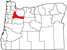
Location of Marion County in Oregon
This list presents the full set of buildings, structures, objects, sites, or districts designated on the National Register of Historic Places in Marion County, Oregon, and offers brief descriptive information about each of them. The National Register recognizes places of national, state, or local historic significance across the United States.[1] Out of over 90,000 National Register sites nationwide,[2] Oregon is home to over 2,000,[3] and 115 of those are found partially or wholly in Marion County.
- This National Park Service list is complete through NPS recent listings posted December 2, 2016.[4]
Current listings
| [5] | Name on the Register | Image | Date listed[6] | Location | City or town | Description |
|---|---|---|---|---|---|---|
| 1 | Louis J. Adams House | _1.jpg) |
(#11000076) |
423 W. Main St. 45°00′11″N 122°47′13″W / 45.003056°N 122.786944°W |
Silverton | |
| 2 | Louise Adams House |  |
(#15000052) |
401 W. Main Street 45°00′12″N 122°47′09″W / 45.003376°N 122.785841°W |
Silverton | |
| 3 | Adolph Block |  |
(#80003348) |
360–372 State Street 44°56′24″N 123°02′22″W / 44.939903°N 123.039552°W |
Salem | |
| 4 | Samuel Adolph House | 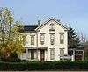 |
(#78002297) |
2493 State Street 44°55′57″N 123°00′37″W / 44.9326°N 123.0103°W |
Salem | |
| 5 | James Mechlin Anderson House |  |
(#79002118) |
728 Ankeny Hill Road, SE 44°46′36″N 123°02′46″W / 44.7767°N 123.0462°W |
Jefferson vicinity | |
| 6 | Aurora Colony Historic District | 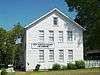 |
(#74001696) |
District roughly bounded by Cemetery Road, Bobs Avenue, and Liberty Street 45°13′57″N 122°45′30″W / 45.23258°N 122.7584°W |
Aurora | |
| 7 | Bank of Woodburn | 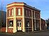 |
(#96001049) |
199 N Front Street 45°08′31″N 122°51′27″W / 45.14181°N 122.8574°W |
Woodburn | |
| 8 | Oliver Beers House |  |
(#84003036) |
10602 Wheatland Road, N 45°04′23″N 123°01′24″W / 45.07305°N 123.0232°W |
Gervais vicinity | |
| 9 | Frederick Bents House |  |
(#81000502) |
22776 Bents Road, NE 45°14′54″N 122°48′40″W / 45.24829°N 122.8111°W |
Aurora vicinity | Originally built in 1887, this French Prairie farmhouse expanded several times over subsequent years, resulting in an unusual admixture of multiple 19th-century architectural styles. It reflects the changing requirements of farm life and economics over a long period in this portion of the Willamette Valley.[7] |
| 10 | R. P. Boise Building |  |
(#81000504) |
217 State Street 44°56′27″N 123°02′30″W / 44.940946°N 123.041671°W |
Salem | |
| 11 | Boon Brick Store |  |
(#75001590) |
888 Liberty Street, NE 44°56′55″N 123°01′59″W / 44.94859°N 123.033°W |
Salem | |
| 12 | John D. Boon House |  |
(#75001591) |
1313 Mill Street, SE 44°56′02″N 123°01′39″W / 44.93382°N 123.0275°W |
Salem | Included in the Mission Mill Museum.[8] |
| 13 | Charles and Martha Brown House |  |
(#02000949) |
425 N First Avenue 44°47′53″N 122°47′40″W / 44.798°N 122.7944°W |
Stayton | |
| 14 | Sam Brown House |  |
(#74001697) |
12878 Portland Road, NE 45°06′21″N 122°53′12″W / 45.10576°N 122.8868°W |
Gervais | |
| 15 | Burggraf–Burt–Webster House |  |
(#80003349) |
901 13th Street, SE 44°55′43″N 123°01′46″W / 44.928594°N 123.029573°W |
Salem | |
| 16 | Bush and Brey Block and Annex |  |
(#81000505) |
179–197 Commercial Street, NE 44°56′29″N 123°02′26″W / 44.941396°N 123.040467°W |
Salem | |
| 17 | Asahel Bush House |  |
(#74001700) |
600 Mission Street, SE 44°55′53″N 123°02′21″W / 44.931428°N 123.039305°W |
Salem | |
| 18 | Bush–Breyman Block | _Salem_Oregon_full.JPG) |
(#78002298) |
141–147 Commercial Street, NE 44°56′28″N 123°02′26″W / 44.940974°N 123.040586°W |
Salem | |
| 19 | Calvary Lutheran Church and Parsonage |  |
(#85001182) |
310–314 Jersey Street 45°00′16″N 122°46′52″W / 45.0045°N 122.781°W |
Silverton | |
| 20 | Hamilton Campbell House |  |
(#79002119) |
13600 Jefferson Highway 99E, SE 44°45′37″N 123°01′41″W / 44.76031°N 123.0281°W |
Jefferson vicinity | |
| 21 | William Case Farm |  |
(#73001578) |
20755 Case Road, NE 45°13′06″N 122°52′49″W / 45.218319°N 122.880393°W |
Aurora | |
| 22 | Champoeg Cemetery | 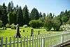 |
(#03001475) |
Champoeg Cemetery Road 45°14′20″N 122°52′34″W / 45.23898°N 122.8762°W |
Aurora | |
| 23 | Champoeg State Park Historic Archeological District |  |
(#84003038) |
8239 Champoeg Road, NE 45°14′54″N 122°53′37″W / 45.2482°N 122.8936°W |
St. Paul | |
| 24 | Chemawa Indian School Site |  |
(#92001333) |
3700 Chemawa Road, NE 45°00′04″N 122°59′42″W / 45.00118°N 122.9951°W |
Chemawa | |
| 25 | Chemeketa Lodge No. 1 Odd Fellows Buildings | 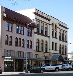 |
(#88000275) |
185–195 High Street, NE 44°56′26″N 123°02′14″W / 44.940452°N 123.037253°W |
Salem | |
| 26 | George Collins House |  |
(#89002063) |
1340 Chemeketa Street, NE 44°56′19″N 123°01′27″W / 44.938509°N 123.024165°W |
Salem | |
| 27 | Jacob Conser House |  |
(#74001699) |
114 Main Street 44°43′04″N 123°00′43″W / 44.717659°N 123.012038°W |
Jefferson | |
| 28 | Court Street – Chemeketa Street Historic District |  |
(#87001373) |
District roughly along Chemeketa and Court Streets, between Mill Creek and 14th Street 44°56′15″N 123°01′15″W / 44.93742°N 123.0208°W |
Salem | |
| 29 | Curtis Cross House |  |
(#81000506) |
1635 Fairmount Avenue, S 44°55′30″N 123°02′56″W / 44.92496°N 123.0489°W |
Salem | |
| 30 | Dr. William A. Cusick House |  |
(#90000281) |
415 Lincoln Street, S 44°55′32″N 123°02′57″W / 44.925609°N 123.049116°W |
Salem | |
| 31 | Alexander Daue House |  |
(#85001181) |
1095 Saginaw Street, S 44°55′50″N 123°02′45″W / 44.930454°N 123.045848°W |
Salem | |
| 32 | Murton E. and Lillian DeGuire House |  |
(#11000077) |
631 B St. 45°00′35″N 122°46′46″W / 45.009722°N 122.779444°W |
Silverton | Silverton, Oregon, and Its Environs MPS |
| 33 | DeGuire–Ludowitzki House |  |
(#15000053) |
840 S. Water Street 44°59′53″N 122°46′37″W / 44.998153°N 122.777062°W |
Silverton | |
| 34 | Deidrich Building |  |
(#06000570) |
195 N 3rd Avenue 44°47′47″N 122°47′33″W / 44.79632°N 122.7924°W |
Stayton | |
| 35 | Delaney–Edwards House |  |
(#04000729) |
4292 Delaney Road, SE 44°50′35″N 122°58′20″W / 44.843053°N 122.972297°W |
Salem vicinity | |
| 36 | Joseph Despard Cabin Site | Upload image | (#91001573) |
Address restricted[9] |
St. Paul | |
| 37 | June D. Drake House |  |
(#11000078) |
409 S. Water St. 45°00′12″N 122°46′52″W / 45.003333°N 122.781111°W |
Silverton | Silverton, Oregon, and Its Environs MPS |
| 38 | Magnus and Emma Ek House |  |
(#13000032) |
729 S. Water Street 45°00′00″N 122°46′40″W / 45°N 122.7778194°W |
Silverton | Silverton, Oregon, and Its Environs MPS |
| 39 | Elsinore Theater | 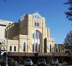 |
(#91001575) |
170 High Street, SE 44°56′20″N 123°02′14″W / 44.938856°N 123.037153°W |
Salem | |
| 40 | Farrar Building |  |
(#82003737) |
351–373 State Street 44°56′25″N 123°02′22″W / 44.940376°N 123.039391°W |
Salem | |
| 41 | Henry Fawk House |  |
(#91000060) |
310 Lincoln Street, S 44°55′31″N 123°02′51″W / 44.92527°N 123.0476°W |
Salem | |
| 42 | First Methodist Episcopal Church of Salem |  |
(#83002162) |
600 State Street 44°56′20″N 123°02′08″W / 44.938763°N 123.035424°W |
Salem | |
| 43 | Gaiety Hill – Bush's Pasture Park Historic District |  |
(#86002849) |
Roughly bounded by Pringle Creek, Mission Street, Bush's Pasture Park, and Cross, High, and Liberty Streets 44°55′50″N 123°02′11″W / 44.93068°N 123.0365°W |
Salem | |
| 44 | Gaiety Hollow |  |
(#14000895) |
545 Mission Street, SE 44°55′58″N 123°02′24″W / 44.932741°N 123.039920°W |
Salem | Includes both the home and the six gardens of Edith Schryver and Elizabeth Lord, who were landscape architects. The pair started the first landscape architecture firm owned by women in the Pacific Northwest, and used the gardens to test new concepts.[10] |
| 45 | Gallon House Bridge | 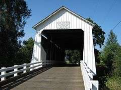 |
(#79002124) |
Abiqua Creek 45°01′56″N 122°47′53″W / 45.03218°N 122.7981°W |
Silverton vicinity | |
| 46 | R.C. Geer Farmhouse |  |
(#80003353) |
12390 Sunnyview Road, NE 44°56′28″N 122°48′26″W / 44.94106°N 122.8072°W |
Salem vicinity | |
| 47 | Andrew T. Gilbert House |  |
(#80003350) |
116 Marion Street, NE 44°56′43″N 123°02′28″W / 44.9453°N 123.041°W |
Salem | |
| 48 | J. K. Gill Building |  |
(#80003351) |
356 State Street 44°56′24″N 123°02′23″W / 44.939940°N 123.039727°W |
Salem | |
| 49 | Gordon House | 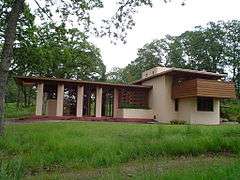 |
(#04001066) |
879 W Main Street 44°59′55″N 122°47′36″W / 44.99857°N 122.7932°W |
Silverton | |
| 50 | Benjamin F. Harding House |  |
(#81000507) |
1043 High Street, SE 44°55′51″N 123°02′29″W / 44.930744°N 123.041350°W |
Salem | |
| 51 | Hinkle–Reid House |  |
(#93001503) |
525 NE Alder Street 44°45′18″N 122°28′14″W / 44.75493°N 122.4706°W |
Mill City | |
| 52 | Hobson–Gehlen General Merchandise Store |  |
(#13000311) |
189 N. 2nd Avenue 44°47′47″N 122°47′37″W / 44.796481°N 122.793547°W |
Stayton | |
| 53 | Hudson's Bay Company Granary and Clerk's House Site | Upload image | (#91001574) |
Address restricted[9] |
St. Paul | |
| 54 | Daniel B. Jarman House and Garden | |
(#79002120) |
567 High Street, SE 44°56′06″N 123°02′24″W / 44.935013°N 123.040000°W |
Salem | |
| 55 | Jefferson Methodist Church | 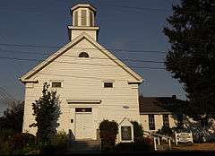 |
(#80003346) |
310–342 N. 2nd Street 44°43′12″N 123°00′38″W / 44.719936°N 123.010532°W |
Jefferson | |
| 56 | Jones–Sherman House |  |
(#81000508) |
835 D Street, NE 44°56′49″N 123°01′38″W / 44.94701°N 123.0273°W |
Salem | |
| 57 | Thomas Kay Woolen Mill | _(marDA0027a).jpg) |
(#73001579) |
1313 Mill Street, SE 44°56′06″N 123°01′38″W / 44.934987°N 123.027198°W |
Salem | Included in the Mission Mill Museum.[8] |
| 58 | John W. and Thomas F. Kirk House |  |
(#87000867) |
4686 St. Paul Highway, NE 45°12′30″N 122°57′59″W / 45.208207°N 122.966430°W |
St. Paul | |
| 59 | Frederick S. Lamport House |  |
(#91000806) |
590 Lower Ben Lomond Drive, SE 44°55′01″N 123°02′26″W / 44.916950°N 123.040593°W |
Salem | |
| 60 | Lee Mission Cemetery |  |
(#78002299) |
D Street 44°56′34″N 123°00′35″W / 44.94278°N 123.0097°W |
Salem | |
| 61 | Jason Lee House |  |
(#73001580) |
260 12th Street, SE 44°56′02″N 123°01′39″W / 44.93382°N 123.0275°W |
Salem | Included in the Mission Mill Museum.[8] |
| 62 | T. A. Livesley House | 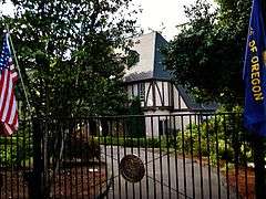 |
(#90000684) |
533 Lincoln Street, S 44°55′33″N 123°03′02″W / 44.925725°N 123.050677°W |
Salem | |
| 63 | S. A. Manning Building |  |
(#87000035) |
200–210 State Street 44°56′26″N 123°02′31″W / 44.940480°N 123.041965°W |
Salem | |
| 64 | Marion County Housing Committee Demonstration House |  |
(#88001243) |
140 Wilson Street, S 44°55′41″N 123°02′41″W / 44.928077°N 123.044805°W |
Salem | |
| 65 | McCallister–Gash Farmhouse | 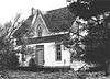 |
(#80003354) |
9626 Kaufman Road 44°58′06″N 122°51′50″W / 44.96846°N 122.864°W |
Silverton vicinity | |
| 66 | David McCully House |  |
(#78002300) |
1365 John Street, S 44°55′40″N 123°03′01″W / 44.927782°N 123.050340°W |
Salem | |
| 67 | Methodist Mission Parsonage | 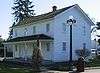 |
(#74001701) |
1313 Mill Street, SE 44°56′02″N 123°01′39″W / 44.93382°N 123.0275°W |
Salem | Included in the Mission Mill Museum.[8] |
| 68 | Miller Cemetery Church | 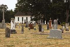 |
(#78002304) |
Cascade Highway, NE 45°02′21″N 122°43′46″W / 45.03915°N 122.7295°W |
Silverton vicinity | |
| 69 | John and Douglas Minto Houses |  |
(#81000509) |
821–841 Saginaw Street, S 44°55′58″N 123°02′44″W / 44.932896°N 123.045659°W |
Salem | |
| 70 | Joseph Henry Moser Barn |  |
(#13000396) |
507 S. 3rd Street 45°00′13″N 122°46′37″W / 45.003548°N 122.776924°W |
Silverton | |
| 71 | Carl E. Nelson House |  |
(#97000587) |
960 E Street, NE 44°56′50″N 123°01′30″W / 44.947225°N 123.025084°W |
Salem | |
| 72 | Odd Fellows Rural Cemetery |  |
(#13000707) |
2201 Commercial Street, SE 44°55′12″N 123°02′52″W / 44.919908°N 123.047796°W |
Salem | |
| 73 | Olallie Meadows Guard Station |  |
(#15000272) |
Mount Hood National Forest 44°51′33″N 121°46′23″W / 44.859068°N 121.773104°W |
Estacada vicinity | |
| 74 | Old First National Bank Building |  |
(#86002851) |
388 State Street 44°56′23″N 123°02′21″W / 44.939794°N 123.039251°W |
Salem | |
| 75 | Old Garfield School |  |
(#81000510) |
528 Cottage Street, NE 44°56′37″N 123°01′53″W / 44.94357°N 123.0315°W |
Salem | |
| 76 | Old Woodburn City Hall |  |
(#79002125) |
550 N 1st Street 45°08′39″N 122°51′21″W / 45.14413°N 122.8559°W |
Woodburn | |
| 77 | Oregon Pacific Railroad Linear Historic District |  |
(#99001285) |
Roughly a 20-mile linear section of the old railroad grade between Idanha and the Cascade Range summit (See also Linn and Jefferson counties.) 44°27′10″N 121°53′57″W / 44.452778°N 121.899167°W |
Idanha to the Cascade Range summit via Santiam Junction | Beginning in 1872, the colorful Thomas Egenton Hogg set out to build a transcontinental railroad terminating in the Oregon Coast. By the time of his venture's final bankruptcy in 1894, completed track reached only from Yaquina Bay to Idanha in the Cascade foothills, with grade work under way east of Idanha to the summit. The historic district protects the remaining signs of the grade work east of Idanha, as well as the sites of two construction camps. Abandoned part way through construction, these remnants provide a unique window onto construction methods and living conditions in 19th century railroad camps.[11] |
| 78 | Oregon State Capitol |  |
(#88001055) |
Capitol Mall 44°56′18″N 123°01′49″W / 44.938466°N 123.030374°W |
Salem | |
| 79 | Oregon State Fair Stadium and Poultry Building Ensemble |  |
(#02000671) |
2330 17th Street, NE 44°57′29″N 123°00′41″W / 44.95796°N 123.0114°W |
Salem | |
| 80 | Oregon State Forester's Office Building |  |
(#82003738) |
2600 State Street 44°55′53″N 123°00′27″W / 44.93148°N 123.0076°W |
Salem | |
| 81 | Oregon State Hospital Historic District | _(marDA006c).jpg) |
(#08000118) |
2600 Center Street, NE 44°56′24″N 123°00′13″W / 44.939922°N 123.003550°W |
Salem | |
| 82 | Christopher Paulus Building |  |
(#92000133) |
355–363 Court Street, NE 44°56′29″N 123°02′20″W / 44.941496°N 123.038886°W |
Salem | |
| 83 | Edgar T. Pierce House |  |
(#97000136) |
1610 Fir Street, S 44°55′30″N 123°02′49″W / 44.925034°N 123.046997°W |
Salem | |
| 84 | Pleasant Grove Presbyterian Church |  |
(#74001703) |
1313 Mill Street, SE 44°56′02″N 123°01′39″W / 44.93382°N 123.0275°W |
Salem | Included in the Mission Mill Museum.[8] Delisted due to relocation September 1984. Relisted in 1987. |
| 85 | Dr. Luke A. Port House |  |
(#73001581) |
1116 Mission Street, SE 44°55′48″N 123°01′54″W / 44.929894°N 123.031736°W |
Salem | |
| 86 | Port–Manning House |  |
(#78002301) |
4922 Halls Ferry Road, S 44°52′51″N 123°07′53″W / 44.880887°N 123.131448°W |
Salem | |
| 87 | Queen of Angels Priory |  |
(#82003736) |
840 S Main Street 45°03′43″N 122°48′10″W / 45.06207°N 122.8029°W |
Mount Angel | |
| 88 | Reed Opera House and McCornack Block Addition |  |
(#78002302) |
177–189 Liberty Street, NE 44°56′28″N 123°02′20″W / 44.940995°N 123.038771°W |
Salem | |
| 89 | Dr. and Mrs. Charles G. Robertson House and Garden |  |
(#83002163) |
460 Leffelle Street, S 44°55′34″N 123°02′59″W / 44.926059°N 123.049655°W |
Salem | |
| 90 | St. Mary's Roman Catholic Church |  |
(#76001583) |
575 E College Street 45°04′03″N 122°47′38″W / 45.06747°N 122.7939°W |
Mount Angel | |
| 91 | St. Paul Historic District |  |
(#82003739) |
45°12′35″N 122°58′34″W / 45.20969°N 122.9761°W |
St. Paul | |
| 92 | St. Paul Roman Catholic Church | .jpg) |
(#79002098) |
Junction of Christie Street and Mission Avenue, NE 45°12′43″N 122°58′42″W / 45.21181°N 122.9783°W |
St. Paul | |
| 93 | Salem Downtown State Street – Commercial Street Historic District | 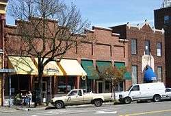 |
(#01001067) |
Roughly bounded by Ferry, High, Chemeketa, and Front Streets 44°56′24″N 123°02′22″W / 44.94009°N 123.0394°W |
Salem | Located on the Willamette River transportation corridor and near Jason Lee's Mission Mill, Salem's central business district was first platted in 1846. Subsequent development patterns closely reflected the drivers of Salem's growth as an important agricultural and commercial center. Surviving buildings represent a wide range of architectural styles from the 1860s through the 1950s.[12] |
| 94 | Salem Southern Pacific Railroad Station | 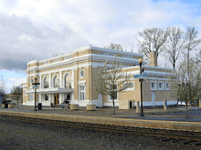 |
(#10000015) |
500 13th Avenue, SE 44°55′56″N 123°01′42″W / 44.932348°N 123.028196°W |
Salem | This grand Beaux-Arts style train station, completed in 1918, is the third station to occupy the same site. The adjacent REA freight terminal is a remnant of the 1889 Queen Anne station that burned in 1917. In 1999, the buildings were restored to their appearance during the first half of the 20th century. The site has been in continuous use for passenger rail service from 1871 through at least 2009.[13] |
| 95 | William Riley Scheurer House |  |
(#81000503) |
23707 1st Street, NE 45°15′44″N 122°50′37″W / 45.262090°N 122.843515°W |
Butteville | Located in Butteville along the Willamette River. |
| 96 | Jesse H. Settlemier House | _(marDA0149).jpg) |
(#74001704) |
355 N. Settlemier Avenue 45°08′41″N 122°51′43″W / 45.144653°N 122.861827°W |
Woodburn | |
| 97 | U. G. Shipley House and Garden |  |
(#94001219) |
260 Washington Street, S 44°55′27″N 123°02′48″W / 44.92426°N 123.0468°W |
Salem | |
| 98 | Silver Creek Youth Camp – Silver Falls State Park | Upload image | (#02000673) |
20024 Silver Falls Highway 44°51′23″N 122°36′36″W / 44.8564°N 122.6099°W |
Sublimity vicinity | |
| 99 | Silver Falls State Park Concession Building Area |  |
(#83002164) |
20024 Silver Falls Highway 44°52′45″N 122°39′23″W / 44.87925°N 122.6565°W |
Sublimity vicinity | |
| 100 | Silverton Commercial Historic District | _(marDA0188).jpg) |
(#87000878) |
Roughly bounded by High and Oak Streets, Silver Creek, and Lewis, Water, and 1st Streets 45°00′19″N 122°46′59″W / 45.005223°N 122.782927°W |
Silverton | These 27 buildings in Silverton's downtown core, dating from between 1870 and 1936, recall the twin stories of water power and commercial development in this small Willamette Valley town.[14] |
| 101 | Smith–Ohmart House |  |
(#79002121) |
2655 East Nob Hill Street, SE 44°54′57″N 123°02′37″W / 44.915933°N 123.043559°W |
Salem | |
| 102 | Peter and Bertha Soderberg House |  |
(#13000397) |
1106 Pine Street 45°00′40″N 122°47′32″W / 45.011148°N 122.792262°W |
Silverton | |
| 103 | South First National Bank Block |  |
(#83002165) |
241–247 Commercial Street, NE 44°56′32″N 123°02′24″W / 44.942087°N 123.039999°W |
Salem | |
| 104 | Starkey–McCully Block |  |
(#79002122) |
223–233 Commercial Street, NE 44°56′31″N 123°02′24″W / 44.941899°N 123.040101°W |
Salem | |
| 105 | John Stauffer House and Barn |  |
(#74001698) |
13551 Stauffer Road, NE 45°11′42″N 122°47′02″W / 45.194938°N 122.783820°W |
Hubbard | |
| 106 | C. C. Stratton House |  |
(#84000475) |
1599 State Street 44°56′09″N 123°01′17″W / 44.935866°N 123.021425°W |
Salem | |
| 107 | Union Street Railroad Bridge and Trestle |  |
(#05001520) |
Junction of Union and Water Streets, NE (See also Polk County.) 44°56′50″N 123°02′31″W / 44.94712°N 123.042°W |
Salem | |
| 108 | Victor Point School |  |
(#96001050) |
1156 Victor Point Road, SE 44°54′59″N 122°45′19″W / 44.916341°N 122.755229°W |
Silverton vicinity | |
| 109 | William Lincoln Wade House |  |
(#78002303) |
1305 John Street, S 44°55′41″N 123°03′01″W / 44.928186°N 123.050353°W |
Salem | |
| 110 | Waller Hall, Willamette University | 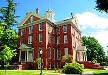 |
(#75001593) |
900 State Street 44°56′14″N 123°01′52″W / 44.937177°N 123.031050°W |
Salem | |
| 111 | Willamette Station Site, Methodist Mission in Oregon | 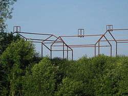 |
(#84003040) |
10991 Wheatland Ferry Road 45°05′03″N 123°02′33″W / 45.084216°N 123.042498°W |
Gervais vicinity | |
| 112 | Windischar's General Blacksmith Shop | |
(#80003347) |
110 Sheridan Street 45°04′04″N 122°47′48″W / 45.067744°N 122.796752°W |
Mount Angel | |
| 113 | T. M. and Emma Witten Drug Store – House |  |
(#99001002) |
104 N Main Street 44°43′04″N 123°00′42″W / 44.71786°N 123.0117°W |
Jefferson | |
| 114 | Robert Witzel House |  |
(#79002123) |
6576 Joseph Street, SE 44°53′07″N 122°55′40″W / 44.88515°N 122.9277°W |
Salem | |
| 115 | Casper Zorn Farmhouse |  |
(#80003355) |
8448 Champoeg Road, NE 45°14′44″N 122°53′11″W / 45.245480°N 122.886317°W |
St. Paul vicinity |
Former listings
| [5] | Name on the Register | Image | Date listed | Date removed | Location | City or town | Summary |
|---|---|---|---|---|---|---|---|
| 1 | Breitenbush Guard Station | Upload image | (#86000843) | Willamette National Forest 44°46′54″N 121°58′03″W / 44.78169°N 121.9676°W |
Detroit vicinity | ||
| 2 | George F. McCorkle House | 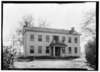 |
(#74001702) | W of Silverton |
Silverton | Removed due to significant historic alteration of the building. | |
| 3 | Paris Woollen Mill | Upload image | (#81000511) | 535 E Florence Street |
Stayton | ||
| 4 | Wilson–Durbin House |  |
(#80003352) | 434 Water Street (former) |
Salem | This Gothic revival house was built in 1861, and was destroyed by fire in 1990. The Salem community built a replica of the house on the same site in 1999, which was incorporated into A.C. Gilbert's Discovery Village.[15] |
See also
- National Register of Historic Places listings in Oregon
- Listings in neighboring counties: Clackamas, Jefferson, Linn, Polk, Wasco, Yamhill
- Historic preservation
- History of Oregon
- Lists of Oregon-related topics
References
- ↑ Andrus, Patrick W.; Shrimpton, Rebecca H.; et al. (2002), How to Apply the National Register Criteria for Evaluation, National Register Bulletin (15), National Park Service, U.S. Department of the Interior, OCLC 39493977, archived from the original on April 6, 2014, retrieved June 20, 2014.
- ↑ National Park Service, National Register of Historic Places Program: Research, archived from the original on February 1, 2015, retrieved January 28, 2015.
- ↑ Oregon Parks and Recreation Department, Oregon Historic Sites Database, retrieved August 6, 2015. Note that a simple count of National Register records in this database returns a slightly higher total than actual listings, due to duplicate records. A close reading of detailed query results is necessary to arrive at the precise count.
- ↑ "National Register of Historic Places: Weekly List Actions". National Park Service, United States Department of the Interior. Retrieved on December 2, 2016.
- 1 2 Numbers represent an ordering by significant words. Various colorings, defined here, differentiate National Historic Landmarks and historic districts from other NRHP buildings, structures, sites or objects.
- ↑ The eight-digit number below each date is the number assigned to each location in the National Register Information System database, which can be viewed by clicking the number.
- ↑ Finch-Tepper, Sheila (March 18, 1981). "National Register of Historic Places Inventory — Nomination Form: Bents, Frederick, House".
- 1 2 3 4 5 Mission Mill Museum Association. "Exhibits". Retrieved October 19, 2009.
- 1 2 Federal and state laws and practices restrict general public access to information regarding the specific location of sensitive archeological sites in many instances. The main reasons for such restrictions include the potential for looting, vandalism, or trampling. See: Knoerl, John; Miller, Diane; Shrimpton, Rebecca H. (1990), Guidelines for Restricting Information about Historic and Prehistoric Resources, National Register Bulletin (29), National Park Service, U.S. Department of the Interior, OCLC 20706997.
- ↑ "Salem landscape pioneers' garden listed on National Register of Historic Places". The Oregonian. January 2, 2015. Retrieved 13 January 2015.
- ↑ Tonsfeldt, Ward; Trussel, Tim; Boyer, William (February 12, 1998), National Register of Historic Places Registration Form: Oregon Pacific Railroad Historic District (PDF), retrieved February 14, 2013.
- ↑ Evans, Gail E. H. (July 2001), National Register of Historic Places Registration Form: Salem Downtown State Street – Commercial Street Historic District (PDF), retrieved March 7, 2016.
- ↑ Osborn, Julie; Calpo, Janice Catlin; Skilton, David; Patton, Hazel (December 2009), National Register of Historic Places Registration Form: Salem Southern Pacific Railroad Station (PDF), retrieved March 7, 2016.
- ↑ Watts-Olmstead, Laura; O'Brien, Elizabeth (August 15, 1986), National Register of Historic Places Inventory — Nomination Form: Silverton Commercial Historic District.
- ↑ A.C. Gilbert's Discovery Village. "About Us". Retrieved October 19, 2009.
External links
- Oregon Parks and Recreation Department, National Register Program
- National Park Service, National Register of Historic Places site
 Media related to National Register of Historic Places in Marion County, Oregon at Wikimedia Commons
| Lists by county |  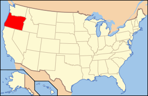 | |
|---|---|---|
| Portland lists | ||
| Other lists |
| |
| Topics | |
|---|---|
| Lists by states |
|
| Lists by insular areas | |
| Lists by associated states | |
| Other areas | |
| |
Municipalities and communities of Marion County, Oregon, United States | ||
|---|---|---|
| Cities | | |
| CDPs | ||
| Unincorporated communities | ||
| Ghost towns | ||
| Footnotes | ‡This populated place also has portions in an adjacent county or counties | |
This article is issued from Wikipedia - version of the 12/2/2016. The text is available under the Creative Commons Attribution/Share Alike but additional terms may apply for the media files.