Ramah, Colorado
| Ramah, Colorado | |
|---|---|
| Town | |
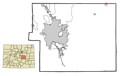 Location in El Paso County and the state of Colorado | |
| Coordinates: 39°7′19″N 104°9′57″W / 39.12194°N 104.16583°WCoordinates: 39°7′19″N 104°9′57″W / 39.12194°N 104.16583°W | |
| Country |
|
| State |
|
| County[1] | El Paso |
| Incorporated (town) | July 18, 1927[2] |
| Government | |
| • Type | Statutory Town[1] |
| Area | |
| • Total | 0.2 sq mi (0.6 km2) |
| • Land | 0.2 sq mi (0.6 km2) |
| • Water | 0 sq mi (0 km2) |
| Elevation[3] | 6,094 ft (1,864 m) |
| Population (2010) | |
| • Total | 123 |
| • Density | 620/sq mi (210/km2) |
| Time zone | Mountain (MST) (UTC-7) |
| • Summer (DST) | MDT (UTC-6) |
| ZIP code | 80832 |
| Area code(s) | 719 |
| FIPS code | 08-62660 |
| GNIS feature ID | 0203671 |
The town of Ramah /ˈreɪmə/ is a Statutory Town in El Paso County, Colorado, United States. The population was 123 as of the 2010 census.[4] According to tradition, the name is derived from India.[5]
History
Ramah began as a small railroading town along the Rock Island Railroad in the late 1800s. It was incorporated on July 18, 1927. During its peak, it was home to several hundred residents. Eventually, by the mid-1900s, the railroad was shut down, and Ramah suffered, since the railroad connected it to the Colorado Springs, forty miles to the southwest. Despite its decline, Ramah continues to exist, with ranching as the mainstay of its economy.
Geography
Ramah is located at 39°7′19″N 104°9′57″W / 39.12194°N 104.16583°W (39.121838, -104.165824).[6]
According to the United States Census Bureau, the town has a total area of 0.2 square miles (0.52 km2), all of it land.
Demographics
| Historical population | |||
|---|---|---|---|
| Census | Pop. | %± | |
| 1930 | 171 | — | |
| 1940 | 186 | 8.8% | |
| 1950 | 142 | −23.7% | |
| 1960 | 109 | −23.2% | |
| 1970 | 101 | −7.3% | |
| 1980 | 119 | 17.8% | |
| 1990 | 94 | −21.0% | |
| 2000 | 117 | 24.5% | |
| 2010 | 123 | 5.1% | |
| Est. 2015 | 126 | [7] | 2.4% |
As of the census[9] of 2000, there were 117 people, 50 households, and 31 families residing in the town. The population density was 473.2 people per square mile (180.7/km²). There were 65 housing units at an average density of 262.9 per square mile (100.4/km²). The racial makeup of the town was 86.32% White, 0.85% African American, 0.85% Pacific Islander, 1.71% from other races, and 10.26% from two or more races. Hispanic or Latino of any race were 8.55% of the population.
There were 50 households out of which 26.0% had children under the age of 18 living with them, 46.0% were married couples living together, 12.0% had a female householder with no husband present, and 38.0% were non-families. 28.0% of all households were made up of individuals and 10.0% had someone living alone who was 65 years of age or older. The average household size was 2.34 and the average family size was 2.94.
In the town the population was spread out with 27.4% under the age of 18, 3.4% from 18 to 24, 20.5% from 25 to 44, 36.8% from 45 to 64, and 12.0% who were 65 years of age or older. The median age was 44 years. For every 100 females there were 91.8 males. For every 100 females age 18 and over, there were 107.3 males.
The median income for a household in the town was $29,250, and the median income for a family was $48,000. Males had a median income of $29,167 versus $21,667 for females. The per capita income for the town was $15,465. There were no families and 2.4% of the population living below the poverty line, including no under eighteens and none of those over 64.
See also
References
- 1 2 "Active Colorado Municipalities". State of Colorado, Department of Local Affairs. Retrieved 2007-09-01.
- ↑ "Colorado Municipal Incorporations". State of Colorado, Department of Personnel & Administration, Colorado State Archives. 2004-12-01. Retrieved 2007-09-02.
- ↑ "US Board on Geographic Names". United States Geological Survey. 2007-10-25. Retrieved 2008-01-31.
- ↑ "Profile of General Population and Housing Characteristics: 2010 Demographic Profile Data (DP-1): Ramah town, Colorado". U.S. Census Bureau, American Factfinder. Retrieved April 11, 2012.
- ↑ Dawson, John Frank. Place names in Colorado: why 700 communities were so named, 150 of Spanish or Indian origin. Denver, CO: The J. Frank Dawson Publishing Co. p. 43.
- ↑ "US Gazetteer files: 2010, 2000, and 1990". United States Census Bureau. 2011-02-12. Retrieved 2011-04-23.
- ↑ "Annual Estimates of the Resident Population for Incorporated Places: April 1, 2010 to July 1, 2015". Retrieved July 2, 2016.
- ↑ "Census of Population and Housing". Census.gov. Retrieved June 4, 2015.
- ↑ "American FactFinder". United States Census Bureau. Retrieved 2008-01-31.
External links
Municipalities and communities of El Paso County, Colorado, United States | ||
|---|---|---|
| Cities | 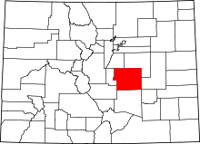 | |
| Towns | ||
| CDPs | ||
| Unincorporated communities | ||
| Footnotes | ‡This populated place also has portions in an adjacent county or counties | |
