Wollangambe River
| Wollangambe | |
| Wollangambe Creek[1] | |
| Perennial river | |
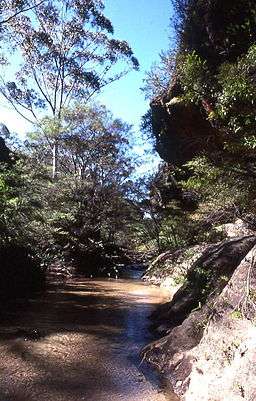 Wollangambe River in the Blue Mountains, 2008. | |
| Country | Australia |
|---|---|
| State | New South Wales |
| Regions | Sydney Basin (IBRA), Greater Blue Mountains Area |
| Local government areas | Lithgow, Blue Mountains |
| Part of | Hawkesbury–Nepean catchment |
| Tributaries | |
| - left | Bungleboori Creek, Nayook Creek |
| - right | Bowens Creek |
| Source | Great Dividing Range |
| - location | near Newnes Junction |
| - elevation | 924 m (3,031 ft) |
| Mouth | confluence with the Colo River |
| - location | west of Colo Heights |
| - elevation | 55 m (180 ft) |
| Length | 57 km (35 mi) |
| National parks | Wollemi NP, Blue Mountains NP |
| [1][2] | |
The Wollangambe River, an Australian perennial river that is part of the Hawkesbury–Nepean catchment within the Sydney Basin, is located in the Greater Blue Mountains Area of New South Wales.
Course and features
The Wollangambe River rises about 1 kilometre (0.62 mi) southeast of Happy Valley Springs, below Newnes Junction and within the Great Dividing Range. The river flows generally east and then north northeast, joined by three minor tributaries, mainly through rugged country that comprises Wollemi and Blue Mountains national parks. The river reaches its confluence with the Colo River west of Parsons Forest, near Colo Heights.[1] The river descends 869 metres (2,851 ft) over its 57-kilometre (35 mi) course.[2]
See also
References
- 1 2 3 "Wollangambe River". Geographical Names Register (GNR) of NSW. Geographical Names Board of New South Wales. Retrieved 11 August 2013.
- 1 2 "Map of Wollangambe River, NSW". Bonzle Digital Atlas of Australia. Retrieved 23 June 2013.
External links
- "Colo River Subcatchment" (PDF). Hawkesbury Nepean River Health Strategy. Hawkesbury Nepean Catchment Management Authority. 2008. pp. 23–24.
- "Northern Valleys". Hawkesbury Nepean River Health Strategy. Hawkesbury Nepean Catchment Management Authority. 2008.
River systems and rivers of Sydney Basin, New South Wales, Australia | |||||||
|---|---|---|---|---|---|---|---|
| |||||||
| |||||||
| |||||||
|
Hawkesbury River region, New South Wales, Australia | |
|---|---|
| Islands | |
| National parks and nature reserves | |
| European explorers of the region | |
| Bridges and ferries | |
| Adjoining rivers, bays, reservoirs, and creeks | |
| Local government areas | |
| Events | |
| |
Coordinates: 33°29′00″S 150°26′00″E / 33.48333°S 150.43333°E