Barrington River (New South Wales)
| Barrington River | |
| Perennial river[1] | |
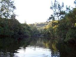 Barrington River, downstream of Barrington Tops National Park. | |
| Name origin: In honour of Lord Barrington[1] | |
| Country | Australia |
|---|---|
| State | New South Wales |
| IBRA | NSW North Coast, Upper Hunter |
| Local government area | Dungog, Mid-Coast Council |
| Part of | Manning River catchment |
| Tributaries | |
| - left | Cobark River, Moppy River |
| - right | Beean Beean Creek, Kerripit River, Mackays Creek |
| Town | Gloucester |
| Landmark | Barrington Volcano |
| Source | Mt Royal Range, Great Dividing Range |
| - location | below Carey's Peak, Barrington Volcano |
| - elevation | 1,460 m (4,790 ft) |
| Mouth | confluence with the Gloucester River |
| - location | near Gloucester |
| - elevation | 85 m (279 ft) |
| Length | 93 km (58 mi) |
| National park | Barrington Tops |
| [2] | |
Barrington River, a perennial river of the Manning River catchment, is located in the Upper Hunter district of New South Wales, Australia.
Course and features
Barrington River rises below Carey's Peak, within Barrington Volcano, on the eastern slopes of the Mt Royal Range, within the Great Dividing Range, and flows generally east, joined by five tributaries including the Kerripit, Cobark, and Moppy rivers, before reaching its confluence with the Gloucester River, near Gloucester. The river descends 1,370 metres (4,490 ft) over its 93 kilometres (58 mi) course.[2]
The river was named in honour of Lord Barrington.[1]
The river is popular with kayakers and canoers due to its sections of white water and attractive scenery,[3] and flows through the Barrington Tops National Park.
See also
References
- 1 2 3 "Barrington River". Geographical Names Register (GNR) of NSW. Geographical Names Board of New South Wales. Retrieved 15 March 2013.
- 1 2 "Map of Barrington River, NSW". Bonzle Digital Atlas of Australia. Retrieved 15 March 2013.
- ↑ "The Barringtons". Barrington Outdoor Adventure Centre. Archived from the original on 13 January 2007.
External links
- "Manning River catchments" (map). Office of Environment and Heritage. Government of New South Wales.
River systems and rivers of Hunter-Central Rivers catchment, New South Wales, Australia | |||||||
|---|---|---|---|---|---|---|---|
| |||||||
| |||||||
| |||||||
|
Coordinates: 31°58′S 151°44′E / 31.967°S 151.733°E