Alberta Highway 12
| ||||
|---|---|---|---|---|
 | ||||
| Route information | ||||
| Length: | 364 km (226 mi) | |||
| Major junctions | ||||
| West end: |
| |||
|
| ||||
| East end: |
Saskatchewan border near Compeer continues as | |||
| Location | ||||
| Specialized and rural municipalities: | Clearwater County, Lacombe County, Stettler No. 6 County, Paintearth No. 18 County, Special Area No. 4 | |||
| Major cities: | Lacombe | |||
| Towns: | Bentley, Stettler, Castor, Coronation | |||
| Villages: | Alix, Botha, Halkirk, Veteran, Consort | |||
| Highway system | ||||
|
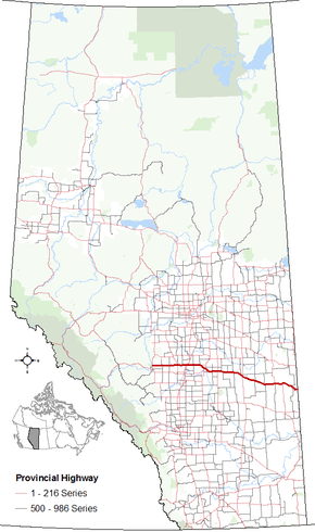
Provincial highways in Alberta
| ||||

Alberta Provincial Highway No. 12[1] is an east-west highway through central Alberta. It spans from the Alberta-Saskatchewan border to Highway 22, generally running parallel to Highway 13 to the north. Within Alberta, it passes through Compeer, Altario, Kirriemuir, Monitor, Consort, Veteran, Throne, Coronation, Fleet, Castor, Halkirk, Gadsby, Botha, Stettler, Erskine, Nevis, Alix, Tees, Clive, Lacombe, Gull Lake, and Bentley.
Major intersections
From west to east:[2]
| Rural/specialized municipality | Location | km | mi | Destinations | Notes | ||
|---|---|---|---|---|---|---|---|
| Clearwater County | | 0 | 0.0 | Western terminus of Hwy 12 | |||
| | 23 | 14 | |||||
| Lacombe County | | 39 | 24 | ||||
| Bentley | 59 | 37 | |||||
| | 66– 67 | 41– 42 | Passes through Aspen Beach Provincial Park | ||||
| Gull Lake | 71 | 44 | |||||
| City of Lacombe | 79 | 49 | Grade Separated | ||||
| 83 | 52 | ||||||
| Lacombe County | | 97 | 60 | ||||
| | 102 | 63 | Urban Approach Road 111 north – Clive | ||||
| | 111 | 69 | Urban Approach Road 88 north – Tees | ||||
| | 111.5 | 69.3 | |||||
| | 112 | 70 | |||||
| Alix | 124 | 77 | |||||
| | 130 | 81 | Hwy 21 concurrency begins | ||||
| Future | |||||||
| ↑ / ↓ | | 132 | 82 | Hwy 21 concurrency ends | |||
| County of Stettler No. 6 | Nevis | 137 | 85 | Main Street | |||
| | 140 | 87 | |||||
| Erskine | 148 | 92 | |||||
| Town of Stettler | 160 | 99 | |||||
| 161 | 100 | 47 Avenue / 50 Street | Hwy 12 branches south and then turns east | ||||
| County of Stettler No. 6 | | 170 | 110 | Hwy 850 concurrency begins | |||
| Botha | 174 | 108 | Hwy 850 concurrency ends | ||||
| Gadsby | 186 | 116 | |||||
| County of Paintearth No. 18 | | 199 | 124 | Hwy 855 concurrency begins | |||
| Halkirk | 200 | 120 | Hwy 855 concurrency ends | ||||
| Castor | 219 | 136 | |||||
| | 223 | 139 | |||||
| Coronation | 253 | 157 | Hwy 872 concurrency begins | ||||
| 255 | 158 | Hwy 872 concurrency ends | |||||
| Special Area No. 4 | Veteran | 279 | 173 | Hwy 884 concurrency begins | |||
| | 280 | 170 | Hwy 884 concurrency ends | ||||
| Consort | 303 | 188 | Hwy 41 concurrency begins | ||||
| Monitor | 321 | 199 | Hwy 41 concurrency ends | ||||
| | 338 | 210 | Range Road 31 south – Kirriemuir | ||||
| Altario | 350 | 220 | |||||
| Compeer | 364 | 226 | Alberta – Saskatchewan border | Eastern terminus of Hwy 12 | |||
| Continues as | |||||||
1.000 mi = 1.609 km; 1.000 km = 0.621 mi
| |||||||
References
External links
- 2010 Provincial Highways 1 - 216 Series Progress Chart (map, 8 MB) by Alberta Transportation.
- Mile by Mile. Alberta Highway # 12
This article is issued from Wikipedia - version of the 10/28/2016. The text is available under the Creative Commons Attribution/Share Alike but additional terms may apply for the media files.