Alberta Highway 29
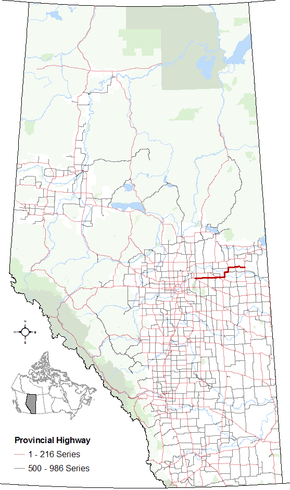
Alberta Provincial Highway No. 29[1] is an east–west highway located in east–central Alberta.
Highway 29 was established in 2006 by renumbering portions of Highway 637, Highway 45, Highway 860, Highway 36, and Highway 28 between Highway 15, approximately 2 km (1.2 mi) northwest of the Town of Lamont, and Highway 41, approximately 28 km (17 mi) east of the Town of St. Paul.[2]
It begins northwest of Lamont at Highway 15, and runs east through Hairy Hill, Duvernay, Brosseau, Foisy, St. Brides, and St. Paul before ending at Highway 41 approximately 9 km (5.6 mi) north of Elk Point.
Major intersections
| Municipality |
km |
Intersecting road |
Notes |
Coordinates |
|---|
| Lamont County |
0 |
 Hwy 15 – Edmonton, Fort Saskatchewan, Bruderheim, Mundare Hwy 15 – Edmonton, Fort Saskatchewan, Bruderheim, Mundare |
Township Road 554
Highway 29 begins |
53°46′24″N 112°49′42″W / 53.77333°N 112.82833°W / 53.77333; -112.82833 (29 km 000) |
| 3 |
 Hwy 831 – Waskatenau, Boyle Hwy 831 – Waskatenau, Boyle |
Lamont
Range Road 194 |
53°46′27″N 112°46′39″W / 53.77417°N 112.77750°W / 53.77417; -112.77750 (29 km 003) |
| 32 |
 Hwy 855 – Andrew, Mundare Hwy 855 – Andrew, Mundare |
Range Road 164 |
53°46′24″N 112°19′55″W / 53.77333°N 112.33194°W / 53.77333; -112.33194 (29 km 032) |
| County of Two Hills No. 21 |
50 |
 Hwy 857 – Willingdon, Vegreville Hwy 857 – Willingdon, Vegreville |
Range Road 145 |
53°46′24″N 112°3′33″W / 53.77333°N 112.05917°W / 53.77333; -112.05917 (29 km 050) |
| 53 |
 Hwy 45 west – Willingdon, Bruderheim Hwy 45 west – Willingdon, Bruderheim |
Hairy Hill
Begin Highway 45 concurrency |
53°46′33″N 112°0′57″W / 53.77583°N 112.01583°W / 53.77583; -112.01583 (29 km 053) |
| 61 |
Hwy 45 east – Two Hills, Derwent, Marwayne |
End Highway 45 concurrency |
53°46′18″N 111°53′55″W / 53.77167°N 111.89861°W / 53.77167; -111.89861 (29 km 061) |
| 62 |
 Hwy 860 north – Highway 645 Hwy 860 north – Highway 645 |
Range Road 133 |
53°46′23″N 111°53′10″W / 53.77306°N 111.88611°W / 53.77306; -111.88611 (29 km 062) |
| 75 |
 Hwy 36 south – Two Hills, Viking Hwy 36 south – Two Hills, Viking |
Duvernay
Range Road 122
Highway 29 turns north
Begin Highway 36 concurrency |
53°46′23″N 111°41′17″W / 53.77306°N 111.68806°W / 53.77306; -111.68806 (29 km 075) |
| 77 |
North Saskatchewan River |
|
53°47′21″N 111°41′17″W / 53.78917°N 111.68806°W / 53.78917; -111.68806 (29 km 077) |
| 78 |
Township Road 560 |
Brosseau |
53°48′8″N 111°41′17″W / 53.80222°N 111.68806°W / 53.80222; -111.68806 (29 km 078) |
| 88 |
Township Road 570 |
Highway turns east |
53°53′9″N 111°40′55″W / 53.88583°N 111.68194°W / 53.88583; -111.68194 (29 km 088) |
| County of St. Paul No. 19 |
94 |
Range Road 114 |
Foisy |
53°53′22″N 111°35′20″W / 53.88944°N 111.58889°W / 53.88944; -111.58889 (29 km 094) |
| 97 |
 Hwy 646 east – Lafond, Elk Point Hwy 646 east – Lafond, Elk Point |
Range Road 112
Highway turns north |
53°53′24″N 111°32′55″W / 53.89000°N 111.54861°W / 53.89000; -111.54861 (29 km 097) |
| 107 |
 Hwy 652 west – Saddle Lake Hwy 652 west – Saddle Lake |
Township Road 570 |
53°58′36″N 111°32′23″W / 53.97667°N 111.53972°W / 53.97667; -111.53972 (29 km 107) |
| 109 |
Hwy 36 north – Ashmont, Vilna, Lac La Biche |
St. Brides
Township Road 571
Highway 29 turns east
End Highway 36 concurrency |
53°59′28″N 111°32′21″W / 53.99111°N 111.53917°W / 53.99111; -111.53917 (29 km 109) |
| 126 |
 Hwy 881 north – St. Vincent, Therien Hwy 881 north – St. Vincent, Therien |
St. Paul
40 Street, Range Road 93
Begin Highway 881 concurrency |
53°59′28″N 111°16′2″W / 53.99111°N 111.26722°W / 53.99111; -111.26722 (29 km 126) |
| 128 |
Hwy 881 south – Myrnam, Mannville |
Range Road 92
End Highway 881 concurrency |
53°59′28″N 111°14′33″W / 53.99111°N 111.24250°W / 53.99111; -111.24250 (29 km 128) |
| 137 |
Range Road 83 |
St. Edouard |
53°59′55″N 111°7′7″W / 53.99861°N 111.11861°W / 53.99861; -111.11861 (29 km 137) |
| 142 |
Township Road 570 |
Now on Township Road 570 |
53°58′37″N 111°2′40″W / 53.97694°N 111.04444°W / 53.97694; -111.04444 (29 km 142) |
| 152 |
 Hwy 41 – Cold Lake, Bonnyville, Elk Point, Vermilion Hwy 41 – Cold Lake, Bonnyville, Elk Point, Vermilion |
Range Road 70
Y intersection
Highway 29 ends |
53°58′35″N 110°53′45″W / 53.97639°N 110.89583°W / 53.97639; -110.89583 (29 km 152) |
1.000 mi = 1.609 km; 1.000 km = 0.621 mi
|
References
External links