Alberta Highway 41

Alberta Highway 41 shield Buffalo Highway shield

Highway 41
Buffalo Trail
Route information
Length: 686 km (426 mi)
Major junctions
South end: S-232 US border at Wild Horse
  Hwy 1 (TCH) near Irvine and Dunmore
Hwy 41A near Medicine Hat
Hwy 9 near Oyen
Hwy 12 near Consort
Hwy 13 near Czar
Hwy 14 at Wainwright
Hwy 16 (TCH) at Vermilion
Hwy 45 near Derwent
Hwy 29 near Elk Point
Hwy 28 at Hoselaw and Bonnyville
North end: Hwy 55 at La Corey
Location
Specialized
and rural
municipalities:
Cypress County, Special Area No. 2, Acadia No. 34 M.D., Special Area No. 3, Special Area No. 4, Provost No. 52 M.D., Wainwright No. 61 M.D., Vermilion River County, Two Hills No. 21 County, St. Paul No. 19 County, Bonnyville No. 87 M.D.
Towns: Oyen, Wainwright, Vermilion, Elk Point, Bonnyville
Villages: Consort, Czar
Highway system

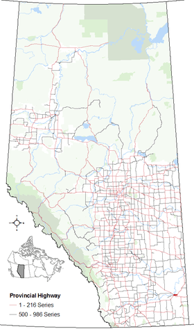
Provincial highways in Alberta

Hwy 40Hwy 42

Alberta Provincial Highway No. 41,[1] also named Buffalo Trail, is a 686 km (426 mi) north-south highway located in eastern Alberta, Canada. It extends from the Hamlet of La Corey at Highway 55 to the United States border at Wild Horse.

Major intersections

From south to north:

Rural/specialized municipalityLocationkmmiDestinationsNotes
Continues as S-232 south towards Havre, Montana.
Cypress CountyWild Horse00.0Canada–United States border49°00′00″N 110°12′56″W / 49.00000°N 110.21556°W / 49.00000; -110.21556 (Wild Horse)
2415 Hwy 501 Eastend, Manyberries, Milk River49°14′41″N 110°15′03″W / 49.24472°N 110.25083°W / 49.24472; -110.25083 (Highway 501)
Cypress Hills
Interprovincial Park
8251PAR 115 west – Elkwater49°39′59″N 110°16′17″W / 49.66639°N 110.27139°W / 49.66639; -110.27139 (PAR 115)
8452 Hwy 514 west49°41′12″N 110°17′52″W / 49.68667°N 110.29778°W / 49.68667; -110.29778 (Highway 514)
9660 Hwy 515 east Maple Creek49°47′12″N 110°20′34″W / 49.78667°N 110.34278°W / 49.78667; -110.34278 (Highway 515)
11471 Hwy 1 (TCH) east Swift Current, Moose Jaw, ReginaHwy 41 branches west
Hwy 1 concurrency begins
49°57′20″N 110°20′22″W / 49.95556°N 110.33944°W / 49.95556; -110.33944 (Highway 1)
Dunmore13081 Hwy 1 (TCH) west Medicine Hat, CalgaryHwy 41 branches north
Hwy 1 concurrency ends
49°58′28″N 110°33′05″W / 49.97444°N 110.55139°W / 49.97444; -110.55139 (Medicine Hat)
13685 Hwy 41A west Medicine Hat50°01′48″N 110°32′01″W / 50.03000°N 110.53361°W / 50.03000; -110.53361 (Highway 41A)
188117 Hwy 528 east Golden Prairie50°15′03″N 110°16′46″W / 50.25083°N 110.27944°W / 50.25083; -110.27944 (Highway 528)
200120UAR 168 west – Schuler50°20′20″N 110°09′47″W / 50.33889°N 110.16306°W / 50.33889; -110.16306 (UAR 168)
205127 Hwy 537 west Fox Valley50°25′31″N 110°05′45″W / 50.42528°N 110.09583°W / 50.42528; -110.09583 (Highway 537)
210130UAR 154 west – Hilda50°29′09″N 110°05′48″W / 50.48583°N 110.09667°W / 50.48583; -110.09667 (UAR 154)
232144 Hwy 545 east Burstall50°39′31″N 110°05′45″W / 50.65861°N 110.09583°W / 50.65861; -110.09583 (Highway 545)
↑ / ↓241150Crosses the South Saskatchewan River50°43′07″N 110°04′43″W / 50.71861°N 110.07861°W / 50.71861; -110.07861 (South Saskatchewan River)
Special Area No. 2256159 Hwy 555 east Bindloss, Jenner50°51′45″N 110°07′11″W / 50.86250°N 110.11972°W / 50.86250; -110.11972 (Highway 555)
259161UAR 139 north – Empress50°54′18″N 110°07′33″W / 50.90500°N 110.12583°W / 50.90500; -110.12583 (UAR 139)
↑ / ↓262163Crosses the Red Deer River50°55′59″N 110°08′59″W / 50.93306°N 110.14972°W / 50.93306; -110.14972 (Red Deer River)
M.D. of Acadia No. 34268167 Hwy 562 east Empress50°58′42″N 110°11′37″W / 50.97833°N 110.19361°W / 50.97833; -110.19361 (Highway 562)
289180UAR 178 east – Acadia Valley51°09′13″N 110°13′14″W / 51.15361°N 110.22056°W / 51.15361; -110.22056 (UAR 178)
↑ / ↓298185 Hwy 570 Big Stone51°14′26″N 110°14′13″W / 51.24056°N 110.23694°W / 51.24056; -110.23694 (Highway 570)
Special Area No. 3Oyen316196 Hwy 895 south51°26′33″N 110°45′42″W / 51.44250°N 110.76167°W / 51.44250; -110.76167 (Highway 895)
318198 Hwy 9 Drumheller, Calgary, Kindersley, Saskatoon51°23′12″N 110°28′24″W / 51.38667°N 110.47333°W / 51.38667; -110.47333 (Highway 9)
Special Area No. 4Monitor386240 Hwy 12 east Altario, KerrobertHwy 41 branches west
Hwy 12 concurrency begins
51°59′23″N 110°31′46″W / 51.98972°N 110.52944°W / 51.98972; -110.52944 (Highway 12)
Consort403250 Hwy 886 south Cereal
Hwy 12 west Coronation, Stettler
Hwy 41 branches north
Hwy 12 concurrency ends
52°00′05″N 110°47′26″W / 52.00139°N 110.79056°W / 52.00139; -110.79056 (Highway 12)
416258PAR 121 east – Gooseberry Lake Provincial Park52°06′50″N 110°47′26″W / 52.11389°N 110.79056°W / 52.11389; -110.79056 (Gooseberry Lake Prov Pk)
M.D. of Provost No. 52441274 Hwy 600 east Cadogan, Provost52°19′03″N 110°49′07″W / 52.31750°N 110.81861°W / 52.31750; -110.81861 (Highway 600)
Czar459285UAR 220 west52°27′08″N 110°49′01″W / 52.45222°N 110.81694°W / 52.45222; -110.81694 (UAR 220)
462287 Hwy 13 Provost, Camrose52°29′18″N 110°49′10″W / 52.48833°N 110.81944°W / 52.48833; -110.81944 (Highway 13)
M.D. of Wainwright No. 61Wainwright502312 Hwy 14 The Battlefords, Viking, Edmonton52°50′35″N 110°49′33″W / 52.84306°N 110.82583°W / 52.84306; -110.82583 (Highway 14)
508316 Hwy 614 east52°57′33″N 110°49′30″W / 52.95917°N 110.82500°W / 52.95917; -110.82500 (Highway 614)
513319Crosses the Battle River52°59′49″N 110°50′58″W / 52.99694°N 110.84944°W / 52.99694; -110.84944 (Battle River)
County of Vermilion River536333 Hwy 619 Lloydminster, Viking53°59′55″N 110°51′59″W / 53.99861°N 110.86639°W / 53.99861; -110.86639 (Highway 883)
Vermilion559347 Hwy 16 (TCH) (Exit 577) Edmonton, Vegreville, LloydminsterInterchange
53°20′15″N 110°51′36″W / 53.33750°N 110.86000°W / 53.33750; -110.86000 (Highway 16)
56134950 Avenue53°21′14″N 110°51′31″W / 53.35389°N 110.85861°W / 53.35389; -110.85861 (50 Avenue)
581361 Hwy 631 west Vegreville, Mundare53°32′25″N 110°52′01″W / 53.54028°N 110.86694°W / 53.54028; -110.86694 (Highway 631)
County of Two Hills No. 21588365 Hwy 45 east Marwayne, Prince AlbertHwy 45 concurrency begins
53°35′56″N 110°52′00″W / 53.59889°N 110.86667°W / 53.59889; -110.86667 (Highway 45 east)
595370 Hwy 45 west Derwent, Two Hills, BruderheimHwy 45 concurrency ends
53°39′25″N 110°52′06″W / 53.65694°N 110.86833°W / 53.65694; -110.86833 (Highway 45 west)
607377 Hwy 640 east Heinsburg53°44′39″N 110°53′46″W / 53.74417°N 110.89611°W / 53.74417; -110.89611 (Highway 640)
County of St. Paul No. 19619385Crosses the North Saskatchewan River53°51′41″N 110°53′52″W / 53.86139°N 110.89778°W / 53.86139; -110.89778 (North Saskatchewan River)
Elk Point622386 Hwy 646 Lafond, Lindbergh53°53′21″N 110°53′46″W / 53.88917°N 110.89611°W / 53.88917; -110.89611 (Highway 646)
631392 Hwy 29 west St. Paul, LamontY intersection
53°58′34″N 110°53′50″W / 53.97611°N 110.89722°W / 53.97611; -110.89722 (Highway 29)
Kehewin I.R. #123643400 Hwy 657 east Gurneyville54°06′41″N 110°53′29″W / 54.11139°N 110.89139°W / 54.11139; -110.89139 (Highway 657)
M.D. of Bonnyville No. 87Hoselaw651405 Hwy 28 west Smoky Lake, EdmontonHwy 41 branches east
Hwy 28 concurrency begins
54°07′32″N 110°47′23″W / 54.12556°N 110.78972°W / 54.12556; -110.78972 (Highway 28 west)
661411UAR 96 west – Bonnyville Beach54°14′20″N 110°49′49″W / 54.23889°N 110.83028°W / 54.23889; -110.83028 (UAR 96)
Bonnyville66941655th Street
Hwy 28 east (50th Avenue) Cold Lake
Hwy 41 branches north
Hwy 28 concurrency ends
54°16′05″N 110°45′19″W / 54.26806°N 110.75528°W / 54.26806; -110.75528 (Highway 28 east)
672418 Hwy 660 Fort Kent, Glendon54°17′49″N 110°45′20″W / 54.29694°N 110.75556°W / 54.29694; -110.75556 (Highway 660)
La Corey688428 Hwy 55 Cold Lake, Lac La Biche, AthabascaHwy 41 ends
54°26′33″N 110°45′42″W / 54.44250°N 110.76167°W / 54.44250; -110.76167 (Highway 55)
1.000 mi = 1.609 km; 1.000 km = 0.621 mi

Highway 41A

Segment of Highway 41A in Alberta

Highway 41A
Location: Cypress County, City of Medicine Hat
Length: 7 km (4 mi)

Alberta Provincial Highway No. 41A[1] is the designation of an alternate route off Highway 41 serving the City of Medicine Hat. It branches off Highway 41 approximately 7 km (4.3 mi) north of the Trans-Canada Highway and runs approximately 12 km (7.5 mi). It winds through Medicine Hat and terminates at its junction with the Trans-Canada Highway and the Crowsnest Highway (Highway 3) west of the downtown core.

References

  1. 1 2 Provincial Highways Designation Order, Alberta Transportation, p. 7

External links

This article is issued from Wikipedia - version of the 11/11/2016. The text is available under the Creative Commons Attribution/Share Alike but additional terms may apply for the media files.