Arthon
| Arthon | |
|---|---|
|
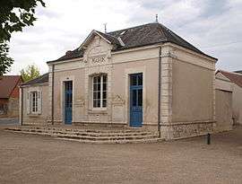
The town hall in Arthon | |
 Arthon | |
|
Location within Centre-Val de Loire region  Arthon | |
| Coordinates: 46°41′40″N 1°42′01″E / 46.6944°N 1.7003°ECoordinates: 46°41′40″N 1°42′01″E / 46.6944°N 1.7003°E | |
| Country | France |
| Region | Centre-Val de Loire |
| Department | Indre |
| Arrondissement | Châteauroux |
| Canton | Ardentes |
| Intercommunality | Châteauroux |
| Government | |
| • Mayor (2008–2014) | Jacky Devolf |
| Area1 | 46.8 km2 (18.1 sq mi) |
| Population (2009)2 | 1,171 |
| • Density | 25/km2 (65/sq mi) |
| Time zone | CET (UTC+1) |
| • Summer (DST) | CEST (UTC+2) |
| INSEE/Postal code | 36009 / 36330 |
| Elevation |
132–184 m (433–604 ft) (avg. 145 m or 476 ft) |
|
1 French Land Register data, which excludes lakes, ponds, glaciers > 1 km² (0.386 sq mi or 247 acres) and river estuaries. 2 Population without double counting: residents of multiple communes (e.g., students and military personnel) only counted once. | |
Arthon is a commune in the Indre department in central France.
Geography
The commune is traversed by the river Bouzanne.
Population
| Historical population | ||
|---|---|---|
| Year | Pop. | ±% |
| 1793 | 661 | — |
| 1800 | 603 | −8.8% |
| 1806 | 590 | −2.2% |
| 1821 | 747 | +26.6% |
| 1831 | 824 | +10.3% |
| 1836 | 907 | +10.1% |
| 1841 | 820 | −9.6% |
| 1846 | 897 | +9.4% |
| 1851 | 843 | −6.0% |
| 1856 | 862 | +2.3% |
| 1861 | 838 | −2.8% |
| 1866 | 883 | +5.4% |
| 1872 | 925 | +4.8% |
| 1876 | 1,002 | +8.3% |
| 1881 | 1,015 | +1.3% |
| 1886 | 1,068 | +5.2% |
| 1891 | 1,113 | +4.2% |
| 1896 | 1,150 | +3.3% |
| 1901 | 1,103 | −4.1% |
| 1906 | 1,115 | +1.1% |
| 1911 | 1,111 | −0.4% |
| 1921 | 938 | −15.6% |
| 1926 | 875 | −6.7% |
| 1931 | 785 | −10.3% |
| 1936 | 750 | −4.5% |
| 1946 | 753 | +0.4% |
| 1954 | 702 | −6.8% |
| 1962 | 634 | −9.7% |
| 1968 | 532 | −16.1% |
| 1975 | 558 | +4.9% |
| 1982 | 751 | +34.6% |
| 1990 | 902 | +20.1% |
| 1999 | 995 | +10.3% |
| 2009 | 1,171 | +17.7% |
See also
References
| Wikimedia Commons has media related to Arthon. |
This article is issued from Wikipedia - version of the 9/16/2015. The text is available under the Creative Commons Attribution/Share Alike but additional terms may apply for the media files.