Chezelles, Indre
| Chezelles | |
|---|---|
|
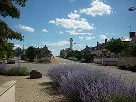
The well-kept village of Chezelles | |
 Chezelles | |
|
Location within Centre-Val de Loire region  Chezelles | |
| Coordinates: 46°53′27″N 1°34′35″E / 46.8908°N 1.5764°ECoordinates: 46°53′27″N 1°34′35″E / 46.8908°N 1.5764°E | |
| Country | France |
| Region | Centre-Val de Loire |
| Department | Indre |
| Arrondissement | Châteauroux |
| Canton | Buzançais |
| Intercommunality | Val de l'Indre-Brenne |
| Government | |
| • Mayor (2008–2014) | Philippe Yvon |
| Area1 | 17.32 km2 (6.69 sq mi) |
| Population (2009)2 | 427 |
| • Density | 25/km2 (64/sq mi) |
| Time zone | CET (UTC+1) |
| • Summer (DST) | CEST (UTC+2) |
| INSEE/Postal code | 36050 / 36500 |
| Elevation |
132–171 m (433–561 ft) (avg. 163 m or 535 ft) |
|
1 French Land Register data, which excludes lakes, ponds, glaciers > 1 km² (0.386 sq mi or 247 acres) and river estuaries. 2 Population without double counting: residents of multiple communes (e.g., students and military personnel) only counted once. | |
Chezelles is a commune in the Indre department in central France.
Population
| Historical population | ||
|---|---|---|
| Year | Pop. | ±% |
| 1793 | 475 | — |
| 1800 | 498 | +4.8% |
| 1806 | 490 | −1.6% |
| 1821 | 477 | −2.7% |
| 1831 | 555 | +16.4% |
| 1836 | 560 | +0.9% |
| 1841 | 550 | −1.8% |
| 1846 | 505 | −8.2% |
| 1851 | 524 | +3.8% |
| 1856 | 534 | +1.9% |
| 1861 | 561 | +5.1% |
| 1866 | 566 | +0.9% |
| 1872 | 553 | −2.3% |
| 1876 | 540 | −2.4% |
| 1881 | 563 | +4.3% |
| 1886 | 595 | +5.7% |
| 1891 | 589 | −1.0% |
| 1896 | 560 | −4.9% |
| 1901 | 555 | −0.9% |
| 1906 | 523 | −5.8% |
| 1911 | 535 | +2.3% |
| 1921 | 474 | −11.4% |
| 1926 | 473 | −0.2% |
| 1931 | 446 | −5.7% |
| 1936 | 432 | −3.1% |
| 1946 | 449 | +3.9% |
| 1954 | 435 | −3.1% |
| 1962 | 410 | −5.7% |
| 1968 | 419 | +2.2% |
| 1975 | 381 | −9.1% |
| 1982 | 379 | −0.5% |
| 1990 | 402 | +6.1% |
| 1999 | 409 | +1.7% |
| 2009 | 427 | +4.4% |
See also
References
| Wikimedia Commons has media related to Chezelles (Indre). |
This article is issued from Wikipedia - version of the 2/9/2015. The text is available under the Creative Commons Attribution/Share Alike but additional terms may apply for the media files.