Jeu-les-Bois
| Jeu-les-Bois | |
|---|---|
|
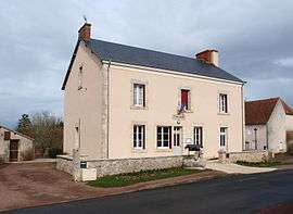
The town hall in Jeu-les-Bois | |
 Jeu-les-Bois | |
|
Location within Centre-Val de Loire region  Jeu-les-Bois | |
| Coordinates: 46°40′27″N 1°47′45″E / 46.6742°N 1.7958°ECoordinates: 46°40′27″N 1°47′45″E / 46.6742°N 1.7958°E | |
| Country | France |
| Region | Centre-Val de Loire |
| Department | Indre |
| Arrondissement | Châteauroux |
| Canton | Ardentes |
| Government | |
| • Mayor (2008–2014) | Jacques Breuillaud |
| Area1 | 38.32 km2 (14.80 sq mi) |
| Population (2009)2 | 399 |
| • Density | 10/km2 (27/sq mi) |
| Time zone | CET (UTC+1) |
| • Summer (DST) | CEST (UTC+2) |
| INSEE/Postal code | 36089 / 36120 |
| Elevation |
143–206 m (469–676 ft) (avg. 171 m or 561 ft) |
|
1 French Land Register data, which excludes lakes, ponds, glaciers > 1 km² (0.386 sq mi or 247 acres) and river estuaries. 2 Population without double counting: residents of multiple communes (e.g., students and military personnel) only counted once. | |
Jeu-les-Bois is a commune in the Indre department in central France.
Geography
The commune is traversed by the river Bouzanne.
Population
| Historical population | ||
|---|---|---|
| Year | Pop. | ±% |
| 1793 | 600 | — |
| 1800 | 609 | +1.5% |
| 1806 | 587 | −3.6% |
| 1821 | 641 | +9.2% |
| 1831 | 636 | −0.8% |
| 1836 | 678 | +6.6% |
| 1841 | 656 | −3.2% |
| 1846 | 660 | +0.6% |
| 1851 | 637 | −3.5% |
| 1856 | 657 | +3.1% |
| 1861 | 663 | +0.9% |
| 1866 | 670 | +1.1% |
| 1872 | 640 | −4.5% |
| 1876 | 648 | +1.2% |
| 1881 | 651 | +0.5% |
| 1886 | 657 | +0.9% |
| 1891 | 697 | +6.1% |
| 1896 | 679 | −2.6% |
| 1901 | 672 | −1.0% |
| 1906 | 658 | −2.1% |
| 1911 | 623 | −5.3% |
| 1921 | 591 | −5.1% |
| 1926 | 566 | −4.2% |
| 1931 | 509 | −10.1% |
| 1936 | 503 | −1.2% |
| 1946 | 473 | −6.0% |
| 1954 | 433 | −8.5% |
| 1962 | 372 | −14.1% |
| 1968 | 343 | −7.8% |
| 1975 | 260 | −24.2% |
| 1982 | 290 | +11.5% |
| 1990 | 335 | +15.5% |
| 1999 | 343 | +2.4% |
| 2009 | 399 | +16.3% |
See also
References
| Wikimedia Commons has media related to Jeu-les-Bois. |
This article is issued from Wikipedia - version of the 7/16/2016. The text is available under the Creative Commons Attribution/Share Alike but additional terms may apply for the media files.