Velles, Indre
| Velles | |
|---|---|
|
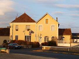
The town hall in Velles | |
 Velles | |
|
Location within Centre-Val de Loire region  Velles | |
| Coordinates: 46°41′20″N 1°39′01″E / 46.689°N 1.6504°ECoordinates: 46°41′20″N 1°39′01″E / 46.689°N 1.6504°E | |
| Country | France |
| Region | Centre-Val de Loire |
| Department | Indre |
| Arrondissement | Châteauroux |
| Canton | Ardentes |
| Intercommunality | Pays d'Argenton-sur-Creuse |
| Government | |
| • Mayor (2008–2014) | Paul Foulatier |
| Area1 | 63.09 km2 (24.36 sq mi) |
| Population (2009)2 | 886 |
| • Density | 14/km2 (36/sq mi) |
| Time zone | CET (UTC+1) |
| • Summer (DST) | CEST (UTC+2) |
| INSEE/Postal code | 36231 / 36330 |
| Elevation |
117–184 m (384–604 ft) (avg. 150 m or 490 ft) |
|
1 French Land Register data, which excludes lakes, ponds, glaciers > 1 km² (0.386 sq mi or 247 acres) and river estuaries. 2 Population without double counting: residents of multiple communes (e.g., students and military personnel) only counted once. | |
Velles is a commune in the Indre department in central France.
Geography
The commune is traversed by the river Bouzanne.
Population
| Historical population | ||
|---|---|---|
| Year | Pop. | ±% |
| 1793 | 584 | — |
| 1800 | 466 | −20.2% |
| 1806 | 581 | +24.7% |
| 1821 | 656 | +12.9% |
| 1831 | 705 | +7.5% |
| 1836 | 745 | +5.7% |
| 1841 | 712 | −4.4% |
| 1846 | 761 | +6.9% |
| 1851 | 761 | +0.0% |
| 1856 | 764 | +0.4% |
| 1861 | 782 | +2.4% |
| 1866 | 757 | −3.2% |
| 1872 | 800 | +5.7% |
| 1876 | 859 | +7.4% |
| 1881 | 972 | +13.2% |
| 1886 | 1,002 | +3.1% |
| 1891 | 1,057 | +5.5% |
| 1896 | 1,122 | +6.1% |
| 1901 | 1,150 | +2.5% |
| 1906 | 1,153 | +0.3% |
| 1911 | 1,114 | −3.4% |
| 1921 | 999 | −10.3% |
| 1926 | 995 | −0.4% |
| 1931 | 931 | −6.4% |
| 1936 | 900 | −3.3% |
| 1946 | 893 | −0.8% |
| 1954 | 900 | +0.8% |
| 1962 | 770 | −14.4% |
| 1968 | 668 | −13.2% |
| 1975 | 716 | +7.2% |
| 1982 | 771 | +7.7% |
| 1990 | 835 | +8.3% |
| 1999 | 827 | −1.0% |
| 2006 | 842 | +1.8% |
| 2009 | 886 | +5.2% |
See also
References
| Wikimedia Commons has media related to Velles (Indre). |
This article is issued from Wikipedia - version of the 2/9/2015. The text is available under the Creative Commons Attribution/Share Alike but additional terms may apply for the media files.