Saint-Lactencin
| Saint-Lactencin | |
|---|---|
|
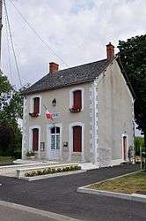
The town hall in Saint-Lactencin | |
 Saint-Lactencin | |
|
Location within Centre-Val de Loire region  Saint-Lactencin | |
| Coordinates: 46°53′56″N 1°29′38″E / 46.8989°N 1.4939°ECoordinates: 46°53′56″N 1°29′38″E / 46.8989°N 1.4939°E | |
| Country | France |
| Region | Centre-Val de Loire |
| Department | Indre |
| Arrondissement | Châteauroux |
| Canton | Buzançais |
| Intercommunality | Val de l'Indre-Brenne |
| Government | |
| • Mayor (2008–2014) | Daniel Biard |
| Area1 | 32.2 km2 (12.4 sq mi) |
| Population (2009)2 | 402 |
| • Density | 12/km2 (32/sq mi) |
| Time zone | CET (UTC+1) |
| • Summer (DST) | CEST (UTC+2) |
| INSEE/Postal code | 36198 / 36500 |
| Elevation |
116–182 m (381–597 ft) (avg. 150 m or 490 ft) |
|
1 French Land Register data, which excludes lakes, ponds, glaciers > 1 km² (0.386 sq mi or 247 acres) and river estuaries. 2 Population without double counting: residents of multiple communes (e.g., students and military personnel) only counted once. | |
Saint-Lactencin is a commune in the Indre department in central France.
Population
| Historical population | ||
|---|---|---|
| Year | Pop. | ±% |
| 1793 | 616 | — |
| 1800 | 616 | +0.0% |
| 1806 | 629 | +2.1% |
| 1821 | 664 | +5.6% |
| 1831 | 658 | −0.9% |
| 1836 | 631 | −4.1% |
| 1841 | 636 | +0.8% |
| 1846 | 601 | −5.5% |
| 1851 | 600 | −0.2% |
| 1856 | 597 | −0.5% |
| 1861 | 512 | −14.2% |
| 1866 | 559 | +9.2% |
| 1872 | 610 | +9.1% |
| 1876 | 592 | −3.0% |
| 1881 | 627 | +5.9% |
| 1886 | 632 | +0.8% |
| 1891 | 594 | −6.0% |
| 1896 | 618 | +4.0% |
| 1901 | 602 | −2.6% |
| 1906 | 606 | +0.7% |
| 1911 | 615 | +1.5% |
| 1921 | 570 | −7.3% |
| 1926 | 565 | −0.9% |
| 1931 | 530 | −6.2% |
| 1936 | 506 | −4.5% |
| 1946 | 508 | +0.4% |
| 1954 | 503 | −1.0% |
| 1962 | 514 | +2.2% |
| 1968 | 389 | −24.3% |
| 1975 | 367 | −5.7% |
| 1982 | 366 | −0.3% |
| 1990 | 409 | +11.7% |
| 1999 | 353 | −13.7% |
| 2006 | 386 | +9.3% |
| 2009 | 402 | +4.1% |
See also
References
| Wikimedia Commons has media related to Saint-Lactencin. |
This article is issued from Wikipedia - version of the 2/9/2015. The text is available under the Creative Commons Attribution/Share Alike but additional terms may apply for the media files.