Lureuil
| Lureuil | |
|---|---|
|
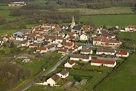
The church and surrounding buildings in Lureuil | |
 Lureuil | |
|
Location within Centre-Val de Loire region  Lureuil | |
| Coordinates: 46°44′41″N 1°02′36″E / 46.7447°N 1.0433°ECoordinates: 46°44′41″N 1°02′36″E / 46.7447°N 1.0433°E | |
| Country | France |
| Region | Centre-Val de Loire |
| Department | Indre |
| Arrondissement | Le Blanc |
| Canton | Tournon-Saint-Martin |
| Government | |
| • Mayor (2008–2014) | Gérard Blondeau |
| Area1 | 22.04 km2 (8.51 sq mi) |
| Population (2009)2 | 271 |
| • Density | 12/km2 (32/sq mi) |
| Time zone | CET (UTC+1) |
| • Summer (DST) | CEST (UTC+2) |
| INSEE/Postal code | 36105 / 36220 |
| Elevation |
90–151 m (295–495 ft) (avg. 152 m or 499 ft) |
|
1 French Land Register data, which excludes lakes, ponds, glaciers > 1 km² (0.386 sq mi or 247 acres) and river estuaries. 2 Population without double counting: residents of multiple communes (e.g., students and military personnel) only counted once. | |
Lureuil is a commune in the Indre department in central France.
Geography
The commune is located in the parc naturel régional de la Brenne.
Population
| Historical population | ||
|---|---|---|
| Year | Pop. | ±% |
| 1793 | 332 | — |
| 1800 | 413 | +24.4% |
| 1806 | 378 | −8.5% |
| 1821 | 447 | +18.3% |
| 1831 | 447 | +0.0% |
| 1836 | 491 | +9.8% |
| 1841 | 402 | −18.1% |
| 1846 | 478 | +18.9% |
| 1851 | 527 | +10.3% |
| 1856 | 477 | −9.5% |
| 1861 | 482 | +1.0% |
| 1866 | 525 | +8.9% |
| 1872 | 496 | −5.5% |
| 1876 | 498 | +0.4% |
| 1881 | 507 | +1.8% |
| 1886 | 482 | −4.9% |
| 1891 | 488 | +1.2% |
| 1896 | 468 | −4.1% |
| 1901 | 443 | −5.3% |
| 1906 | 467 | +5.4% |
| 1911 | 456 | −2.4% |
| 1921 | 405 | −11.2% |
| 1926 | 372 | −8.1% |
| 1931 | 367 | −1.3% |
| 1936 | 396 | +7.9% |
| 1946 | 352 | −11.1% |
| 1954 | 351 | −0.3% |
| 1962 | 336 | −4.3% |
| 1968 | 302 | −10.1% |
| 1975 | 222 | −26.5% |
| 1982 | 215 | −3.2% |
| 1990 | 281 | +30.7% |
| 1999 | 287 | +2.1% |
| 2009 | 271 | −5.6% |
See also
References
| Wikimedia Commons has media related to Lureuil. |
This article is issued from Wikipedia - version of the 3/15/2016. The text is available under the Creative Commons Attribution/Share Alike but additional terms may apply for the media files.