Le Poinçonnet
| Le Poinçonnet | |
|---|---|
|
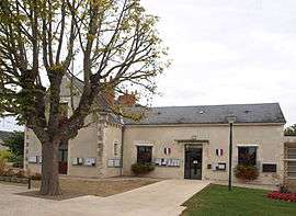
Town hall | |
 Le Poinçonnet | |
|
Location within Centre-Val de Loire region  Le Poinçonnet | |
| Coordinates: 46°45′52″N 1°43′11″E / 46.7644°N 1.7197°ECoordinates: 46°45′52″N 1°43′11″E / 46.7644°N 1.7197°E | |
| Country | France |
| Region | Centre-Val de Loire |
| Department | Indre |
| Arrondissement | Châteauroux |
| Canton | Ardentes |
| Intercommunality | Castelroussine |
| Government | |
| • Mayor (2008–2014) | Jean Petitpretre |
| Area1 | 45 km2 (17 sq mi) |
| Population (2009)2 | 5,808 |
| • Density | 130/km2 (330/sq mi) |
| Time zone | CET (UTC+1) |
| • Summer (DST) | CEST (UTC+2) |
| INSEE/Postal code | 36159 / 36330 |
| Elevation |
145–186 m (476–610 ft) (avg. 159 m or 522 ft) |
|
1 French Land Register data, which excludes lakes, ponds, glaciers > 1 km² (0.386 sq mi or 247 acres) and river estuaries. 2 Population without double counting: residents of multiple communes (e.g., students and military personnel) only counted once. | |
Le Poinçonnet is a commune in the Indre department in central France.
Population
| Historical population | ||
|---|---|---|
| Year | Pop. | ±% |
| 1793 | 766 | — |
| 1800 | 844 | +10.2% |
| 1806 | 930 | +10.2% |
| 1821 | 1,036 | +11.4% |
| 1831 | 962 | −7.1% |
| 1836 | 1,029 | +7.0% |
| 1841 | 1,036 | +0.7% |
| 1846 | 1,163 | +12.3% |
| 1851 | 1,178 | +1.3% |
| 1856 | 1,154 | −2.0% |
| 1861 | 1,059 | −8.2% |
| 1866 | 1,111 | +4.9% |
| 1872 | 1,125 | +1.3% |
| 1876 | 1,206 | +7.2% |
| 1881 | 1,180 | −2.2% |
| 1886 | 1,169 | −0.9% |
| 1891 | 1,188 | +1.6% |
| 1896 | 1,132 | −4.7% |
| 1901 | 1,159 | +2.4% |
| 1906 | 1,226 | +5.8% |
| 1911 | 1,104 | −10.0% |
| 1921 | 1,027 | −7.0% |
| 1926 | 1,047 | +1.9% |
| 1931 | 1,001 | −4.4% |
| 1936 | 1,013 | +1.2% |
| 1946 | 1,285 | +26.9% |
| 1954 | 1,402 | +9.1% |
| 1962 | 1,457 | +3.9% |
| 1968 | 1,551 | +6.5% |
| 1975 | 2,347 | +51.3% |
| 1982 | 3,766 | +60.5% |
| 1990 | 4,600 | +22.1% |
| 1999 | 5,021 | +9.2% |
| 2009 | 5,808 | +15.7% |
See also
References
| Wikimedia Commons has media related to Le Poinçonnet. |
This article is issued from Wikipedia - version of the 5/26/2014. The text is available under the Creative Commons Attribution/Share Alike but additional terms may apply for the media files.