Buxeuil, Indre
| Buxeuil | |
|---|---|
|
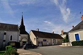
The main square in Buxeuil | |
 Buxeuil | |
|
Location within Centre-Val de Loire region  Buxeuil | |
| Coordinates: 47°08′02″N 1°41′15″E / 47.1339°N 1.6875°ECoordinates: 47°08′02″N 1°41′15″E / 47.1339°N 1.6875°E | |
| Country | France |
| Region | Centre-Val de Loire |
| Department | Indre |
| Arrondissement | Issoudun |
| Canton | Vatan |
| Intercommunality | Vatan |
| Government | |
| • Mayor (2008–2014) | Daniel Thénot |
| Area1 | 19.75 km2 (7.63 sq mi) |
| Population (2009)2 | 218 |
| • Density | 11/km2 (29/sq mi) |
| Time zone | CET (UTC+1) |
| • Summer (DST) | CEST (UTC+2) |
| INSEE/Postal code | 36029 / 36150 |
| Elevation |
97–161 m (318–528 ft) (avg. 110 m or 360 ft) |
|
1 French Land Register data, which excludes lakes, ponds, glaciers > 1 km² (0.386 sq mi or 247 acres) and river estuaries. 2 Population without double counting: residents of multiple communes (e.g., students and military personnel) only counted once. | |
Buxeuil is a commune in the Indre department in central France.
Population
| Historical population | ||
|---|---|---|
| Year | Pop. | ±% |
| 1793 | 615 | — |
| 1800 | 624 | +1.5% |
| 1806 | 687 | +10.1% |
| 1821 | 564 | −17.9% |
| 1831 | 582 | +3.2% |
| 1836 | 669 | +14.9% |
| 1841 | 650 | −2.8% |
| 1846 | 675 | +3.8% |
| 1851 | 725 | +7.4% |
| 1856 | 677 | −6.6% |
| 1861 | 709 | +4.7% |
| 1866 | 714 | +0.7% |
| 1872 | 681 | −4.6% |
| 1876 | 655 | −3.8% |
| 1881 | 680 | +3.8% |
| 1886 | 670 | −1.5% |
| 1891 | 688 | +2.7% |
| 1896 | 668 | −2.9% |
| 1901 | 625 | −6.4% |
| 1906 | 598 | −4.3% |
| 1911 | 633 | +5.9% |
| 1921 | 520 | −17.9% |
| 1926 | 533 | +2.5% |
| 1931 | 496 | −6.9% |
| 1936 | 496 | +0.0% |
| 1946 | 458 | −7.7% |
| 1954 | 384 | −16.2% |
| 1962 | 377 | −1.8% |
| 1968 | 322 | −14.6% |
| 1975 | 271 | −15.8% |
| 1982 | 231 | −14.8% |
| 1990 | 202 | −12.6% |
| 1999 | 227 | +12.4% |
| 2009 | 218 | −4.0% |
See also
References
| Wikimedia Commons has media related to Buxeuil (Indre). |
This article is issued from Wikipedia - version of the 2/9/2015. The text is available under the Creative Commons Attribution/Share Alike but additional terms may apply for the media files.