Reuilly, Indre
| Reuilly | |
|---|---|
|
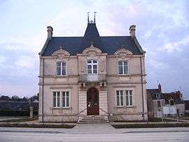
The town hall in Reuilly | |
 Reuilly | |
|
Location within Centre-Val de Loire region  Reuilly | |
| Coordinates: 47°05′05″N 2°02′42″E / 47.0847°N 2.045°ECoordinates: 47°05′05″N 2°02′42″E / 47.0847°N 2.045°E | |
| Country | France |
| Region | Centre-Val de Loire |
| Department | Indre |
| Arrondissement | Issoudun |
| Canton | Issoudun-Nord |
| Intercommunality | Pays d’Issoudun |
| Government | |
| • Mayor (2008–2014) | Patrick Bertrand |
| Area1 | 25.8 km2 (10.0 sq mi) |
| Population (2009)2 | 2,060 |
| • Density | 80/km2 (210/sq mi) |
| Time zone | CET (UTC+1) |
| • Summer (DST) | CEST (UTC+2) |
| INSEE/Postal code | 36171 / 36260 |
| Elevation |
107–167 m (351–548 ft) (avg. 114 m or 374 ft) |
|
1 French Land Register data, which excludes lakes, ponds, glaciers > 1 km² (0.386 sq mi or 247 acres) and river estuaries. 2 Population without double counting: residents of multiple communes (e.g., students and military personnel) only counted once. | |
Reuilly is a commune in the Indre department in central France.
It is about 15 km south of Vierzon, and 30 km west of Bourges. The area around Reuilly is noted for its wine; there is a designated Reuilly AOC.
Population
| Historical population | ||
|---|---|---|
| Year | Pop. | ±% |
| 1793 | 1,712 | — |
| 1800 | 1,671 | −2.4% |
| 1806 | 1,762 | +5.4% |
| 1821 | 1,859 | +5.5% |
| 1831 | 2,185 | +17.5% |
| 1836 | 2,297 | +5.1% |
| 1841 | 2,241 | −2.4% |
| 1846 | 2,418 | +7.9% |
| 1851 | 2,586 | +6.9% |
| 1856 | 2,524 | −2.4% |
| 1861 | 2,568 | +1.7% |
| 1866 | 2,632 | +2.5% |
| 1872 | 2,667 | +1.3% |
| 1876 | 2,719 | +1.9% |
| 1881 | 2,735 | +0.6% |
| 1886 | 2,776 | +1.5% |
| 1891 | 2,714 | −2.2% |
| 1896 | 2,610 | −3.8% |
| 1901 | 2,569 | −1.6% |
| 1906 | 2,535 | −1.3% |
| 1911 | 2,578 | +1.7% |
| 1921 | 2,222 | −13.8% |
| 1926 | 2,091 | −5.9% |
| 1931 | 2,052 | −1.9% |
| 1936 | 1,918 | −6.5% |
| 1946 | 2,078 | +8.3% |
| 1954 | 2,058 | −1.0% |
| 1962 | 2,011 | −2.3% |
| 1968 | 2,020 | +0.4% |
| 1975 | 2,036 | +0.8% |
| 1982 | 2,017 | −0.9% |
| 1990 | 1,952 | −3.2% |
| 1999 | 1,962 | +0.5% |
| 2009 | 2,060 | +5.0% |
See also
References
| Wikimedia Commons has media related to Reuilly (Indre). |
This article is issued from Wikipedia - version of the 2/9/2015. The text is available under the Creative Commons Attribution/Share Alike but additional terms may apply for the media files.