Auberchicourt
| Auberchicourt | ||
|---|---|---|
|
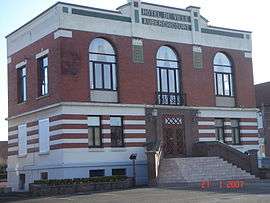
Town hall | ||
| ||
 Auberchicourt | ||
|
Location within Hauts-de-France region  Auberchicourt | ||
| Coordinates: 50°20′00″N 3°14′00″E / 50.3333°N 3.2333°ECoordinates: 50°20′00″N 3°14′00″E / 50.3333°N 3.2333°E | ||
| Country | France | |
| Region | Hauts-de-France | |
| Department | Nord | |
| Arrondissement | Douai | |
| Canton | Douai-Sud | |
| Intercommunality | Cœur d'Ostrevent | |
| Government | ||
| • Mayor (2008–2014) | Gilles Grevin | |
| Area1 | 7.12 km2 (2.75 sq mi) | |
| Population (2009)2 | 4,628 | |
| • Density | 650/km2 (1,700/sq mi) | |
| Time zone | CET (UTC+1) | |
| • Summer (DST) | CEST (UTC+2) | |
| INSEE/Postal code | 59024 / 59165 | |
| Elevation |
21–63 m (69–207 ft) (avg. 50 m or 160 ft) | |
|
1 French Land Register data, which excludes lakes, ponds, glaciers > 1 km² (0.386 sq mi or 247 acres) and river estuaries. 2 Population without double counting: residents of multiple communes (e.g., students and military personnel) only counted once. | ||

Auberchicourt is a commune in the Nord department in northern France.
Population
| Historical population | ||
|---|---|---|
| Year | Pop. | ±% |
| 1793 | 763 | — |
| 1800 | 711 | −6.8% |
| 1806 | 935 | +31.5% |
| 1821 | 1,077 | +15.2% |
| 1831 | 1,241 | +15.2% |
| 1836 | 1,205 | −2.9% |
| 1841 | 1,281 | +6.3% |
| 1846 | 1,462 | +14.1% |
| 1851 | 1,476 | +1.0% |
| 1856 | 1,585 | +7.4% |
| 1861 | 1,744 | +10.0% |
| 1866 | 1,970 | +13.0% |
| 1872 | 1,946 | −1.2% |
| 1876 | 2,255 | +15.9% |
| 1881 | 2,453 | +8.8% |
| 1886 | 2,580 | +5.2% |
| 1891 | 2,700 | +4.7% |
| 1896 | 2,739 | +1.4% |
| 1901 | 2,948 | +7.6% |
| 1906 | 3,183 | +8.0% |
| 1911 | 3,597 | +13.0% |
| 1921 | 3,540 | −1.6% |
| 1926 | 3,979 | +12.4% |
| 1931 | 4,057 | +2.0% |
| 1936 | 3,924 | −3.3% |
| 1946 | 3,865 | −1.5% |
| 1954 | 4,484 | +16.0% |
| 1962 | 5,085 | +13.4% |
| 1968 | 5,369 | +5.6% |
| 1975 | 5,292 | −1.4% |
| 1982 | 4,826 | −8.8% |
| 1990 | 4,733 | −1.9% |
| 1999 | 4,547 | −3.9% |
| 2006 | 4,569 | +0.5% |
| 2009 | 4,628 | +1.3% |
See also
References
| Wikimedia Commons has media related to Auberchicourt. |
This article is issued from Wikipedia - version of the 3/18/2013. The text is available under the Creative Commons Attribution/Share Alike but additional terms may apply for the media files.