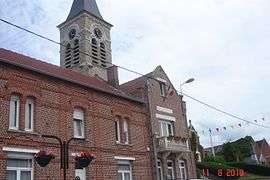
Bugnicourt
| Bugnicourt | ||
|---|---|---|
 | ||
| ||
 Bugnicourt | ||
|
Location within Hauts-de-France region  Bugnicourt | ||
| Coordinates: 50°17′30″N 3°09′24″E / 50.2917°N 3.1567°ECoordinates: 50°17′30″N 3°09′24″E / 50.2917°N 3.1567°E | ||
| Country | France | |
| Region | Hauts-de-France | |
| Department | Nord | |
| Arrondissement | Douai | |
| Canton | Arleux | |
| Intercommunality | Douaisis | |
| Government | ||
| • Mayor (2008–2014) | Christian Dordain | |
| Area1 | 6.28 km2 (2.42 sq mi) | |
| Population (2009)2 | 954 | |
| • Density | 150/km2 (390/sq mi) | |
| Time zone | CET (UTC+1) | |
| • Summer (DST) | CEST (UTC+2) | |
| INSEE/Postal code | 59117 / 59151 | |
| Elevation |
36–84 m (118–276 ft) (avg. 57 m or 187 ft) | |
|
1 French Land Register data, which excludes lakes, ponds, glaciers > 1 km² (0.386 sq mi or 247 acres) and river estuaries. 2 Population without double counting: residents of multiple communes (e.g., students and military personnel) only counted once. | ||
Bugnicourt is a commune in the Nord department in northern France.
Population
| Historical population | ||
|---|---|---|
| Year | Pop. | ±% |
| 1793 | 440 | — |
| 1800 | 474 | +7.7% |
| 1806 | 545 | +15.0% |
| 1821 | 662 | +21.5% |
| 1831 | 720 | +8.8% |
| 1836 | 729 | +1.2% |
| 1841 | 760 | +4.3% |
| 1846 | 833 | +9.6% |
| 1851 | 770 | −7.6% |
| 1856 | 743 | −3.5% |
| 1861 | 778 | +4.7% |
| 1866 | 771 | −0.9% |
| 1872 | 792 | +2.7% |
| 1876 | 785 | −0.9% |
| 1881 | 769 | −2.0% |
| 1886 | 787 | +2.3% |
| 1891 | 741 | −5.8% |
| 1896 | 685 | −7.6% |
| 1901 | 729 | +6.4% |
| 1906 | 774 | +6.2% |
| 1911 | 761 | −1.7% |
| 1921 | 711 | −6.6% |
| 1926 | 757 | +6.5% |
| 1931 | 760 | +0.4% |
| 1936 | 755 | −0.7% |
| 1946 | 773 | +2.4% |
| 1954 | 785 | +1.6% |
| 1962 | 786 | +0.1% |
| 1968 | 811 | +3.2% |
| 1975 | 765 | −5.7% |
| 1982 | 928 | +21.3% |
| 1990 | 934 | +0.6% |
| 1999 | 870 | −6.9% |
| 2006 | 904 | +3.9% |
| 2009 | 954 | +5.5% |
Heraldry
_Nord-France.svg.png) |
The arms of Bugnicourt are blazoned : Ermine, on a cross gules, 5 roses Or. (Aniche, Bugnicourt, and Rieulay use the same arms.) |
See also
References
| Wikimedia Commons has media related to Bugnicourt. |
This article is issued from Wikipedia - version of the 10/24/2016. The text is available under the Creative Commons Attribution/Share Alike but additional terms may apply for the media files.