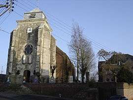
Bertry
| Bertry | ||
|---|---|---|
 | ||
| ||
 Bertry | ||
|
Location within Hauts-de-France region  Bertry | ||
| Coordinates: 50°05′16″N 3°26′36″E / 50.0878°N 3.4433°ECoordinates: 50°05′16″N 3°26′36″E / 50.0878°N 3.4433°E | ||
| Country | France | |
| Region | Hauts-de-France | |
| Department | Nord | |
| Arrondissement | Cambrai | |
| Canton | Clary | |
| Intercommunality | Espace Sud Cambrésis | |
| Government | ||
| • Mayor (2008–2014) | Jacques Olivier | |
| Area1 | 8.54 km2 (3.30 sq mi) | |
| Population (2009)2 | 2,199 | |
| • Density | 260/km2 (670/sq mi) | |
| Time zone | CET (UTC+1) | |
| • Summer (DST) | CEST (UTC+2) | |
| INSEE/Postal code | 59074 / 59980 | |
| Elevation |
119–152 m (390–499 ft) (avg. 131 m or 430 ft) | |
|
1 French Land Register data, which excludes lakes, ponds, glaciers > 1 km² (0.386 sq mi or 247 acres) and river estuaries. 2 Population without double counting: residents of multiple communes (e.g., students and military personnel) only counted once. | ||
Bertry is a commune in the Nord department in northern France.
Population
| Historical population | ||
|---|---|---|
| Year | Pop. | ±% |
| 1793 | 1,169 | — |
| 1800 | 1,180 | +0.9% |
| 1806 | 1,244 | +5.4% |
| 1821 | 1,332 | +7.1% |
| 1831 | 1,602 | +20.3% |
| 1836 | 1,829 | +14.2% |
| 1841 | 2,141 | +17.1% |
| 1846 | 2,273 | +6.2% |
| 1851 | 2,331 | +2.6% |
| 1856 | 2,488 | +6.7% |
| 1861 | 2,849 | +14.5% |
| 1866 | 2,933 | +2.9% |
| 1872 | 3,010 | +2.6% |
| 1876 | 3,182 | +5.7% |
| 1881 | 3,001 | −5.7% |
| 1886 | 2,997 | −0.1% |
| 1891 | 2,902 | −3.2% |
| 1896 | 3,055 | +5.3% |
| 1901 | 3,031 | −0.8% |
| 1906 | 3,081 | +1.6% |
| 1911 | 3,239 | +5.1% |
| 1921 | 3,002 | −7.3% |
| 1926 | 3,009 | +0.2% |
| 1931 | 3,002 | −0.2% |
| 1936 | 2,920 | −2.7% |
| 1946 | 2,640 | −9.6% |
| 1954 | 2,597 | −1.6% |
| 1962 | 2,657 | +2.3% |
| 1968 | 2,526 | −4.9% |
| 1975 | 2,295 | −9.1% |
| 1982 | 2,089 | −9.0% |
| 1990 | 2,119 | +1.4% |
| 1999 | 2,256 | +6.5% |
| 2006 | 2,225 | −1.4% |
| 2009 | 2,199 | −1.2% |
Heraldry
_Nord-France.svg.png) |
The arms of Bertry are blazoned : Azure, a chevron between 2 mullets of 6 and a trefoil Or. (Bertry and Troisvilles use the same arms.) |
See also
References
| Wikimedia Commons has media related to Bertry. |
This article is issued from Wikipedia - version of the 9/17/2015. The text is available under the Creative Commons Attribution/Share Alike but additional terms may apply for the media files.