Croix-Caluyau
| Croix-Caluyau | ||
|---|---|---|
|
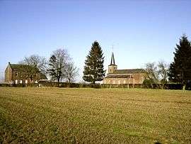
Church and school | ||
| ||
 Croix-Caluyau | ||
|
Location within Hauts-de-France region  Croix-Caluyau | ||
| Coordinates: 50°08′52″N 3°34′54″E / 50.1478°N 3.5817°ECoordinates: 50°08′52″N 3°34′54″E / 50.1478°N 3.5817°E | ||
| Country | France | |
| Region | Hauts-de-France | |
| Department | Nord | |
| Arrondissement | Avesnes-sur-Helpe | |
| Canton | Landrecies | |
| Intercommunality | Pays de Mormal et Maroilles | |
| Government | ||
| • Mayor (2008–2014) | Elisabeth Pruvot | |
| Area1 | 4.01 km2 (1.55 sq mi) | |
| Population (1999)2 | 213 | |
| • Density | 53/km2 (140/sq mi) | |
| Time zone | CET (UTC+1) | |
| • Summer (DST) | CEST (UTC+2) | |
| INSEE/Postal code | 59164 / 59222 | |
| Elevation |
128–151 m (420–495 ft) (avg. 134 m or 440 ft) | |
|
1 French Land Register data, which excludes lakes, ponds, glaciers > 1 km² (0.386 sq mi or 247 acres) and river estuaries. 2 Population without double counting: residents of multiple communes (e.g., students and military personnel) only counted once. | ||
Croix-Caluyau is a commune in the Nord department in northern France.
Heraldry
.svg.png) |
The arms of Croix-Caluyau are blazoned : Sable, 3 crosses couped Or. |
See also
References
| Wikimedia Commons has media related to Croix-Caluyau. |
This article is issued from Wikipedia - version of the 11/14/2016. The text is available under the Creative Commons Attribution/Share Alike but additional terms may apply for the media files.