Robersart
| Robersart | |
|---|---|
 | |
 Robersart | |
|
Location within Hauts-de-France region  Robersart | |
| Coordinates: 50°09′27″N 3°38′39″E / 50.1575°N 3.6442°ECoordinates: 50°09′27″N 3°38′39″E / 50.1575°N 3.6442°E | |
| Country | France |
| Region | Hauts-de-France |
| Department | Nord |
| Arrondissement | Avesnes-sur-Helpe |
| Canton | Landrecies |
| Intercommunality | Pays de Mormal et Maroilles |
| Government | |
| • Mayor (2008–2014) | André Jacquinet |
| Area1 | 2.33 km2 (0.90 sq mi) |
| Population (1999)2 | 170 |
| • Density | 73/km2 (190/sq mi) |
| Time zone | CET (UTC+1) |
| • Summer (DST) | CEST (UTC+2) |
| INSEE/Postal code | 59503 / 59550 |
| Elevation |
139–166 m (456–545 ft) (avg. 150 m or 490 ft) |
|
1 French Land Register data, which excludes lakes, ponds, glaciers > 1 km² (0.386 sq mi or 247 acres) and river estuaries. 2 Population without double counting: residents of multiple communes (e.g., students and military personnel) only counted once. | |
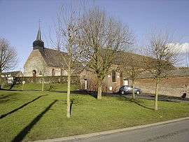
Robersart is a commune in the Nord department in northern France.
Heraldry
.svg.png) |
The arms of Robersart are blazoned : Vert, a lion Or, armed and langued gules. (Ribécourt-la-Tour and Robersart use the same arms.) |
See also
References
| Wikimedia Commons has media related to Robersart. |
This article is issued from Wikipedia - version of the 11/26/2014. The text is available under the Creative Commons Attribution/Share Alike but additional terms may apply for the media files.