Erquinghem-Lys
| Erquinghem-Lys | ||
|---|---|---|
 | ||
| ||
 Erquinghem-Lys | ||
|
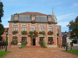
Location within Hauts-de-France region  Erquinghem-Lys | ||
| Coordinates: 50°40′34″N 2°50′54″E / 50.6761°N 2.8483°ECoordinates: 50°40′34″N 2°50′54″E / 50.6761°N 2.8483°E | ||
| Country | France | |
| Region | Hauts-de-France | |
| Department | Nord | |
| Arrondissement | Lille | |
| Canton | Armentières | |
| Intercommunality | Lille Métropole | |
| Government | ||
| • Mayor (2008–2014) | Alain Bézirard | |
| Area1 | 8.94 km2 (3.45 sq mi) | |
| Population (1999)2 | 4,495 | |
| • Density | 500/km2 (1,300/sq mi) | |
| Time zone | CET (UTC+1) | |
| • Summer (DST) | CEST (UTC+2) | |
| INSEE/Postal code | 59202 / 59193 | |
| Elevation |
12–20 m (39–66 ft) (avg. 18 m or 59 ft) | |
|
1 French Land Register data, which excludes lakes, ponds, glaciers > 1 km² (0.386 sq mi or 247 acres) and river estuaries. 2 Population without double counting: residents of multiple communes (e.g., students and military personnel) only counted once. | ||
Erquinghem-Lys is a commune in the Nord department in northern France.
It is part of the Urban Community of Lille Métropole.
Erquinghem-Lys has been twinned with Skipton, North Yorkshire, England since 24 October 2009.[1]
Heraldry
_Nord-France.svg.png) |
The arms of Erquinghem-Lys are blazoned : Or, a lion sable, overall a bend componey argent and gules. |
See also
Erquinghem is one of a series of villages on the river Lys established by the Viking Rikiwulf in 880 AD at the time of the invasion led by Godfrid, Duke of Frisia: Racquinghem, Reclinghem, Rekkem and Rijkegem (the latter two now in West Flanders - Belgium).
References
- ↑ Herald Reporter (2009-10-30). "Skipton Twins with Erquinghem-Lys". Craven Herald & Pioneer.
| Wikimedia Commons has media related to Erquinghem-Lys. |
.svg.png)
This article is issued from Wikipedia - version of the 11/14/2016. The text is available under the Creative Commons Attribution/Share Alike but additional terms may apply for the media files.