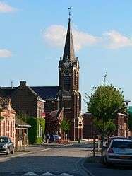
Cappelle-en-Pévèle
| Cappelle-en-Pévèle | ||
|---|---|---|
 | ||
| ||
 Cappelle-en-Pévèle | ||
|
Location within Hauts-de-France region  Cappelle-en-Pévèle | ||
| Coordinates: 50°30′39″N 3°10′24″E / 50.5108°N 3.1733°ECoordinates: 50°30′39″N 3°10′24″E / 50.5108°N 3.1733°E | ||
| Country | France | |
| Region | Hauts-de-France | |
| Department | Nord | |
| Arrondissement | Lille | |
| Canton | Cysoing | |
| Intercommunality | Pays de Pévèle | |
| Government | ||
| • Mayor (2008–2014) | Bernard Chocraux | |
| Area1 | 8.11 km2 (3.13 sq mi) | |
| Population (2006)2 | 1,891 | |
| • Density | 230/km2 (600/sq mi) | |
| Time zone | CET (UTC+1) | |
| • Summer (DST) | CEST (UTC+2) | |
| INSEE/Postal code | 59129 / 59242 | |
| Elevation |
34–56 m (112–184 ft) (avg. 44 m or 144 ft) | |
|
1 French Land Register data, which excludes lakes, ponds, glaciers > 1 km² (0.386 sq mi or 247 acres) and river estuaries. 2 Population without double counting: residents of multiple communes (e.g., students and military personnel) only counted once. | ||
Cappelle-en-Pévèle is a commune in the Nord department in northern France.
Heraldry
_Nord-France.svg.png) |
The arms of Cappelle-en-Pévèle are blazoned : Quarterly Or and gules. (Cappelle-en-Pévèle and Roucourt use the same arms.) |
See also
References
| Wikimedia Commons has media related to Cappelle-en-Pévèle. |
This article is issued from Wikipedia - version of the 10/29/2016. The text is available under the Creative Commons Attribution/Share Alike but additional terms may apply for the media files.