Awoingt
| Awoingt | ||
|---|---|---|
 | ||
| ||
 Awoingt | ||
|
Location within Hauts-de-France region  Awoingt | ||
| Coordinates: 50°09′20″N 3°16′52″E / 50.1556°N 3.2811°ECoordinates: 50°09′20″N 3°16′52″E / 50.1556°N 3.2811°E | ||
| Country | France | |
| Region | Hauts-de-France | |
| Department | Nord | |
| Arrondissement | Cambrai | |
| Canton | Cambrai-Est | |
| Intercommunality | Cambrai | |
| Government | ||
| • Mayor (2008–2014) | Gille Rouze | |
| Area1 | 6.31 km2 (2.44 sq mi) | |
| Population (2009)2 | 603 | |
| • Density | 96/km2 (250/sq mi) | |
| Time zone | CET (UTC+1) | |
| • Summer (DST) | CEST (UTC+2) | |
| INSEE/Postal code | 59039 / 59400 | |
| Elevation |
61–101 m (200–331 ft) (avg. 60 m or 200 ft) | |
|
1 French Land Register data, which excludes lakes, ponds, glaciers > 1 km² (0.386 sq mi or 247 acres) and river estuaries. 2 Population without double counting: residents of multiple communes (e.g., students and military personnel) only counted once. | ||
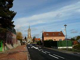
Awoingt is a commune in the Nord department in northern France. It is 4 km (2.5 mi) southeast of the centre of Cambrai.
Population
| Historical population | ||
|---|---|---|
| Year | Pop. | ±% |
| 1793 | 338 | — |
| 1800 | 326 | −3.6% |
| 1806 | 348 | +6.7% |
| 1821 | 425 | +22.1% |
| 1831 | 462 | +8.7% |
| 1836 | 496 | +7.4% |
| 1841 | 486 | −2.0% |
| 1846 | 477 | −1.9% |
| 1851 | 476 | −0.2% |
| 1856 | 496 | +4.2% |
| 1861 | 524 | +5.6% |
| 1866 | 528 | +0.8% |
| 1872 | 541 | +2.5% |
| 1876 | 516 | −4.6% |
| 1881 | 551 | +6.8% |
| 1886 | 537 | −2.5% |
| 1891 | 531 | −1.1% |
| 1896 | 513 | −3.4% |
| 1901 | 494 | −3.7% |
| 1906 | 507 | +2.6% |
| 1911 | 506 | −0.2% |
| 1921 | 403 | −20.4% |
| 1926 | 437 | +8.4% |
| 1931 | 401 | −8.2% |
| 1936 | 402 | +0.2% |
| 1946 | 406 | +1.0% |
| 1954 | 406 | +0.0% |
| 1962 | 374 | −7.9% |
| 1968 | 353 | −5.6% |
| 1975 | 391 | +10.8% |
| 1982 | 447 | +14.3% |
| 1990 | 524 | +17.2% |
| 1999 | 552 | +5.3% |
| 2006 | 535 | −3.1% |
| 2009 | 603 | +12.7% |
Heraldry
_Nord-France.svg.png) |
The arms of Awoingt are blazoned : Argent, on a bend azure, 3 escallops bendwise Or. (Awoingt and Montrécourt use the same arms.) |
See also
References
| Wikimedia Commons has media related to Awoingt. |
This article is issued from Wikipedia - version of the 8/23/2016. The text is available under the Creative Commons Attribution/Share Alike but additional terms may apply for the media files.