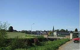
Cartignies
| Cartignies | ||
|---|---|---|
 | ||
| ||
 Cartignies | ||
|
Location within Hauts-de-France region  Cartignies | ||
| Coordinates: 50°05′36″N 3°50′48″E / 50.0933°N 3.8467°ECoordinates: 50°05′36″N 3°50′48″E / 50.0933°N 3.8467°E | ||
| Country | France | |
| Region | Hauts-de-France | |
| Department | Nord | |
| Arrondissement | Avesnes-sur-Helpe | |
| Canton | Avesnes-sur-Helpe-Sud | |
| Intercommunality | Deux Helpes | |
| Government | ||
| • Mayor (2008–2014) | Joël Ratte | |
| Area1 | 26.41 km2 (10.20 sq mi) | |
| Population (1999)2 | 1,128 | |
| • Density | 43/km2 (110/sq mi) | |
| Time zone | CET (UTC+1) | |
| • Summer (DST) | CEST (UTC+2) | |
| INSEE/Postal code | 59134 / 59244 | |
| Elevation |
140–213 m (459–699 ft) (avg. 150 m or 490 ft) | |
|
1 French Land Register data, which excludes lakes, ponds, glaciers > 1 km² (0.386 sq mi or 247 acres) and river estuaries. 2 Population without double counting: residents of multiple communes (e.g., students and military personnel) only counted once. | ||
Cartignies is a commune in the Nord department in northern France.
Heraldry
 |
The arms of Cartignies are blazoned : Bendy Or and gules. (Avesnes-sur-Helpe, Cartignies, Damousies, Dimechaux, Dimont, Felleries, Larouillies, Lomme, and Ramousies use the same arms.) |
See also
References
| Wikimedia Commons has media related to Cartignies. |
This article is issued from Wikipedia - version of the 10/29/2016. The text is available under the Creative Commons Attribution/Share Alike but additional terms may apply for the media files.