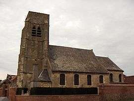
Boussières-en-Cambrésis
| Boussières-en-Cambrésis | ||
|---|---|---|
 | ||
| ||
 Boussières-en-Cambrésis | ||
|
Location within Hauts-de-France region  Boussières-en-Cambrésis | ||
| Coordinates: 50°09′57″N 3°22′03″E / 50.1658°N 3.3675°ECoordinates: 50°09′57″N 3°22′03″E / 50.1658°N 3.3675°E | ||
| Country | France | |
| Region | Hauts-de-France | |
| Department | Nord | |
| Arrondissement | Cambrai | |
| Canton | Carnières | |
| Intercommunality | Caudrésis–Catésis | |
| Government | ||
| • Mayor (2008–2014) | Gérard Lenoble | |
| Area1 | 4.82 km2 (1.86 sq mi) | |
| Population (2009)2 | 424 | |
| • Density | 88/km2 (230/sq mi) | |
| Time zone | CET (UTC+1) | |
| • Summer (DST) | CEST (UTC+2) | |
| INSEE/Postal code | 59102 / 59217 | |
| Elevation |
70–109 m (230–358 ft) (avg. 75 m or 246 ft) | |
|
1 French Land Register data, which excludes lakes, ponds, glaciers > 1 km² (0.386 sq mi or 247 acres) and river estuaries. 2 Population without double counting: residents of multiple communes (e.g., students and military personnel) only counted once. | ||
Boussières-en-Cambrésis is a commune in the Nord department in northern France.
Population
| Historical population | ||
|---|---|---|
| Year | Pop. | ±% |
| 1793 | 463 | — |
| 1800 | 492 | +6.3% |
| 1806 | 564 | +14.6% |
| 1821 | 616 | +9.2% |
| 1831 | 758 | +23.1% |
| 1836 | 773 | +2.0% |
| 1841 | 824 | +6.6% |
| 1846 | 855 | +3.8% |
| 1851 | 856 | +0.1% |
| 1856 | 893 | +4.3% |
| 1861 | 912 | +2.1% |
| 1866 | 972 | +6.6% |
| 1872 | 1,002 | +3.1% |
| 1876 | 1,078 | +7.6% |
| 1881 | 1,122 | +4.1% |
| 1886 | 1,088 | −3.0% |
| 1891 | 1,017 | −6.5% |
| 1896 | 1,010 | −0.7% |
| 1901 | 952 | −5.7% |
| 1906 | 951 | −0.1% |
| 1911 | 926 | −2.6% |
| 1921 | 726 | −21.6% |
| 1926 | 711 | −2.1% |
| 1931 | 685 | −3.7% |
| 1936 | 602 | −12.1% |
| 1946 | 573 | −4.8% |
| 1954 | 573 | +0.0% |
| 1962 | 526 | −8.2% |
| 1968 | 502 | −4.6% |
| 1975 | 439 | −12.5% |
| 1982 | 462 | +5.2% |
| 1990 | 458 | −0.9% |
| 1999 | 428 | −6.6% |
| 2006 | 407 | −4.9% |
| 2009 | 424 | +4.2% |
Heraldry
_Nord-France.svg.png) |
The arms of Boussières-en-Cambrésis are blazoned : Per fess 1: Azure, a latin cross enfiled of a crown of thorns Or; 2: Gules, 3 fleurs de lys Or. (Boussières-en-Cambrésis, Morenchies and Quiévy use the same arms.) |
See also
References
| Wikimedia Commons has media related to Boussières-en-Cambrésis. |
This article is issued from Wikipedia - version of the 9/17/2015. The text is available under the Creative Commons Attribution/Share Alike but additional terms may apply for the media files.