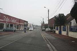
Flers-en-Escrebieux
| Flers-en-Escrebieux | ||
|---|---|---|
 | ||
| ||
 Flers-en-Escrebieux | ||
|
Location within Hauts-de-France region  Flers-en-Escrebieux | ||
| Coordinates: 50°23′53″N 3°03′47″E / 50.398°N 3.063°ECoordinates: 50°23′53″N 3°03′47″E / 50.398°N 3.063°E | ||
| Country | France | |
| Region | Hauts-de-France | |
| Department | Nord | |
| Arrondissement | Douai | |
| Canton | Douai-Nord-Est | |
| Intercommunality | Douaisis | |
| Government | ||
| • Mayor (2001–2008) | Jean-Jacques Peyraud | |
| Area1 | 7.11 km2 (2.75 sq mi) | |
| Population (1999)2 | 5,540 | |
| • Density | 780/km2 (2,000/sq mi) | |
| Time zone | CET (UTC+1) | |
| • Summer (DST) | CEST (UTC+2) | |
| INSEE/Postal code | 59234 / 59128 | |
| Elevation |
18–43 m (59–141 ft) (avg. 23 m or 75 ft) | |
|
1 French Land Register data, which excludes lakes, ponds, glaciers > 1 km² (0.386 sq mi or 247 acres) and river estuaries. 2 Population without double counting: residents of multiple communes (e.g., students and military personnel) only counted once. | ||
Flers-en-Escrebieux is a commune in the Nord department in northern France.
Heraldry
_Nord-France.svg.png) |
The arms of Flers-en-Escrebieux are blazoned : Argent, a chevron, and in base an annulet gules. |
See also
References
| Wikimedia Commons has media related to Flers-en-Escrebieux. |
This article is issued from Wikipedia - version of the 11/16/2016. The text is available under the Creative Commons Attribution/Share Alike but additional terms may apply for the media files.