Caldy
| Caldy | |
| — Village — | |
.jpg) The village green in Caldy |
|
 Caldy |
|
| Population | 1,290 (2001 Census)[1] |
|---|---|
| OS grid reference | SJ226854 |
| – London | 181 mi (291 km)[2] SE |
| Metropolitan borough | Wirral |
| Metropolitan county | Merseyside |
| Region | North West |
| Country | England |
| Sovereign state | United Kingdom |
| Post town | WIRRAL |
| Postcode district | CH48 |
| Dialling code | 0151 |
| ISO 3166 code | GB-WRL |
| Police | Merseyside |
| Fire | Merseyside |
| Ambulance | North West |
| EU Parliament | North West England |
| UK Parliament | Wirral West |
|
|
Coordinates: 53°21′32″N 3°09′50″W / 53.359°N 3.164°W
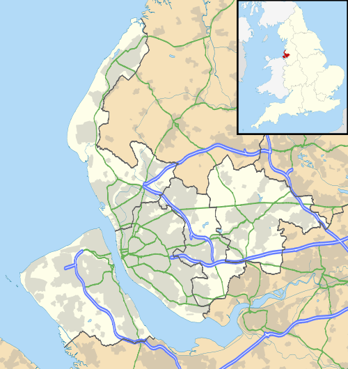
Caldy is a small, affluent village on the Wirral Peninsula, England, located to the south east of West Kirby. It is part of the West Kirby & Thurstaston Ward of the Metropolitan Borough of Wirral and is situated in the parliamentary constituency of Wirral West. At the time of the 2001 Census, Caldy had 1,290 inhabitants,[1] of a total ward population of 12,869.[3]
History
It was first mentioned in the Domesday Book in 1086 as being owned by Hugh of Mere. Nearby is a large area of National Trust land called Caldy Hill. Many of the houses and walls in the village centre are built from the local red sandstone.
Caldy was a township in the West Kirby Parish of the Wirral Hundred. The population was 92 in 1801, 142 in 1851, 202 in 1901 and 607 in 1951.[4] Until the twentieth century, Caldy was effectively a farming and agricultural village. However, The Caldy Manor Estates Company divided the land into smaller building plots, and from here one of the north of England's most exclusive residential village emerged.[5] Between 1894 and 1933, Caldy was part of Wirral Rural District, then subsequently Wirral Urban District. On 1 April 1974, local government reorganisation in England and Wales resulted in most of Wirral, including Caldy, transfer from the county of Cheshire to Merseyside.
Caldy railway station was situated on the Hooton to West Kirby branch of the Chester and Birkenhead Railway. The station closed in 1954 and the trackbed is now the 'Wirral Way' of Wirral Country Park.
Geography
Caldy lies on the western side of the Wirral Peninsula, and is situated on the eastern side of the Dee Estuary. The village is approximately 3.5 km (2.2 mi) south-south-east of the Irish Sea at Hoylake and about 11 km (6.8 mi) west-south-west of the River Mersey at Woodside. The centre of the village is situated at an elevation of about 44 m (144 ft) above sea level.[6]
 |
West Kirby | Grange | Larton Frankby |
|
| Point of Ayr (across Dee Estuary) |
|
Thurstaston Common | ||
| ||||
| | ||||
| Mostyn (across Dee Estuary) |
Bagillt (across Dee Estuary) |
Thurstaston |
Education
Calday Grange Grammar School is between Caldy and West Kirby, with West Kirby Grammar School and Hilbre High School nearby.
Sport
Caldy Rugby Football Club, a rugby union club, play at Paton Field in nearby Thurstaston. The team currently compete in National League 2 North, the fourth tier of the rugby union pyramid in England.
Caldy Cricket Club play at Paton Field in nearby Thurstaston in the summer months. They currently field four Saturday teams in the Liverpool and District Cricket Competition.
Transport
Road
.jpg)
Caldy is located at the junction of the B5140 and B5141 roads, and is near to the A540.
Bus
Services operating in the Caldy area, as of January 2014:
| Number | Route | Operator | Days of Operation |
|---|---|---|---|
| 82 | West Kirby-Heswall | Avon Buses | Monday-Saturday |
Rail
The nearest railway station to Caldy is West Kirby, on the Wirral Line of the Merseyrail network after it lost its own station in 1954.
Notable residents
Caldy is noted for having many well-known residents, particularly those connected to professional football, such as Robbie Fowler[7] and Rafael Benítez. Rafael Benitez in a press conference referred to 'John the milkman' in the Wirral while launching cryptic attack on previous Liverpool club owner Tom Hicks and managing director Christian Purslow.[8]
The poet and novelist Malcolm Lowry lived in Caldy as a child, and the science fiction author Olaf Stapledon lived in Caldy from 1940 until his death in 1950.
See also
References
- 1 2 Wirral 2001 Census: Caldy, Metropolitan Borough of Wirral, retrieved 10 May 2007
- ↑ "Coordinate Distance Calculator". boulter.com. Retrieved 6 March 2016.
- ↑ 2001 Census: West Kirby & Caldy (Ward), Office for National Statistics, retrieved 10 May 2007
- ↑ Cheshire Towns & Parishes: Caldy, GENUKI UK & Ireland Genealogy, retrieved 26 April 2008
- ↑ Hughes, Mark, Caldy, Village of Dreams (draft)
- ↑ "SRTM & Ordnance Survey Elevation Data in PHP". Retrieved 1 November 2016.
- ↑ Fowler admits phone drive offence, BBC Merseyside, 20 March 2009, retrieved 20 March 2009
- ↑ "Former Liverpool manager Rafael Benítez attacks former owner and Anfield hierarchy". The Daily Telegraph. London. 19 October 2010.
Bibliography
- Mortimer, William Williams (1847). The History of the Hundred of Wirral. London: Whittaker & Co. pp270-273.
External links
| Wikimedia Commons has media related to Caldy. |